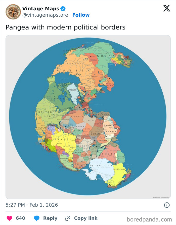
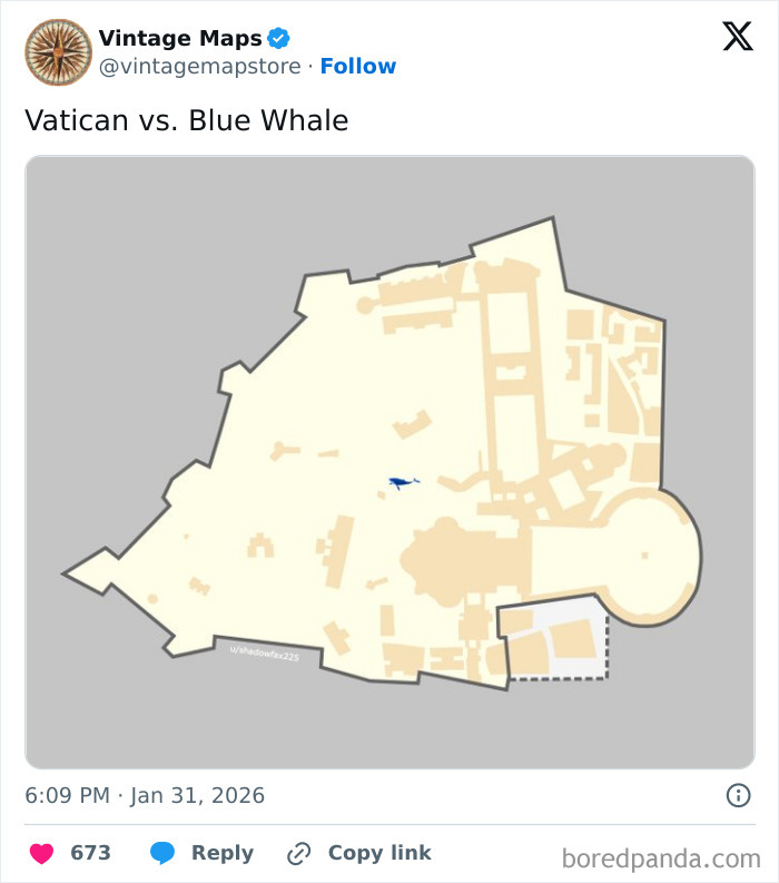
Are you a fan of cartography but curious to see the world through a different lens? Have you ever wondered how many blue whales would fit into the Vatican? Or what the ancient continent of Pangea would look like with modern political borders? Or maybe you would just like to see how Manhattan looked when it was still called New Amsterdam?
If you’ve said “yes” to at least one of these, you’re in luck! Bored Panda has prepared a compilation of cool maps from the Vintage Maps page on X, where you can learn history and interesting new facts through the medium of cartography. So, scroll through these maps and marvel at how cool our world is.
More info: X (Twitter)
Click here & follow us for more lists, facts, and stories.
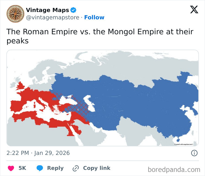
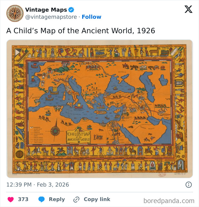
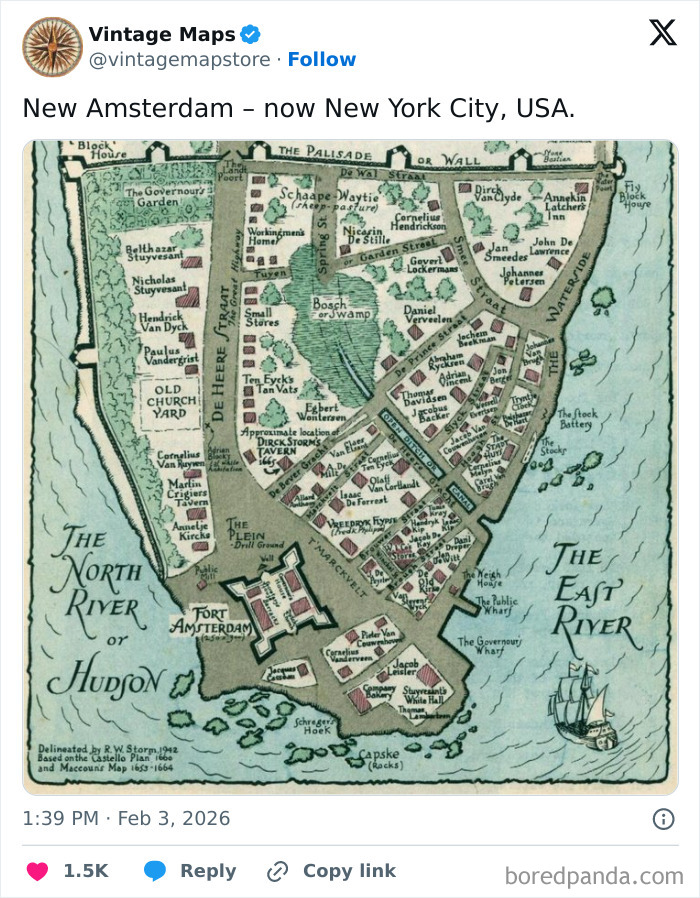
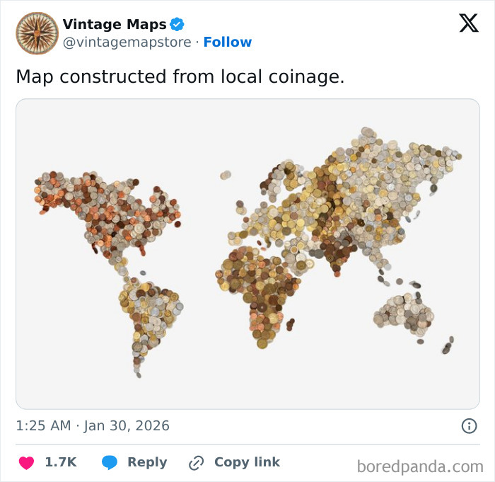
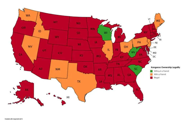
#1
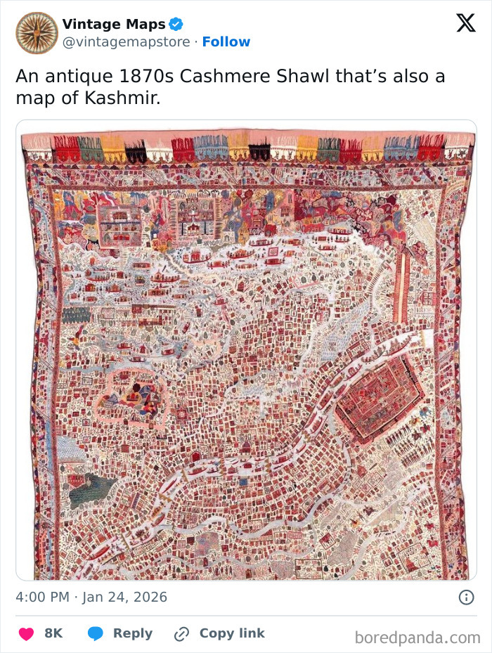
© Photo: vintagemapstore
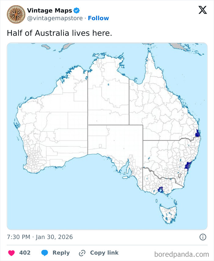
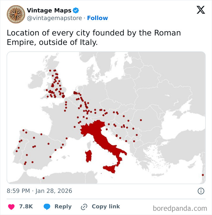
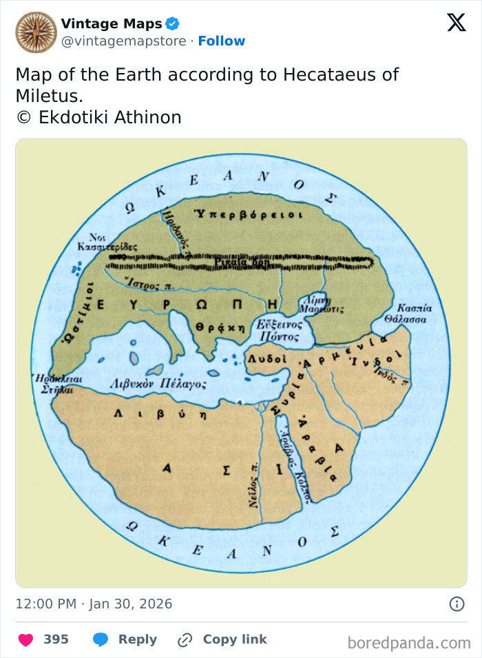
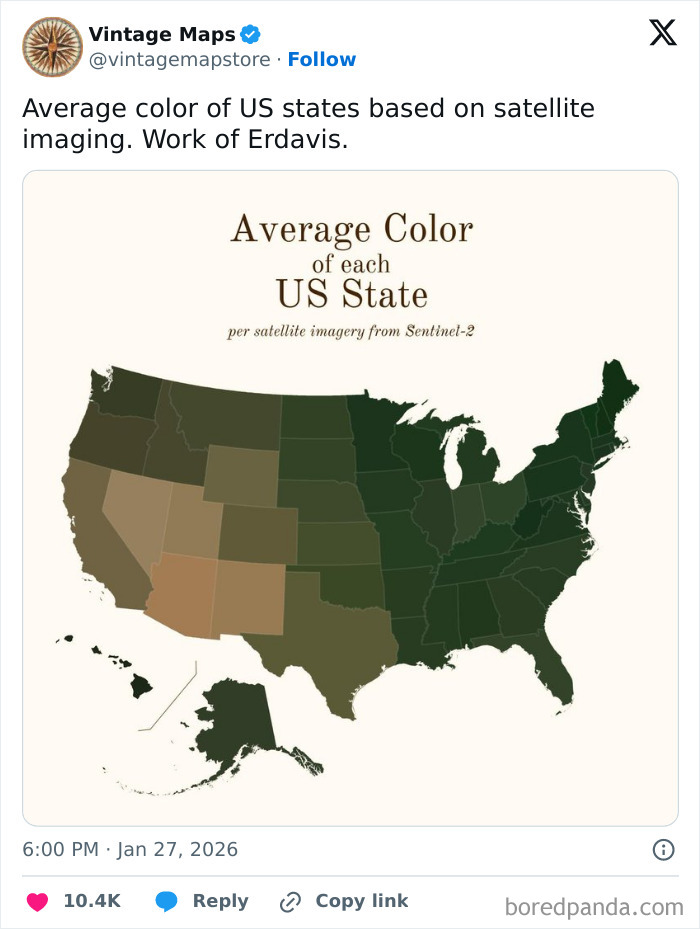
#2
© Photo: vintagemapstore
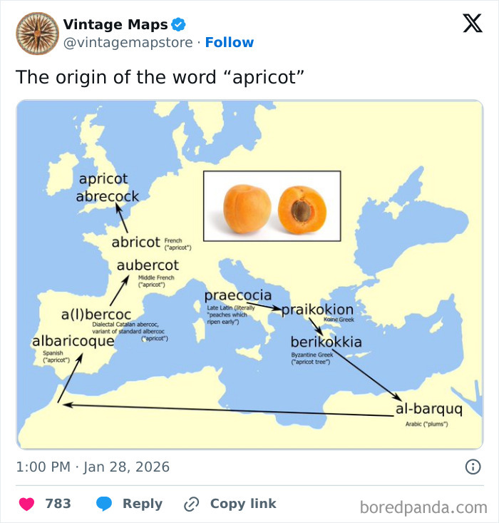
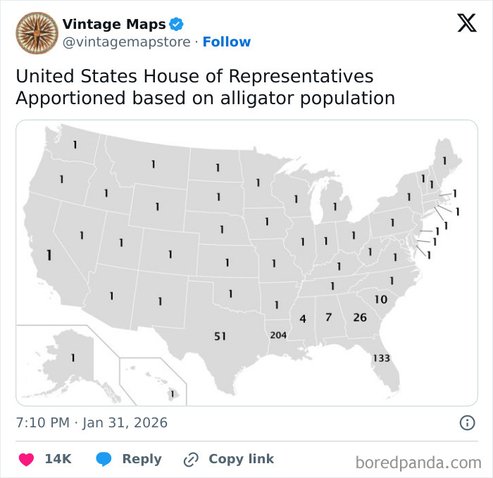
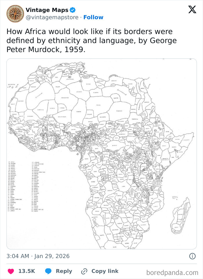
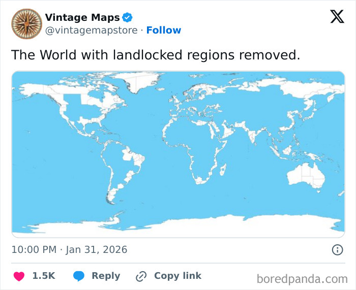
#3
© Photo: vintagemapstore
Today, we think of maps as visual representations of information. As evident from this list, maps can show more than just geography. They offer us historical comparisons, goofy facts, and even where the word “apricot” came from. Today, we think of maps as accurate, reliable information.
But in the past, maps were a mix of artistry, imagination, mythology, and just a dash of geographical knowledge. Take the Borgia Map of the late 18th century, for example. Although it claims to be a map of the world, we could hardly recognize what it even is. There are illustrations of humans and animals on it, and the south is at the top.
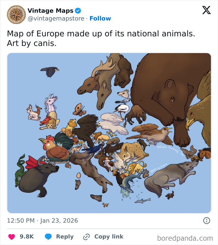
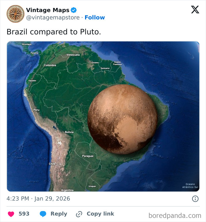
#4
© Photo: vintagemapstore
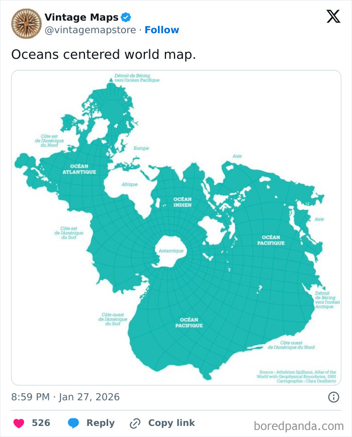
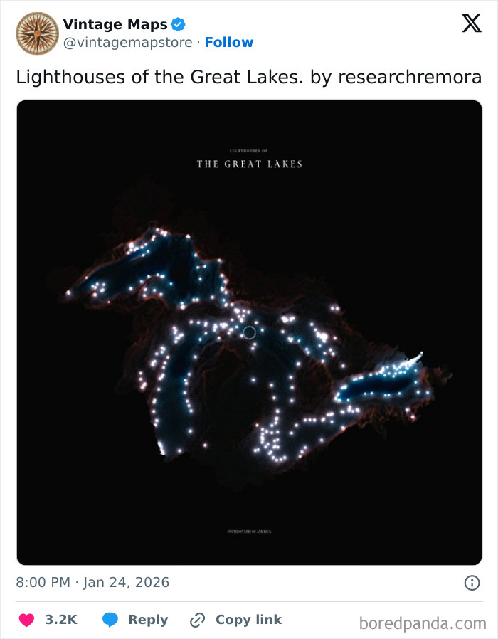
#5
© Photo: vintagemapstore
#6
© Photo: vintagemapstore
According to the Borgia Map, North Russia was “Asia Major.” Its creators claimed that dogs were stronger than lions there. The Hyperborean Mountains (possibly the Ural Mountains) were said to be the dwelling place of griffins and tigers. They also got some things right, like Alexandria in Egypt. However, the description of the phoenix, a bird that supposedly lived there, was a dash of mythology.
“Phoenix, the sole most beautiful and solitary bird in the world, burns itself in an aromatic fire, and in three days is recreated from its ashes,” the description on the Borgia Map says. Cartographers note that in many other maps of that time, Jerusalem was the center, hence why the maps were oriented to the east. They speculate that the Borgia Map, with its orientation to the south, was purely for decoration.
#7
© Photo: vintagemapstore
#8
© Photo: vintagemapstore
#9
© Photo: vintagemapstore
Not all ancient maps were of land. The oldest nautical map of the Western World, the Carta Pisana, was supposedly designed in the 13th century and mapped out the Mediterranean basin. Different from the Borgia Map, the Carta Pisana is impressively accurate.
The Italian coastline is represented proportionally, and the most important ports are all in their precise locations. Historians call the Carta Pisana a turning point in mapmaking in the Middle Ages. It wasn’t just a political or religious representation of the world, but practical and of unmatched precision.
#10
© Photo: vintagemapstore
#11
© Photo: vintagemapstore
#12
© Photo: vintagemapstore
The typical maps of the Middle Ages are called Mappa Mundi. The Hereford Mappa Mundi, for example, is the largest medieval map (5’2” by 4’4”). As was right for its time, its creator wasn’t very keen on geographical accuracy. The Hereford map included depictions of Heaven and H**l. Anthropologist Francesca Small’s verdict for it was “all propaganda, religious propaganda.”
#13
© Photo: vintagemapstore
#14
© Photo: vintagemapstore
#15
© Photo: vintagemapstore
But there was another medieval map that was quite accurate in the geographical sense, the Fra Mauro Mappa Mundi. Today, it’s considered the most accurate depiction of early Europe. However, it includes more than just the Eurasian continent. Although its top points south, there is a surprisingly accurate depiction of the African continent. It’s surprising because the Portuguese traveled to the Cape of Good Hope only in 1488, and the map was created in 1450.
#16
© Photo: vintagemapstore
#17
© Photo: vintagemapstore
#18
© Photo: vintagemapstore
If you’ve ever seen the “Blue Marble” image that Apollo 17 took of the Earth (that was originally taken upside down), you’d have a pretty similar picture of Fra Mauro’s Mappa Mundi. Of course, the accuracy would be lacking, but the general shape of the coastlines is still there. “The comparison is stunning when you consider that Fra Mauro compiled his data from the travel tales of myriad 15th century sailors,” according to NASA scientists.
#19
© Photo: vintagemapstore
#20
© Photo: vintagemapstore
#21
© Photo: vintagemapstore
Which of the maps on this list caught your attention the most, Pandas? Share your thoughts with us in the comments! Were there any other quirky and interesting maps that you expected to see here but didn’t? Tell us all about it in the comment section as well. And if you’d like to see even more cool maps you probably haven’t seen before, be sure to check this compilation where you can learn new facts about the world through unconventional maps!
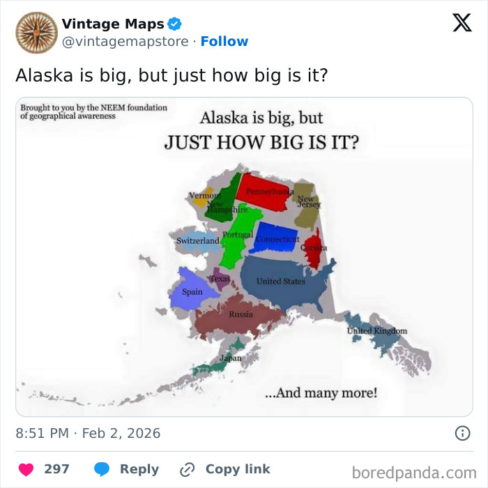
#22
© Photo: vintagemapstore
#23
© Photo: vintagemapstore
#24
© Photo: vintagemapstore
#25
© Photo: vintagemapstore
#26
© Photo: vintagemapstore
#27
© Photo: vintagemapstore
#28
© Photo: vintagemapstore
#29
© Photo: vintagemapstore
#30
© Photo: vintagemapstore
#31
© Photo: vintagemapstore
#32
© Photo: vintagemapstore
#33
© Photo: vintagemapstore
#34
© Photo: vintagemapstore
#35
© Photo: vintagemapstore
#36
© Photo: vintagemapstore
#37
© Photo: vintagemapstore
#38
© Photo: vintagemapstore
#39
© Photo: vintagemapstore
#40
© Photo: vintagemapstore
#41
© Photo: vintagemapstore
#42
© Photo: vintagemapstore
#43
© Photo: vintagemapstore
#44
© Photo: vintagemapstore
#45
© Photo: vintagemapstore
#46
© Photo: vintagemapstore
#47
© Photo: vintagemapstore
#48
© Photo: vintagemapstore
#49
© Photo: vintagemapstore
#50
© Photo: vintagemapstore
#51
© Photo: vintagemapstore
#52
© Photo: vintagemapstore
#53
© Photo: vintagemapstore
#54
© Photo: vintagemapstore
#55
© Photo: vintagemapstore
#56
© Photo: vintagemapstore
#57
© Photo: vintagemapstore
#58
© Photo: vintagemapstore
#59
© Photo: vintagemapstore
#60
© Photo: vintagemapstore
#61
© Photo: vintagemapstore
#62
© Photo: vintagemapstore
You might also like: 50 ‘Weird Facts’ About The World That Might Give You A Fresh Perspective
from Bored Panda https://ift.tt/m1Vnp89
via IFTTT source site : boredpanda