I was lucky enough to be born in a time where I’ve never had to use physical maps to get places. And while I do find paper maps to be charming, I have to admit that I’m glad I can rely on Google and a robotic voice with questionable pronunciation to tell me where I need to go while driving. But if you’re not behind the wheel, maps can be so much more than simply tools for navigation.
We took a trip to The World in Maps Instagram account and gathered some of their most informative and fascinating posts below. As you scroll through this list, we hope you’ll learn something new about our planet, as well as your own country. And remember to upvote all of your favorite images!
#1 Interesting Fact
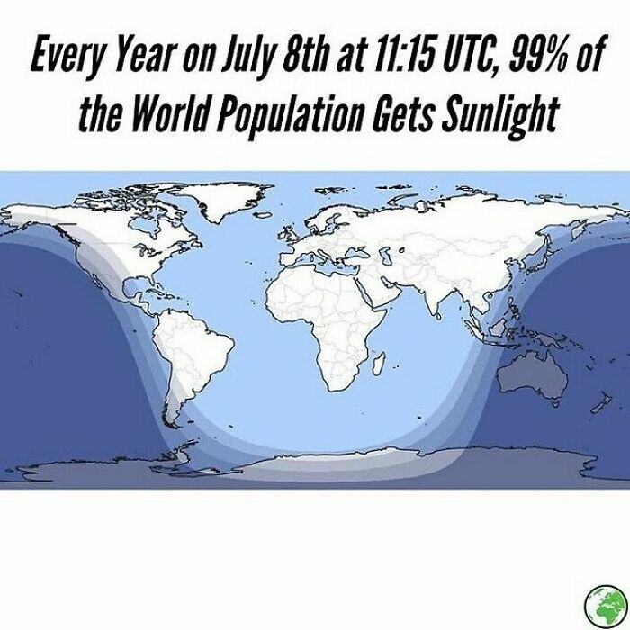
Image credits: instagram
#2 What A Shame For Hungary
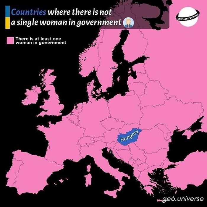
Image credits: instagram
#3 A World Map Showing Only The Countries That Have Gained Independence From The UK
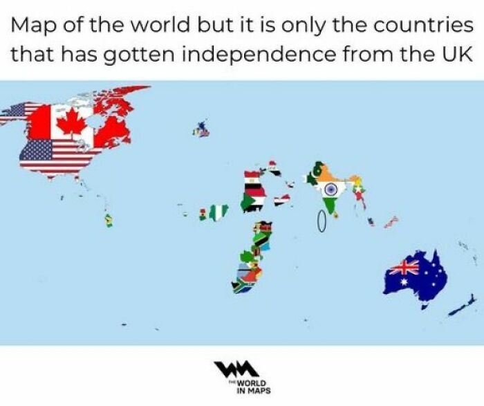
Image credits: instagram
#4 Denmark?!
Image credits: instagram
#5
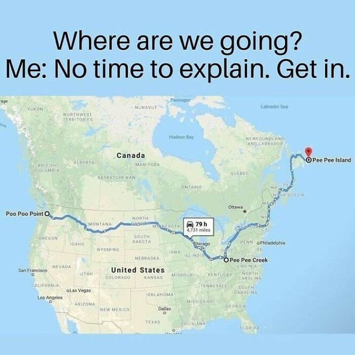
Image credits: instagram
#6
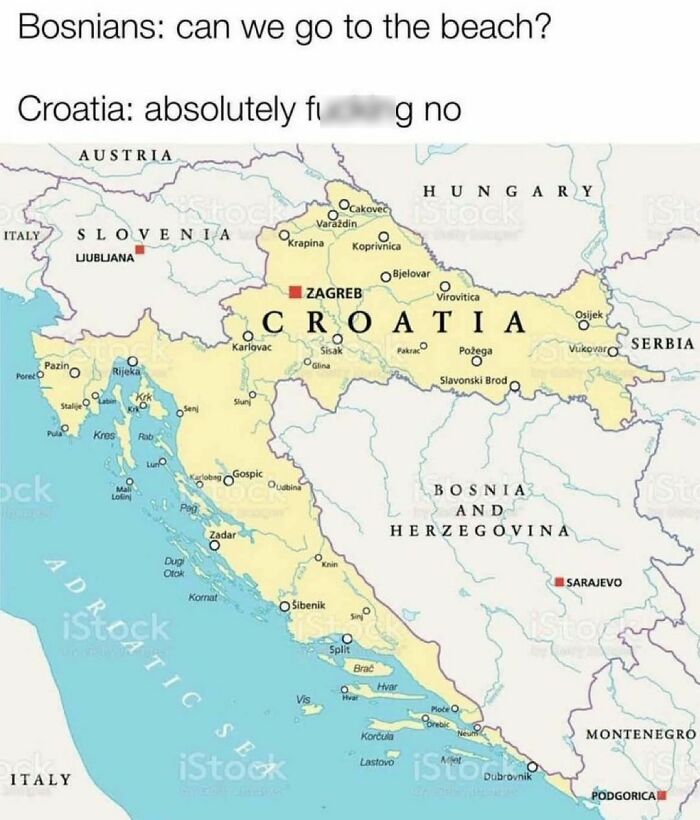
Image credits: instagram
#7 With A Stunning Victory, Spain Extends The Streak To 6 Consecutive Southern Euro Cup Winners!
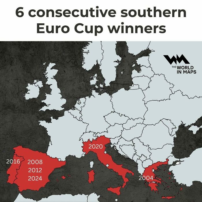
Image credits: instagram
#8 This Map Showing The Most Valuable Italian Brands Starkly Highlights The Divide Between Italy’s North And South
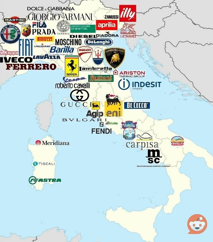
Image credits: instagram
#9 Which Countries Actually Speak English The Best As A Second Language?
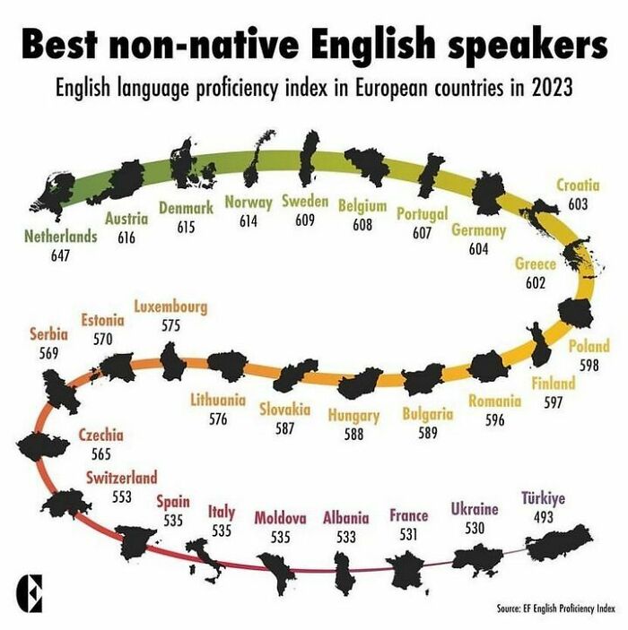
Image credits: instagram
#10
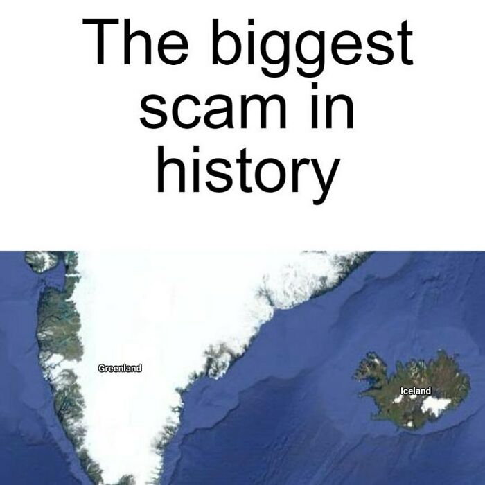
Image credits: instagram
#11 All Were Once Part Of The Same Ancient Mountain Range, The Central Pangean Mountains
This range formed over 300 million years ago during the Paleozoic Era when the supercontinent Pangaea was assembled. These mountains are now separated by vast distances due to the drifting of tectonic plates over millions of years.
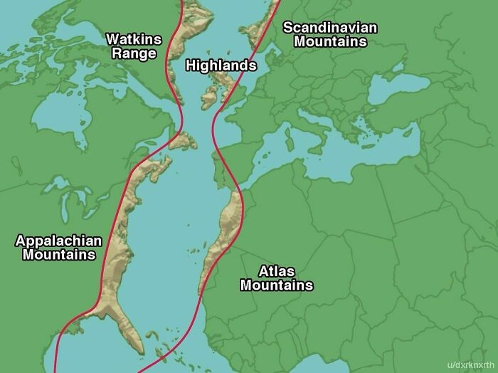
Image credits: instagram
#12 California Explained
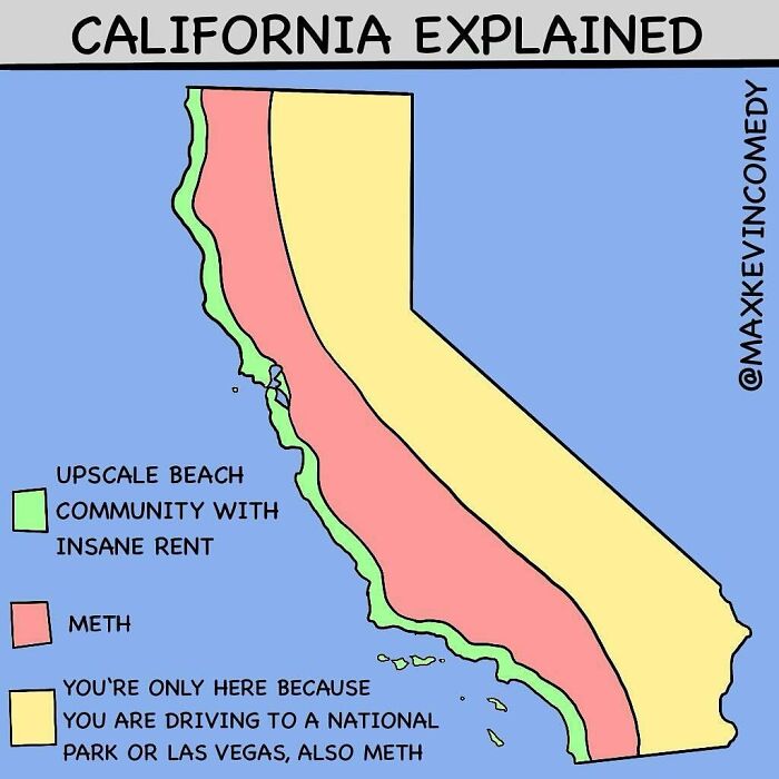
Image credits: instagram
#13 Dutch Women Are The Tallest Women In, Not Only Europe, But In The Whole World!
They are followed by Montenegrin and Danish women
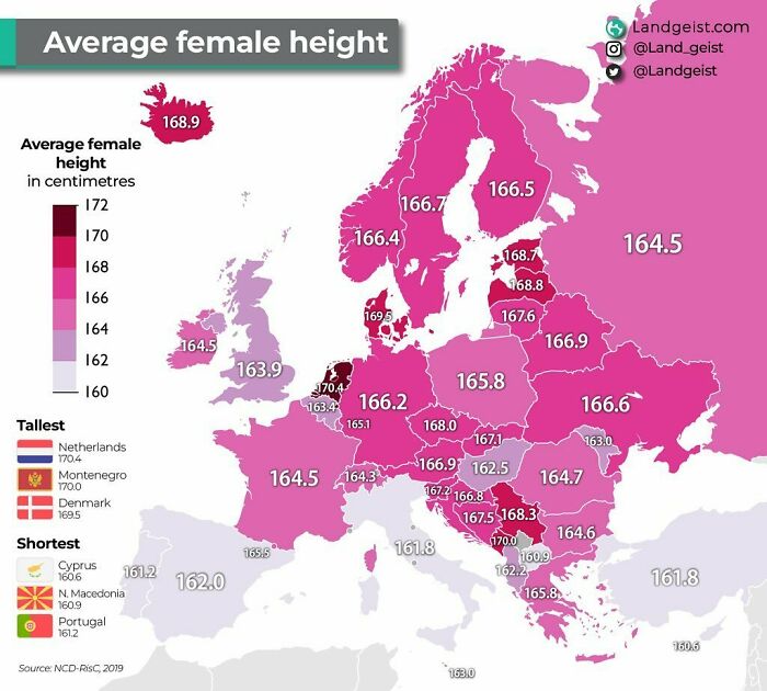
Image credits: instagram
#14 Map Shows The Percentage Of Population Able To Hold A Conversation In English In Each European Country
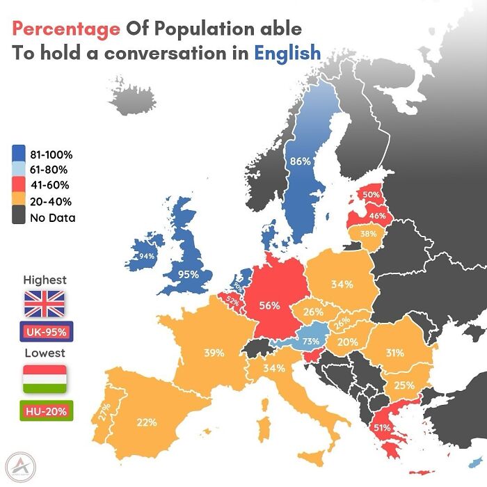
Image credits: instagram
#15 Millions Of Years Ago, Africa And South America Were Like Two Pieces Of A Giant Puzzle, Joined Together In A Supercontinent Called Pangaea
Over time, tectonic forces slowly pulled them apart, creating the Atlantic Ocean and shaping the continents we know today.
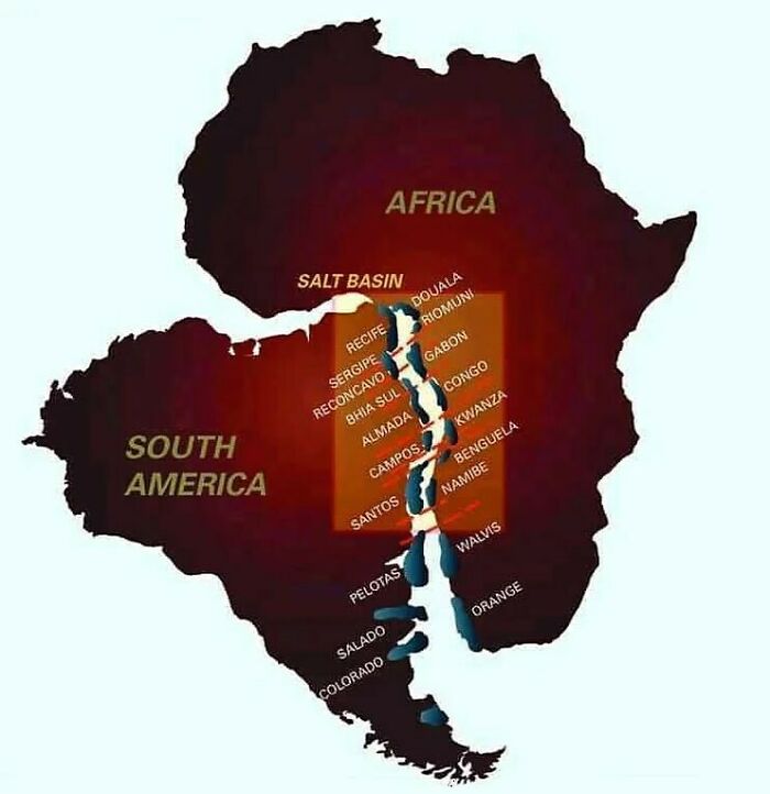
Image credits: instagram
#16 “Awesome Meme Dude” Map Through Western Europe
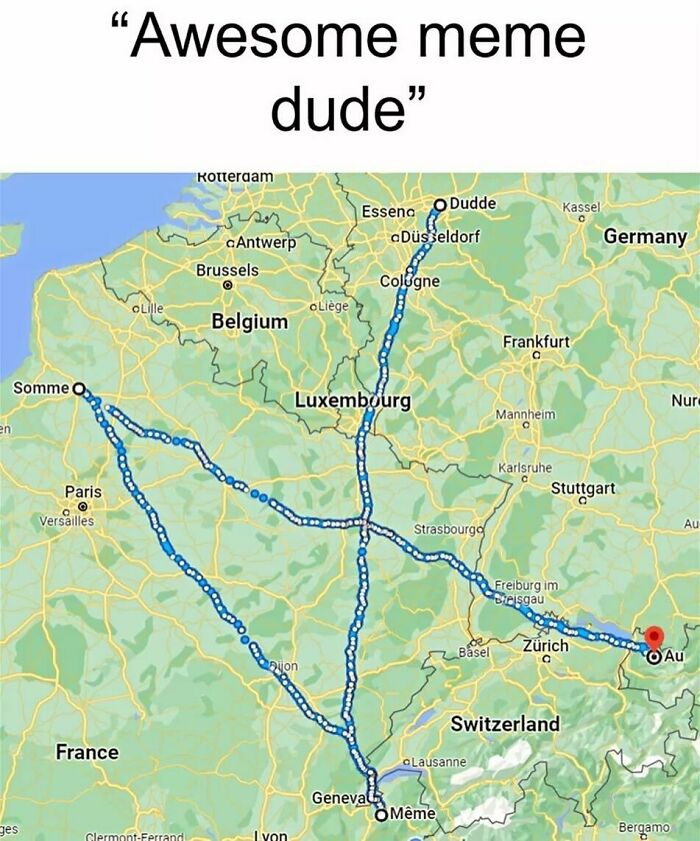
Image credits: instagram
#17
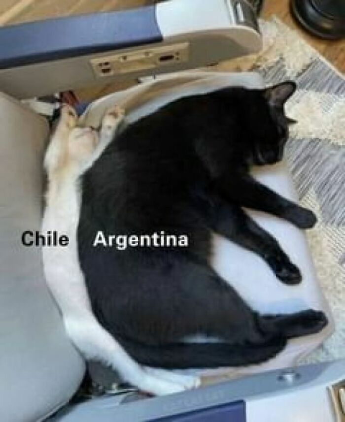
Image credits: instagram
#18 Civilization vs. Barbarism
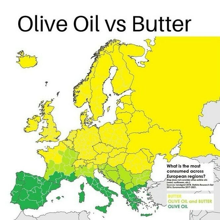
Image credits: instagram
#19 Map Shows What % Of South American Countries’ Population Resides In The Capital
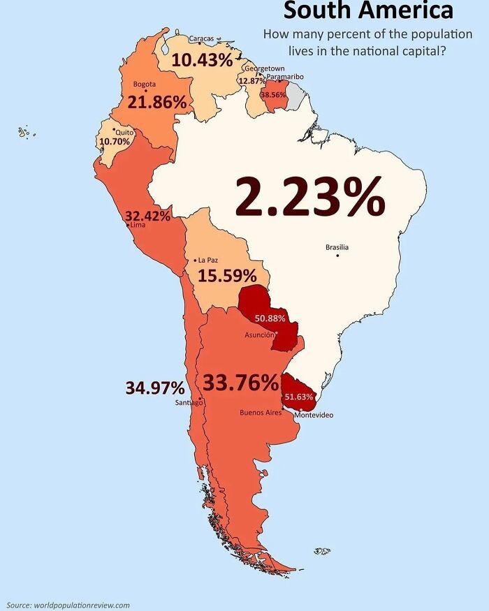
Image credits: instagram
#20 The Amount Of Sugar In Your Fanta Varies Widely Across Europe
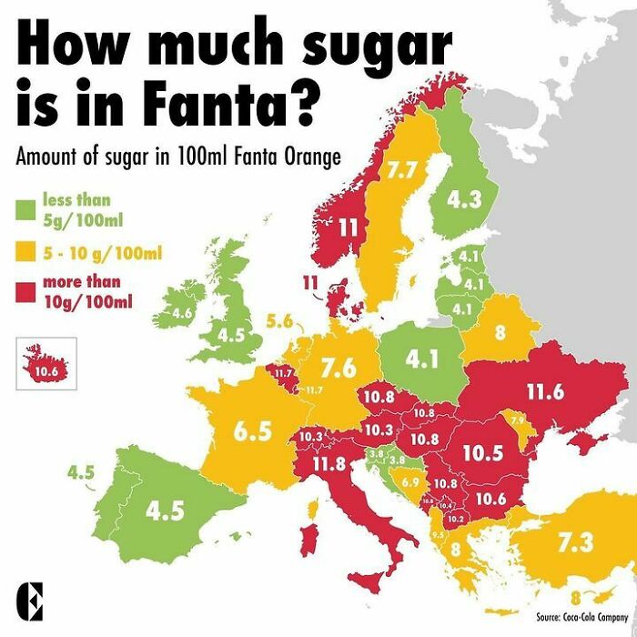
Image credits: instagram
#21 What If Canada And Mexico Split The United States Between Them?
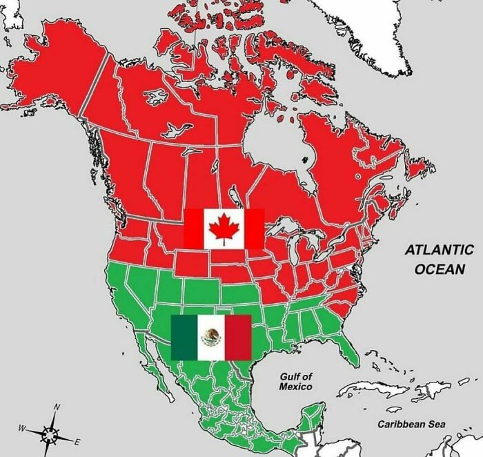
Image credits: instagram
#22 The “”blue Banana”” Is A Term Used To Describe Europe’s Most Densely Populated And Industrialized Belt
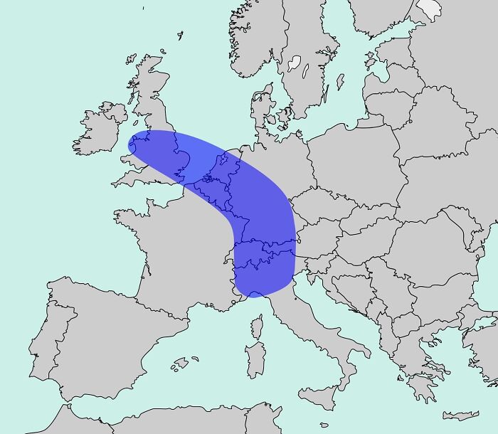
Image credits: instagram
#23 A Powerful And Prolonged Heatwave Is Affecting Eastern Europe And The Balkans
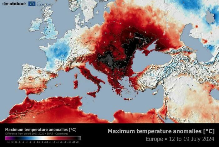
Image credits: instagram
#24
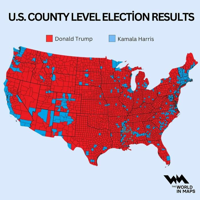
Image credits: instagram
#25 So Accurate
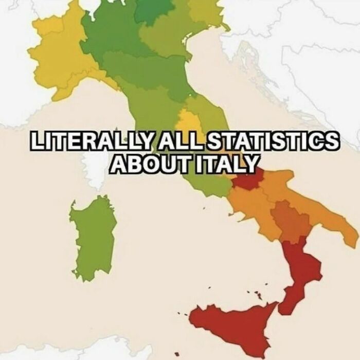
Image credits: instagram
#26
Image credits: instagram
#27 A Female Falcon Was Equipped With A Satellite Tracking System In South Africa Before Migrating To Finland
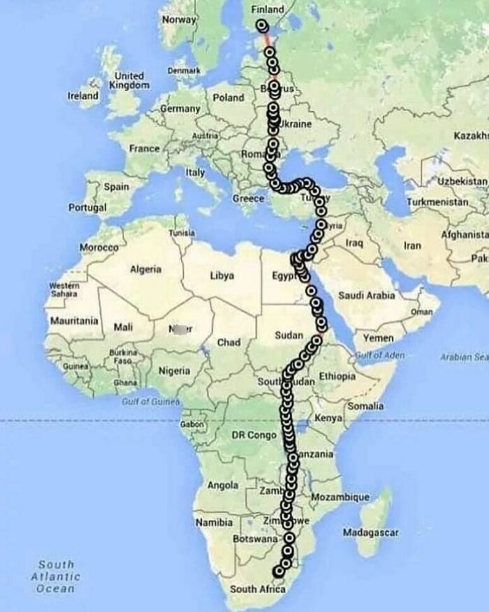
Image credits: instagram
#28
Image credits: instagram
#29 United States Of America Partition Plan: Splitting America Into Two Nations, Based On Election Results Maps From The Past 12 Years, And Along County Lines
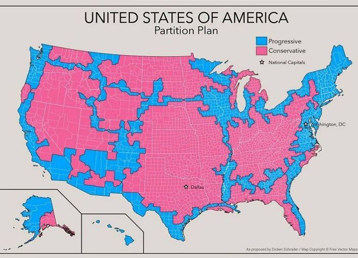
Image credits: instagram
#30 Personal Income Tax Rate In Europe
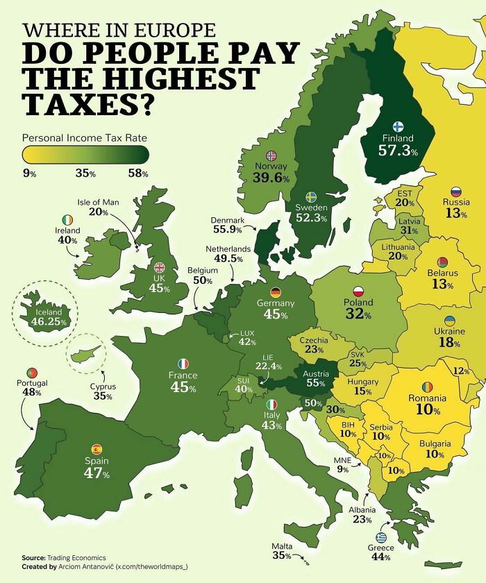
Image credits: instagram
#31 87% Of The World Lives In The Northern Hemisphere, And Only 13% Of The World Lives In The Southern Hemisphere
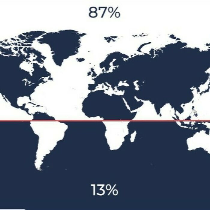
Image credits: instagram
#32
Image credits: instagram
#33 50 Most Valuable Companies On The Continent. Visual By The European Correspondent
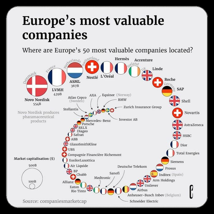
Image credits: instagram
#34 The Columbian Exchange
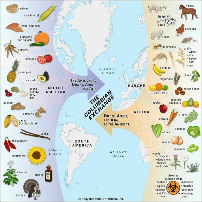
Image credits: instagram
#35 Map Shows All Known Battles In Human History
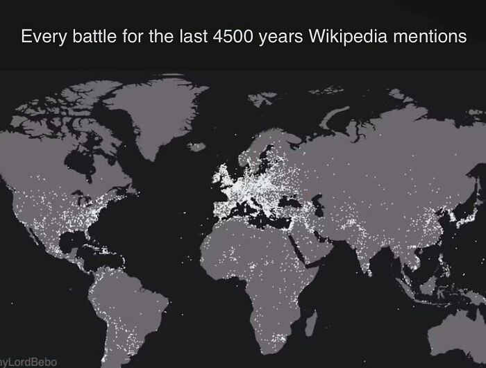
Image credits: instagram
#36 Several Countries Around The World Have No Rivers
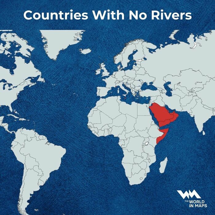
Image credits: instagram
#37
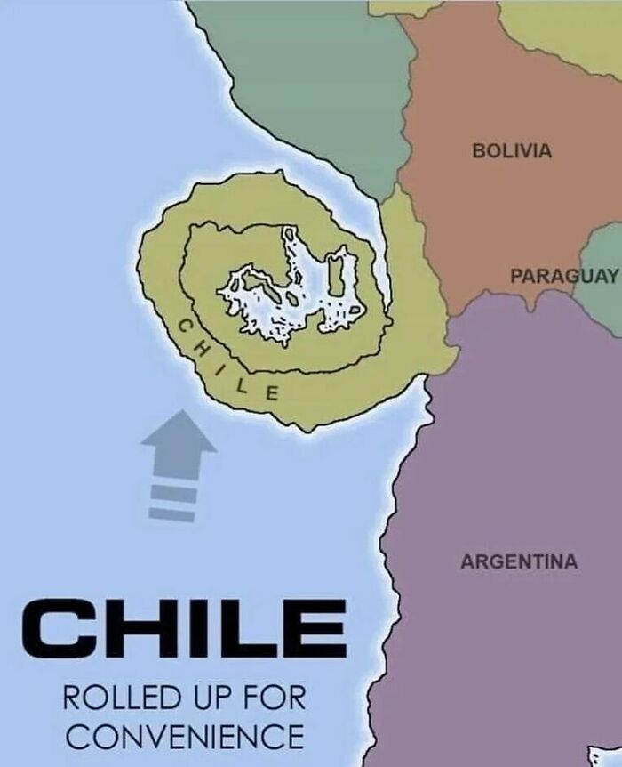
Image credits: instagram
#38 The Land Between Iceland And Ireland
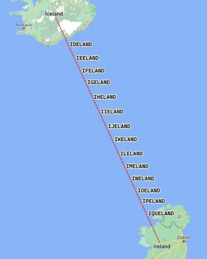
Image credits: instagram
#39 In Case You Were Wondering Why More Firms Are Setting Up Camp In Poland After Leaving Germany
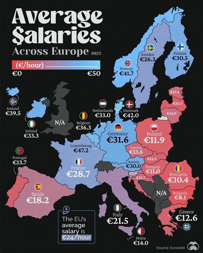
Image credits: instagram
#40 35 Years After The Fall Of The Wall, Divide Between West And East Berlin Can Still Be Seen From Space Due To Different Lightbulbs Used On Each Side

Image credits: instagram
#41
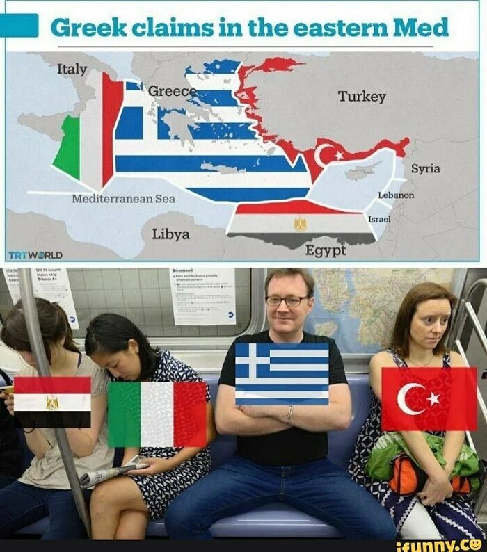
Image credits: instagram
#42
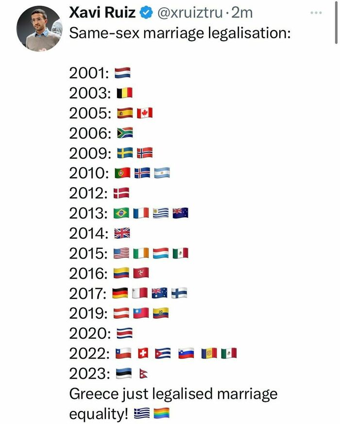
Image credits: instagram
#43 Percentage Of Indigenous In The Americas By Country/Region
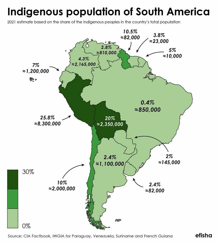
Image credits: instagram
#44 Fun Fact: The Nile River Valley And Vietnam Have A Very Similar Shape
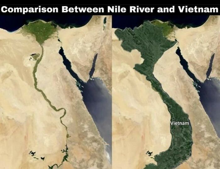
Image credits: instagram
#45 What’s Your Favorite One?
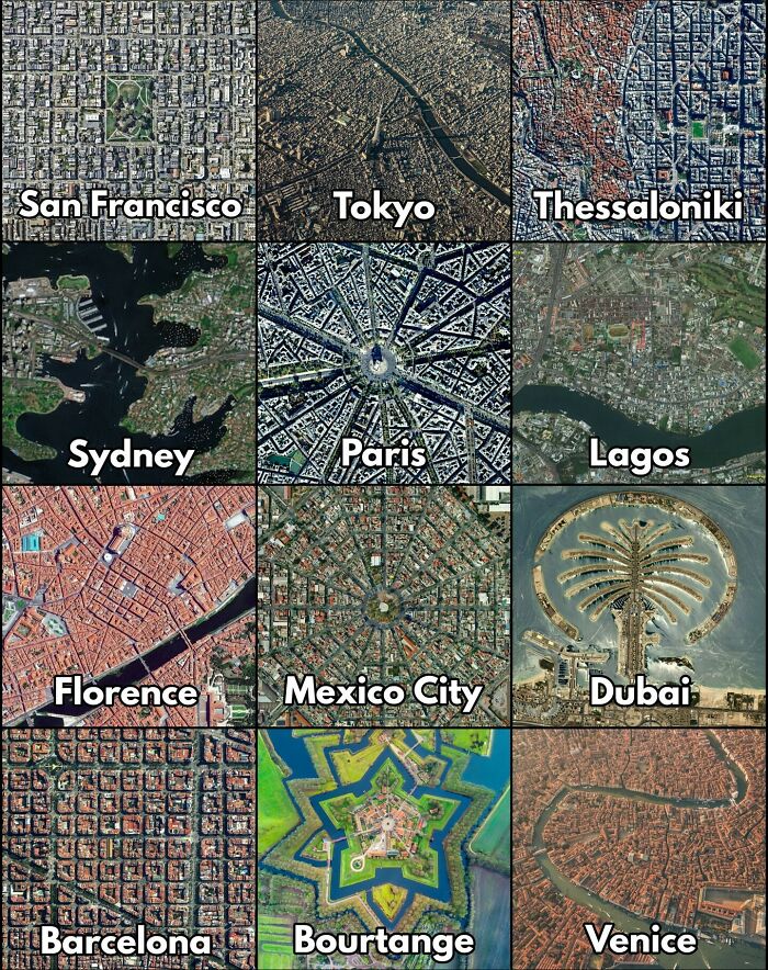
Image credits: instagram
#46 Did You Know That Turkey Borders 8 Countries With 7 Different Alphabets? This Map Shows How Turkey Is A Bridge Between Different Cultures And Civilizations
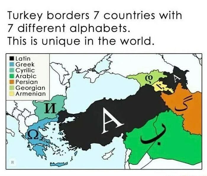
Image credits: instagram
#47 Irish Diaspora | Countries With The Highest Population
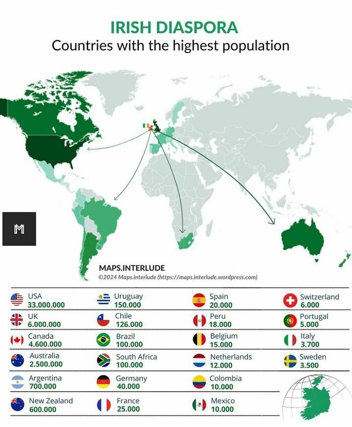
Image credits: instagram
#48 What’s The Nearest Country To Your Position In The Us?
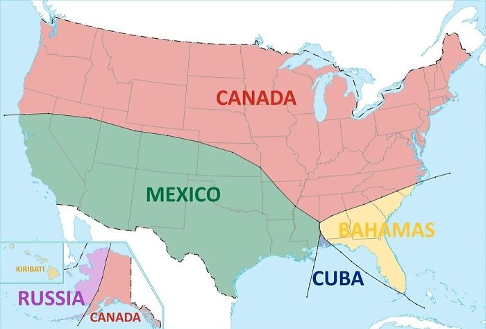
Image credits: instagram
#49 Iranian Diaspora ; Countries With The Highest Population
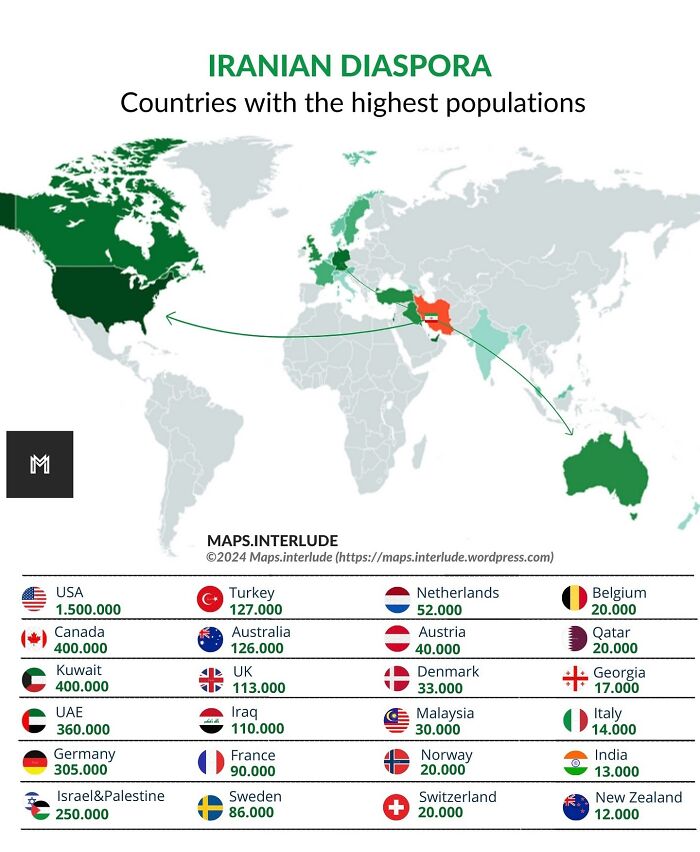
Image credits: instagram
#50 Areas That Have Had Muslim Rulers Any Time In History
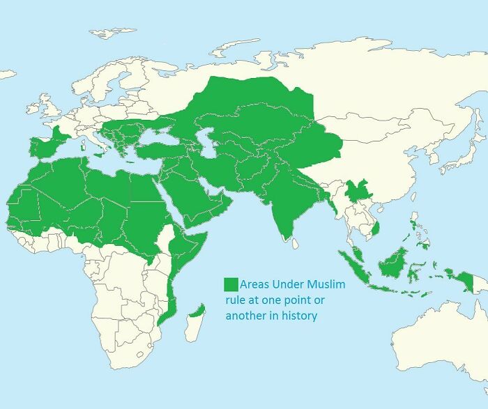
Image credits: instagram
#51
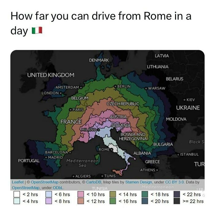
Image credits: instagram
#52 Most Common Immigrant In Germany
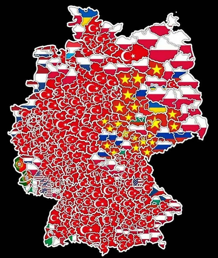
Image credits: instagram
#53 Map Shows Which Countries Use Which Alphabet In Europe
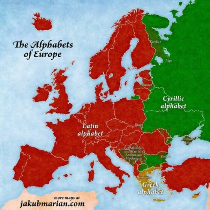
Image credits: instagram
#54 Propaganda Poster, “Portugal Is Not A Small Country,” Showing The Size Of Portugal And The Portuguese Colonial Possessions Compared To The U.S. (1951)
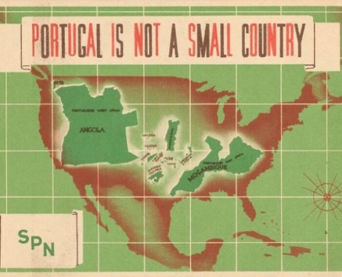
Image credits: instagram
#55 We Really Love These Size Comparisons. This Map Compares Pakistan With The East Coast Of USA
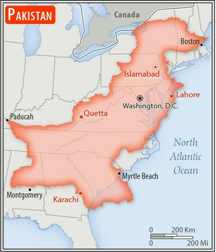
Image credits: instagram
#56 Europe Split Into 4 Regions
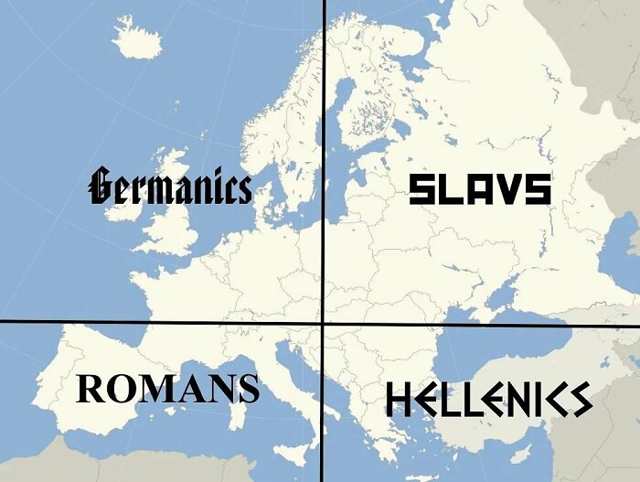
Image credits: instagram
#57 A Person Made By European Countries ✨

Image credits: instagram
#58 Gran Colombia (1819-1830), A Short-Lived Republic Established By Simu00f3n Bolu00edvar In 1819
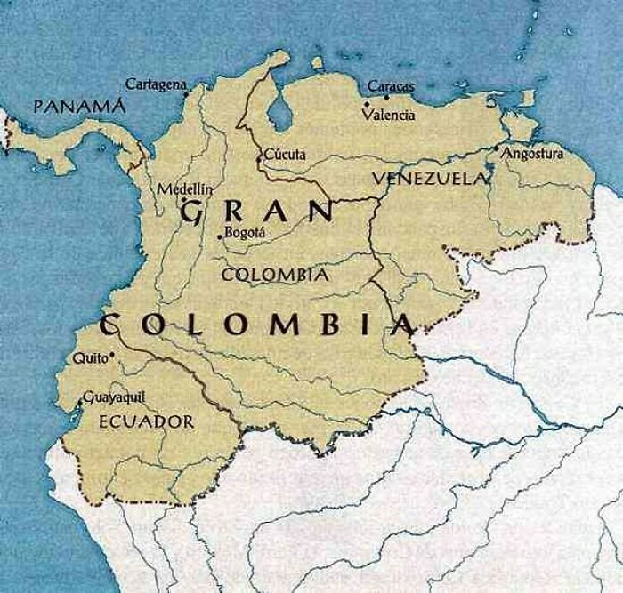
Image credits: instagram
#59 Map Shows The Areas The Ambitions Terrorist Organization Isis (Islamic State Of Iraq And Syria) Aspired To Control By 2020
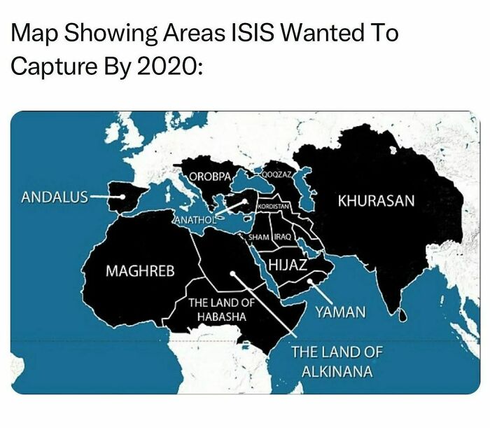
Image credits: instagram
#60 This Map Divides Europe Into Regions Of Equal Gdp – With The Exception Of Germany, Which Remains Largely Unchanged.
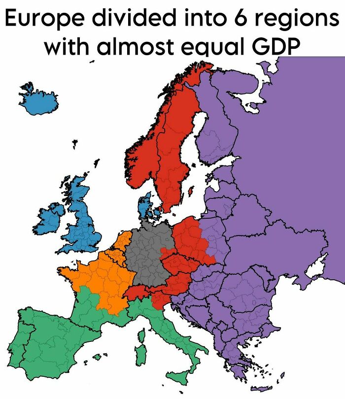
Image credits: instagram
#61 Tiny Bangladesh Has More Population Than Russia
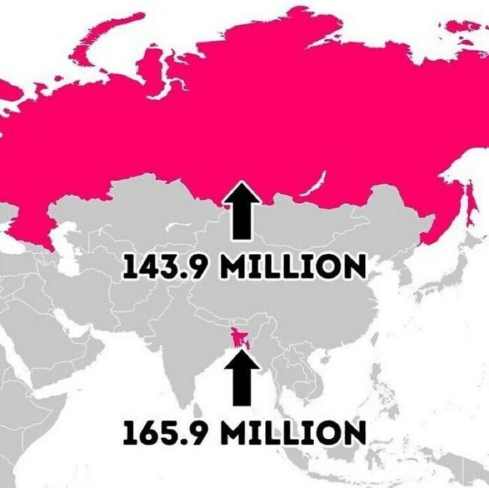
Image credits: instagram
#62 Subway Line Comparision: Rio De Janeiro ?? vs. Shanghai ??
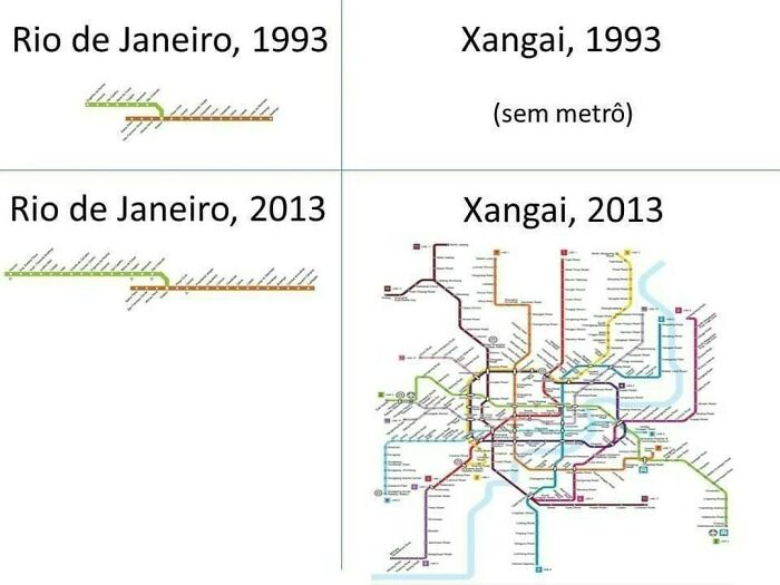
Image credits: instagram
#63 Kiribati Is The Only Country In The World To Straddle All Four Hemispheres
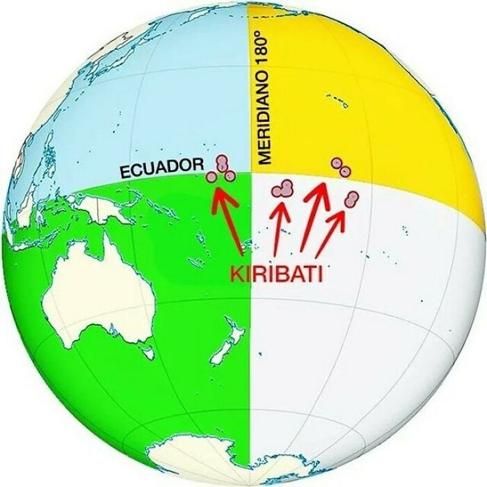
Image credits: instagram
#64 This Map Overlays Europe (Minus Russia) On Australia
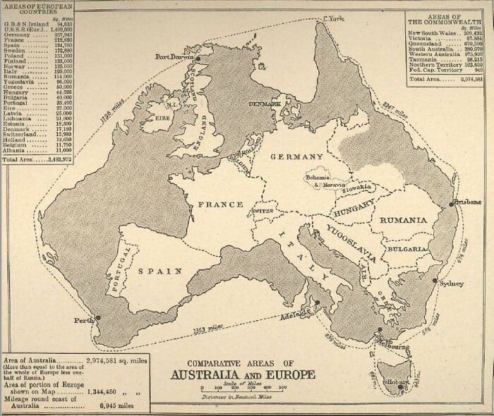
Image credits: instagram
#65
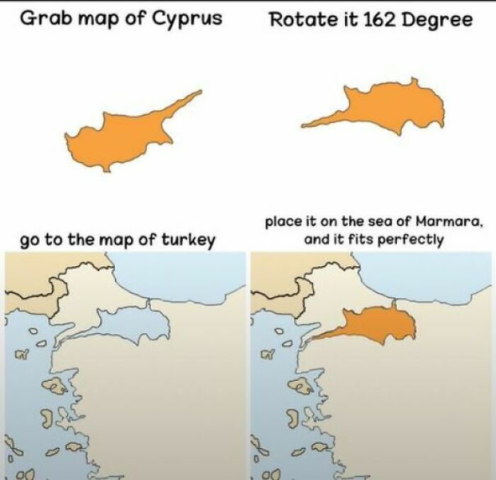
Image credits: instagram
#66 Us/Canada Time Zones If They Were Not Adjusted For Political Boundaries
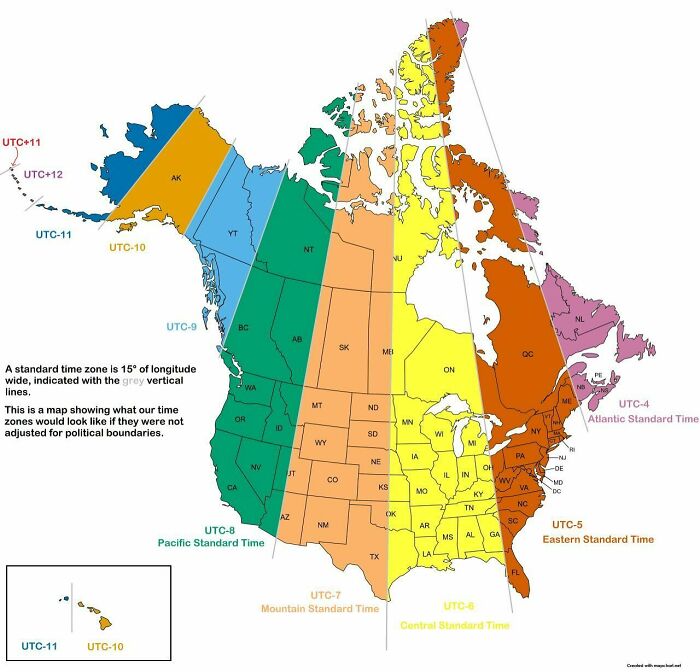
Image credits: instagram
#67 How The Next Three Solar Eclipses Will Be Seen From Spain
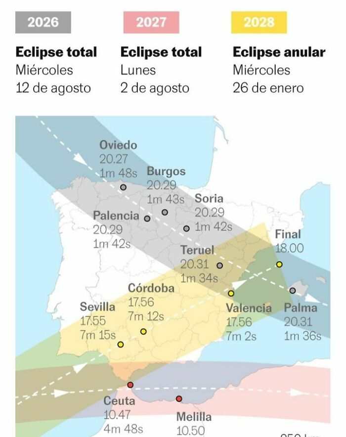
Image credits: instagram
#68 America, Still Undefeated
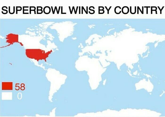
Image credits: instagram
#69 Map Shows The Top 4 Longest National Borders: America ?? – Canada ?? Russia ?? – Kazakhstan ?? Chile ?? – Argentina ?? China ?? – Mongolia ??
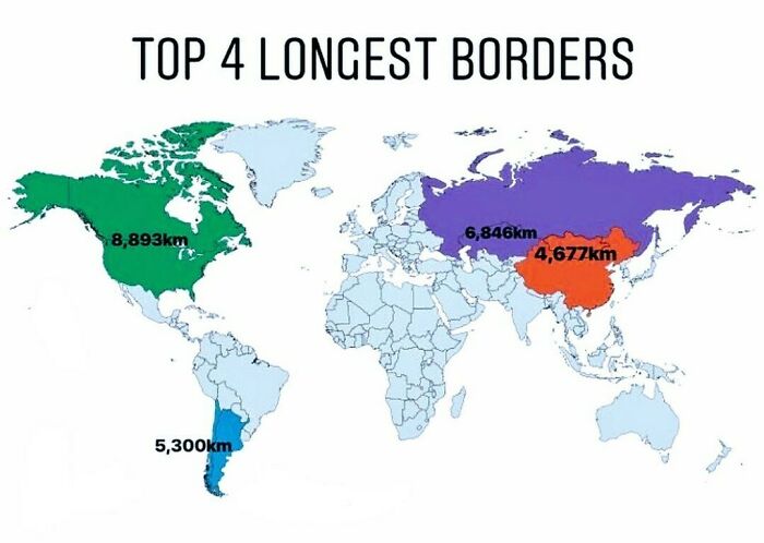
Image credits: instagram
#70 Map Above Shows Just How Successful Chengdu, China Has Been At Growing Their Metro System
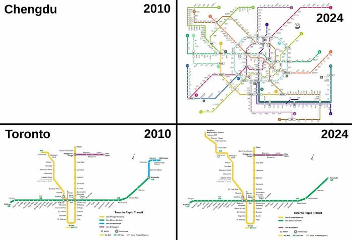
Image credits: instagram
#71 Which Countries Pollute The Most Ocean Plastic Waste?
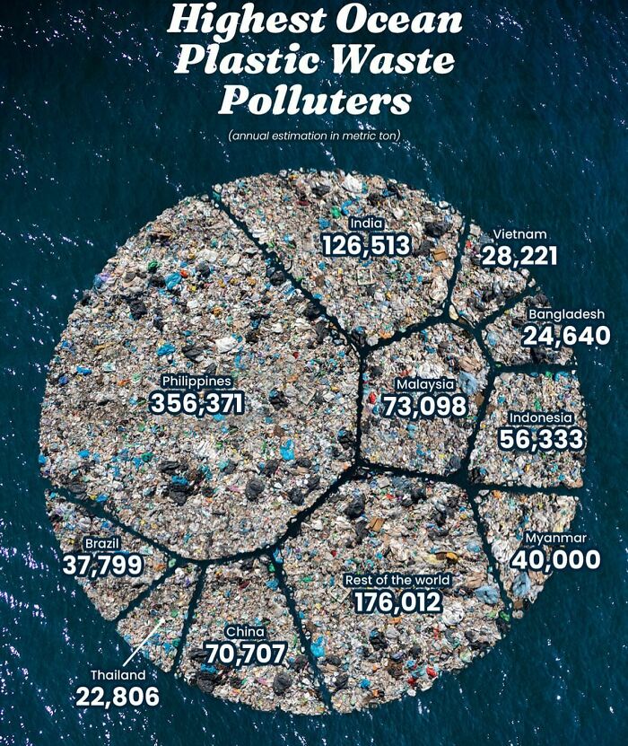
Image credits: instagram
#72 California: 2020 vs. 2024
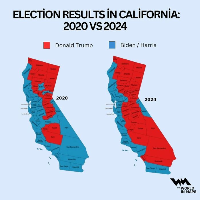
Image credits: instagram
#73 A Lovely Overview Of The Approximate Limits Of The World Known To The Romans, Around 150 Ad
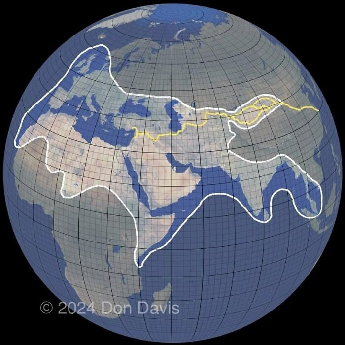
Image credits: instagram
#74 Citizenship By Land vs. Blood
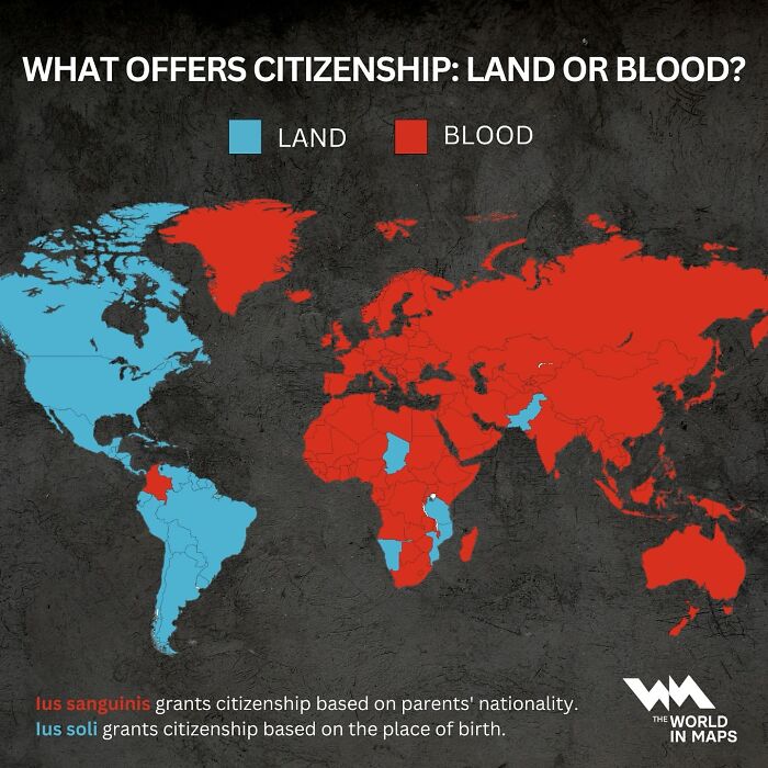
Image credits: instagram
#75 This Is A Really Cool Ottoman Map Of Australia From The Year 1803
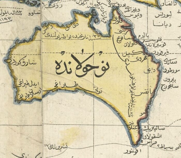
Image credits: instagram
#76 The Netherlands Is The 30th Most Densely Populated Country Or Territory In The World And The Densest Country In Europe
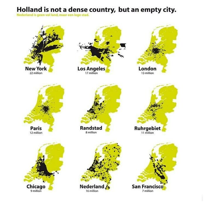
Image credits: instagram
#77 The Island Of Java In Indonesia ?? Is More Populated Than Russia ??

Image credits: instagram
#78 The Lion, Once Widely Distributed Across Most Of Africa And Parts Of Europe And Asia, Is Now Confined To A Number Of Isolated Areas
Amounting to only about 20% of its historic range.nn#WorldLionDaynnvia wikipedia
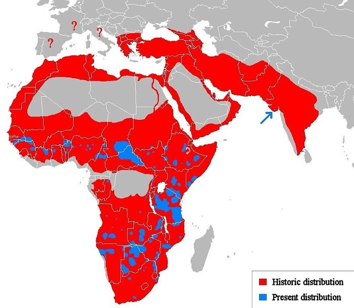
Image credits: instagram
#79 ?? The Word For Italy In Various European Languages
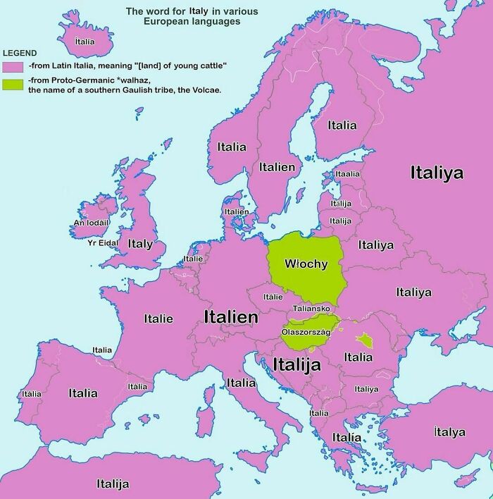
Image credits: instagram
#80 Map Shows The Largest Foreign Community In Each Country Across The Americas
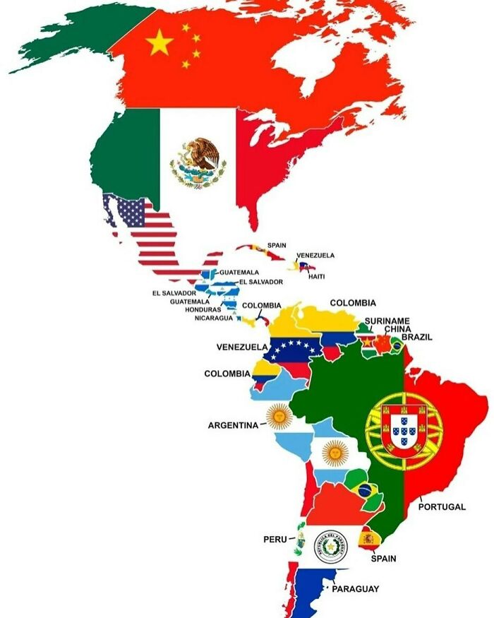
Image credits: instagram
#81 Until This Heatwave… Sweden ?? And Norway ?? Had Never Hit > 30 °c
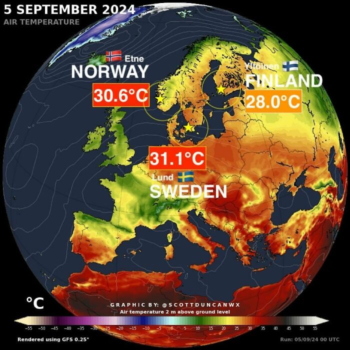
Image credits: instagram
#82 How Different European Countries Pronounce The X In Mexico
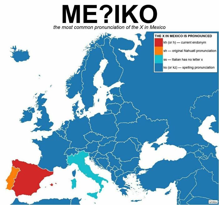
Image credits: instagram
#83 Map Shows The Roots Of The Death March Into The Syrian Desert. Approximately 1.5 Million Armenians Were Systematically Deported, Massacred, Or Marched To Their Deaths By The Ottoman Empire
Armenian Genocide Remembrance Day
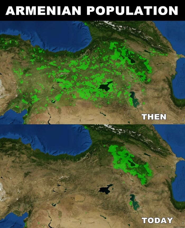
Image credits: instagram
#84 The Roman Empire Was A Multicultural, Multiracial And Multi-Linguistic Success
A bewilderingly diverse number of peoples, from primitive Britons to sophisticated Greeks and Egyptians, accepted a uniform and well-understood set of Roman values and belief systems. There had never been an empire like it, and there has not been one since
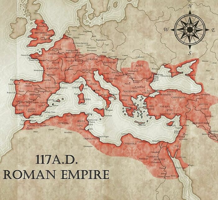
Image credits: instagram
#85 Children Deserve A Childhood Filled With Joy And Rest, Not Early Mornings That Force Them Out Of Bed
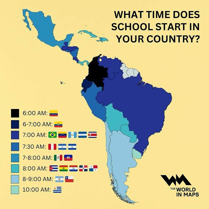
Image credits: instagram
#86 Map Compares North American Climatic Zones To Eurasian Regions
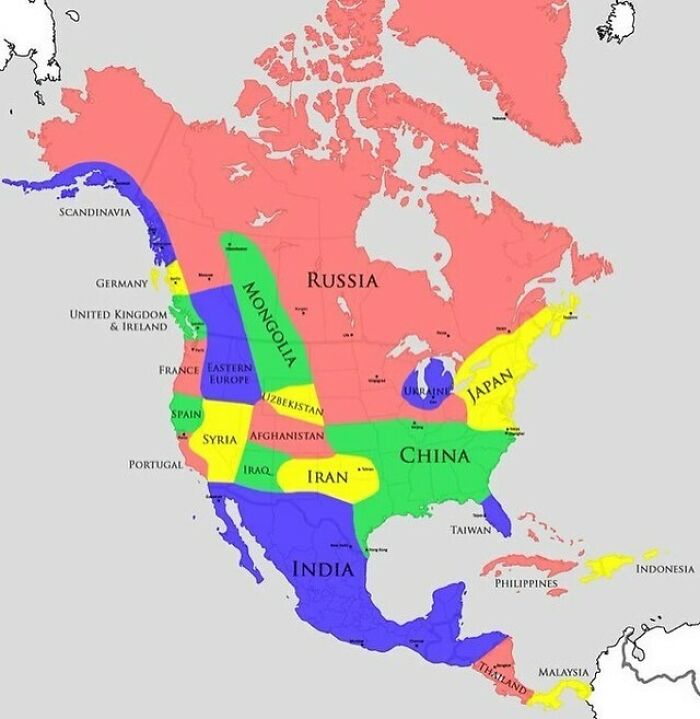
Image credits: instagram
#87 Iran Possesses The Largest And Most Diverse Missile Arsenal In The Middle East
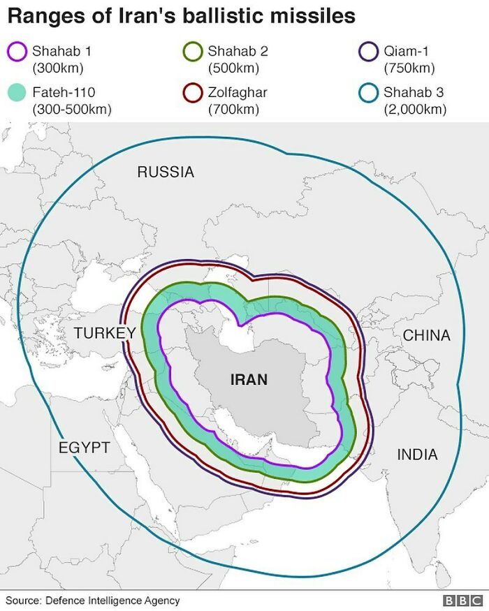
Image credits: instagram
#88 For The 32nd Year In A Row, The United Nations Votes Overwhelmingly To End The Us Embargo On Cuba
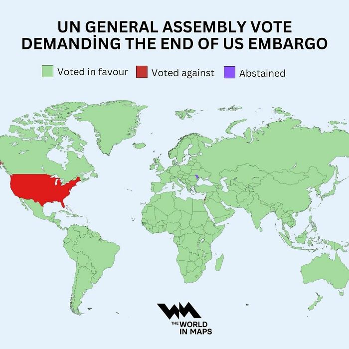
Image credits: instagram
#89 On January 1, 1999, The Euro Was Introduced As A Virtual Currency,it Officially Entered Circulation On January 1, 2002
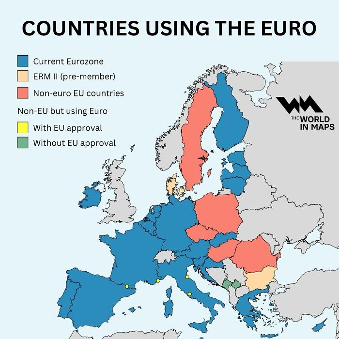
Image credits: instagram
#90 No Title
Image credits: instagram
#91 Map Shows Which States Require Front And Rear License Plates vs. Those That Only Require Rear License Plates
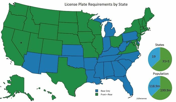
Image credits: instagram
#92 Where Do European Tourists Go?there Is A Clear Favourite Destination For Europeans: Spain
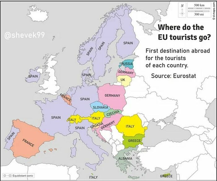
Image credits: instagram
#93 Asia Is Divided Into Six Regions
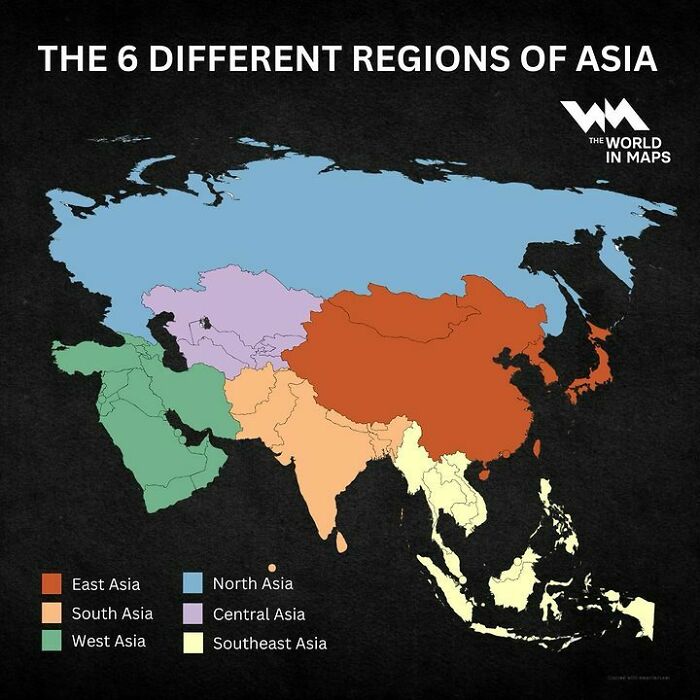
Image credits: instagram
#94 Write Your Opinion In Comments
Image credits: instagram
#95 The Triple Frontier: The Tri-Border Region Where The Borders Of 3 Countries Meet: Argentina, Paraguay And Brazil
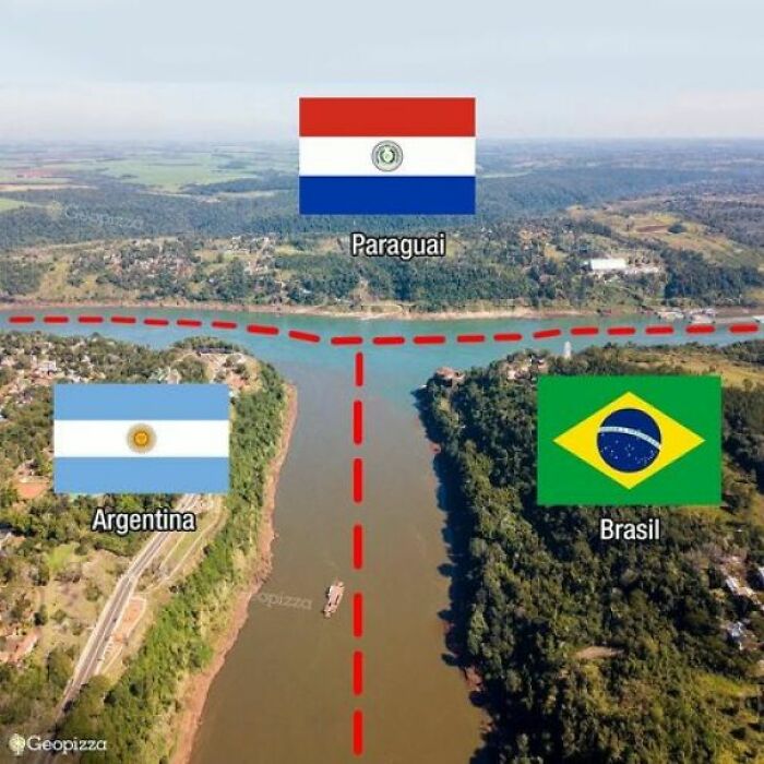
Image credits: instagram
#96 Write Your Opinion In Comments
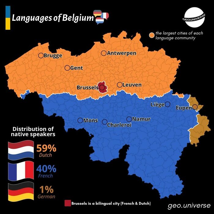
Image credits: instagram
#97 Map Shows The Vegetation Or Biomeme Analogues Of Australia
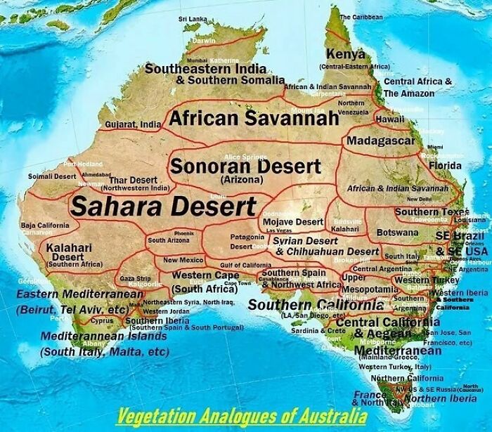
Image credits: instagram
#98 Italians In Europe
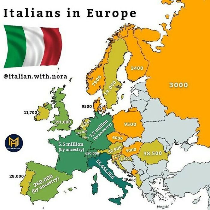
Image credits: instagram
#99 Map Shows Where You Can Find Tennis Courts In Europe
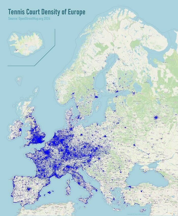
Image credits: instagram
#100 Luxembourg Is Not A Microstate!
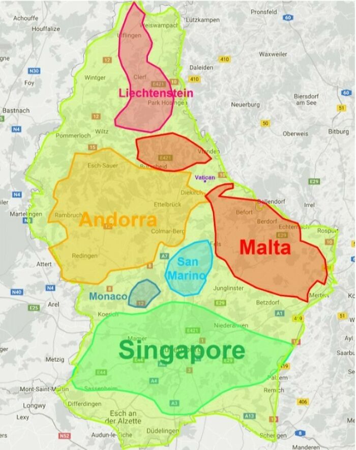
Image credits: instagram
#101 The European Union’s Livestock Population
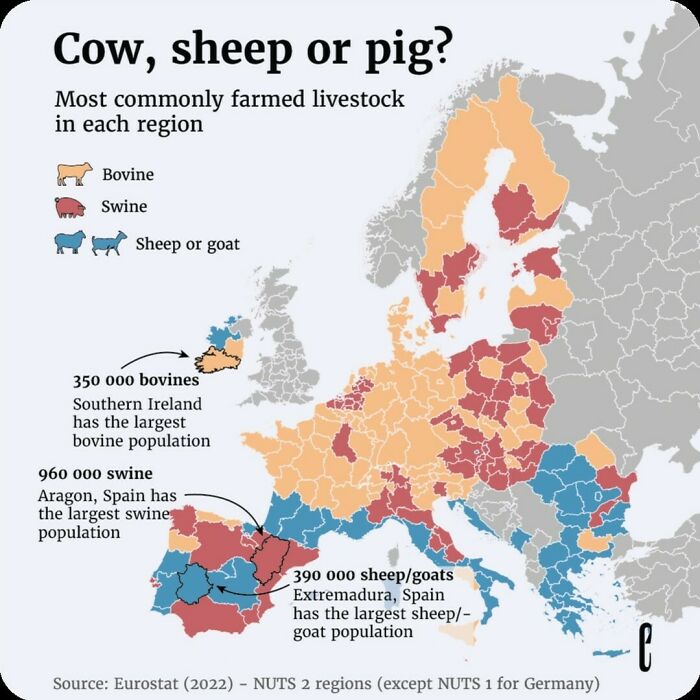
Image credits: instagram
from Bored Panda https://ift.tt/dN8fLyl
via IFTTT source site : boredpanda