Article created by: Rugilė Žemaitytė
If you’re looking for a cool hobby, studying maps might be it. They are like time-traveling storytellers, murmuring stories from hidden corners of countries, the ebb and flow of populations, and the shifting borders across time in history. They’re engaging and can easily captivate your attention for hours, much like the 2.6 million members of one special Reddit community.
We invite you to enter a cartographer’s dreamland, where lines and colors come together. You might find yourself captivated by the various marks, boundaries, and notes, joining the ranks of map enthusiasts. Give your best-liked maps an upvote and share in the comments the ones that made you want to take up this hobby.
#1 A Map Depicting The Changes In Costa Rica’s Forest Coverage Over Time
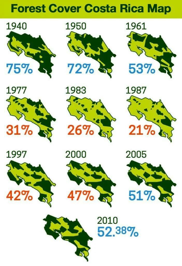
Image credits: d-williams
#2 A Dissected Globe Made In 1866
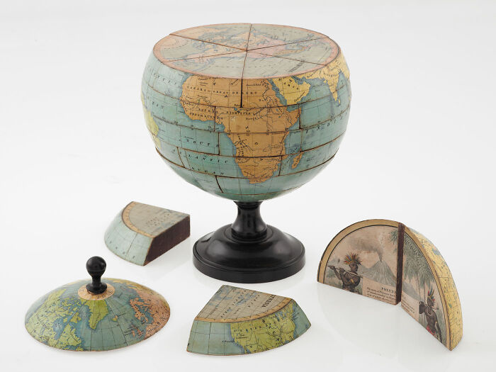
Image credits: Lepke2011
#3 No Hurricane Has Ever Crossed The Equator
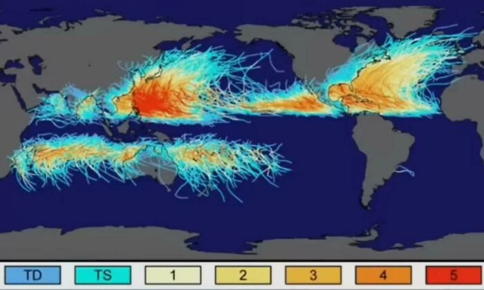
Image credits: Hockputer09
#4 Map Of Africa Using Ethnically Drawn Borders
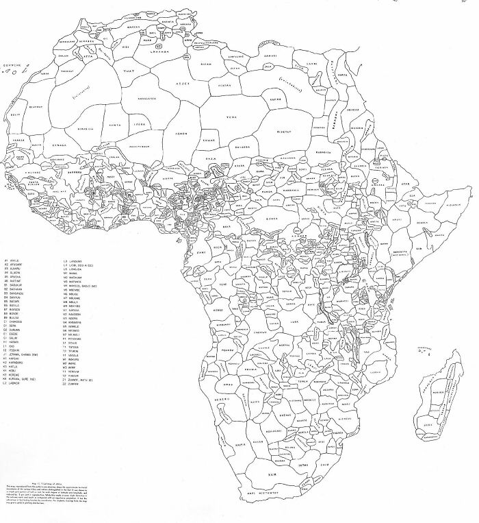
Image credits: rustyyryan
#5 The European Green Belt, Is A Wildlife Corridor Connecting Many National Parks, Built Somewhat By Mistake Over The Iron Curtain During The Cold War
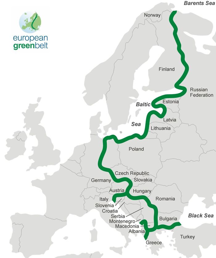
Image credits: tomydenger
#6 1529 Map Of The Americas By Diego Ribero [5701 X 7674]
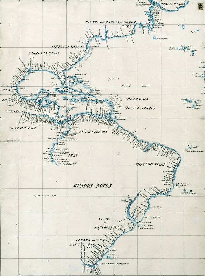
Image credits: girusatuku
#7 The Bizarre Border Between Finland And Sweden On Märket Island
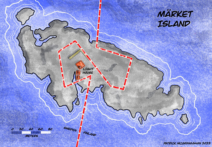
Image credits: patrickmcgranaghan
#8 Castles Of The British And Irish Isles (Oc)
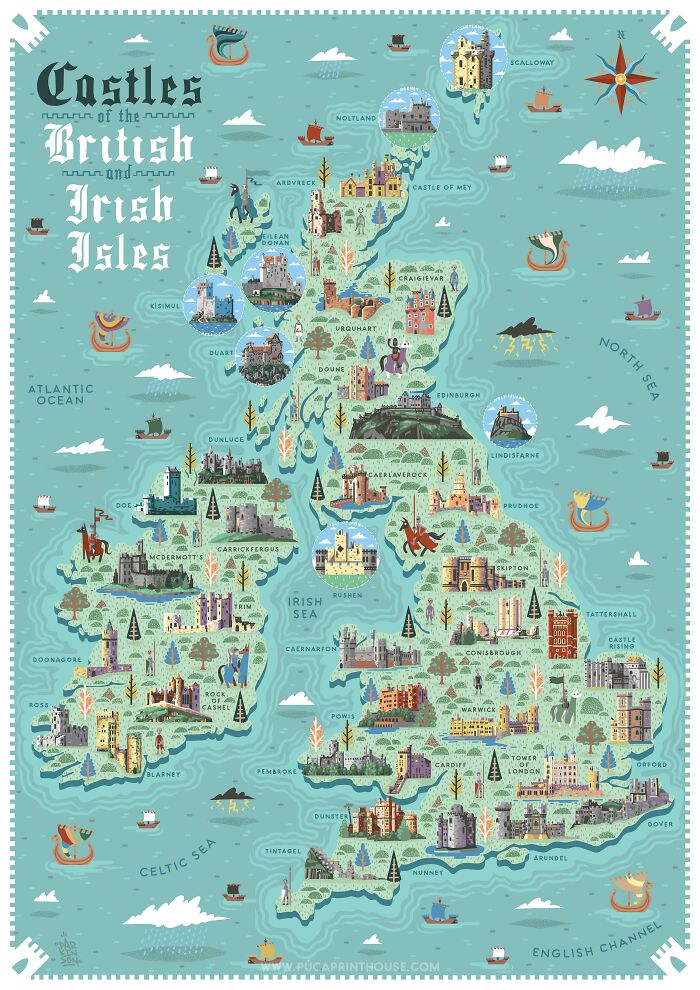
Image credits: NeilParkinsonMakes
#9 Android vs. iOS In Europe
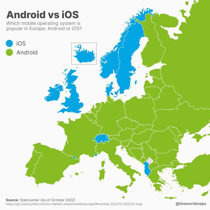
Image credits: JoeFalchetto
#10 Over 20,000 Flights ‘In The Air Right Now’
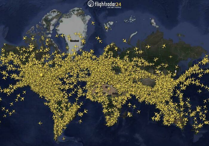
Image credits: Roy4Pris
#11 The Himalayan Weather Wall
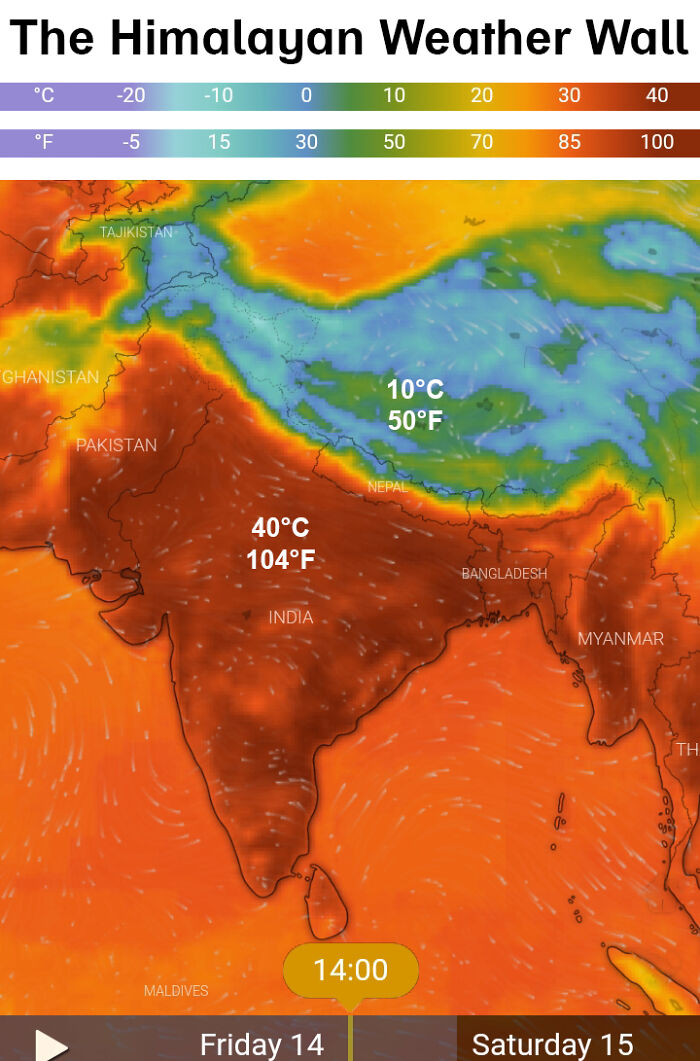
Image credits: two_plus_two_is_zero
#12 Life Expectancy In America
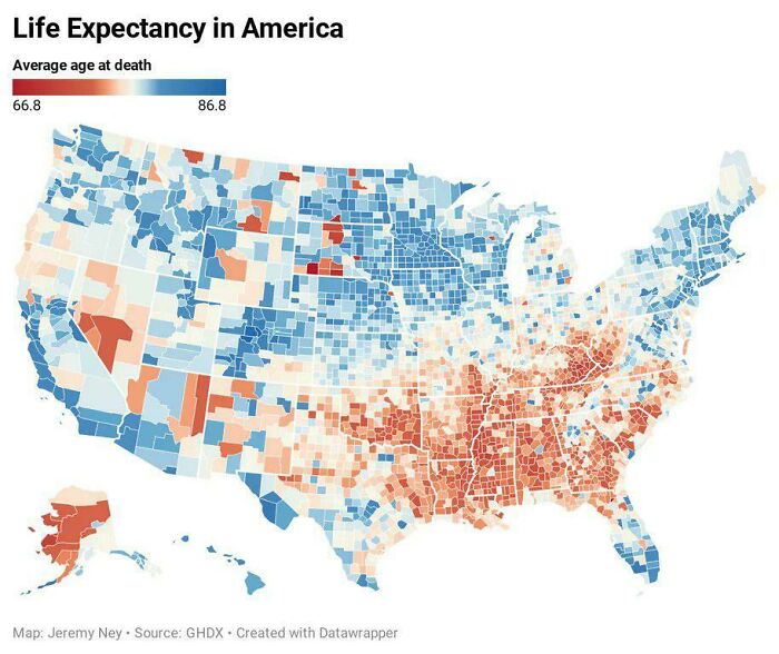
Image credits: Yiddishstalin
#13 Today I Bring To You Large Zeland
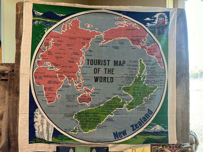
Image credits: Stormfather21
#14 Population Distribution
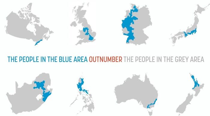
Image credits: Vaguelymortify40
#15 Potato Consumption Per Country In Europe
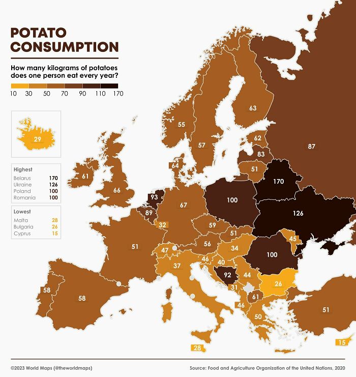
Image credits: Money_Astronaut9789
#16 An Interesting Map I Found Of World Cloud Coverage
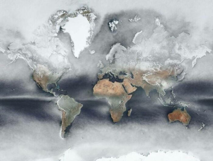
Image credits: coolperson-6408
#17 Spain Is Gonna Change Its Name To Mordor! Surface Temperature Map
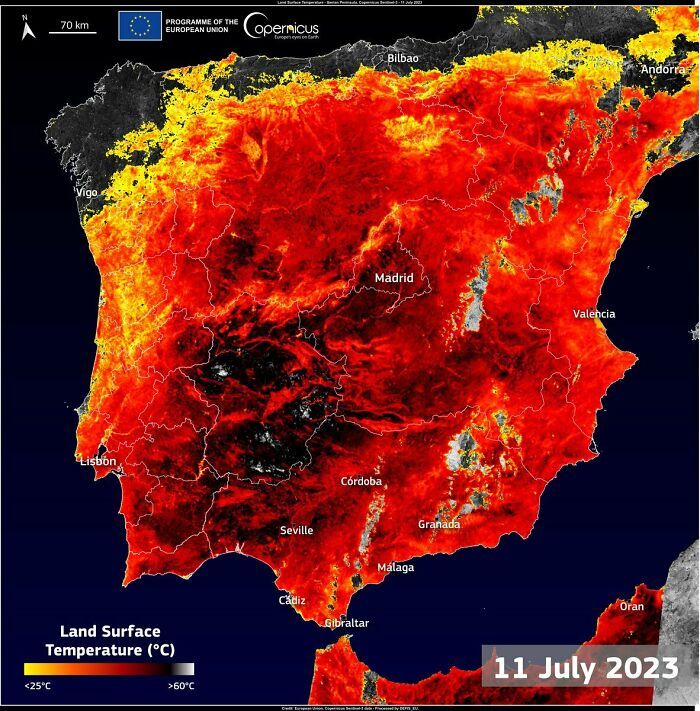
Image credits: Shevek99
#18 What Year Is It Right Now?
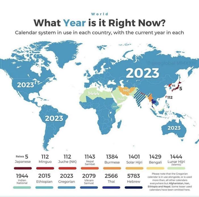
Image credits: ledim35
#19 A Population Density Map Of Hawaii
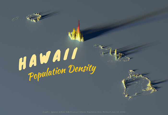
Image credits: hesiodu
#20 Percentage Of Urban Tree Cover In The European Capitals
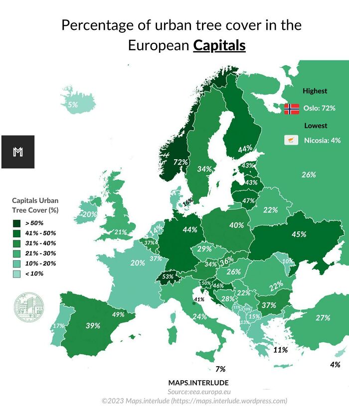
Image credits: quindiassomigli
#21 Wine Map Of France
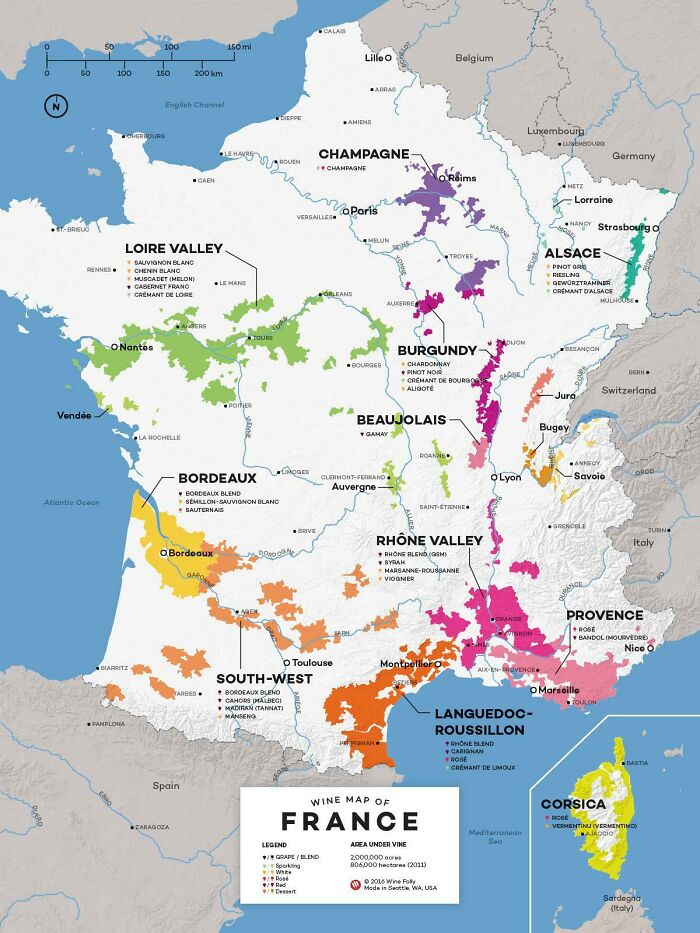
Image credits: sam_3758
#22 France 1848 Election By Dodi Maps
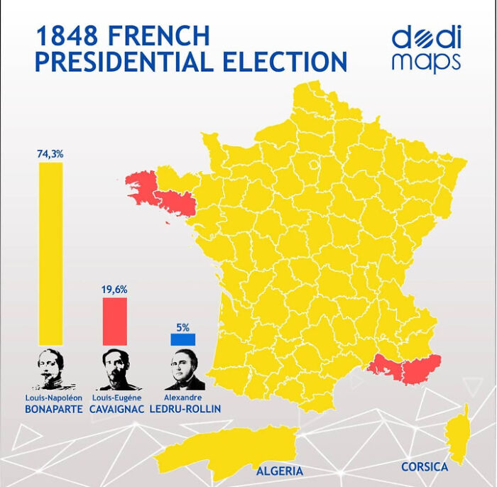
Image credits: kyno1
#23 All Red Line. A Map Of Submarine Cables Connecting British Empire In 1902
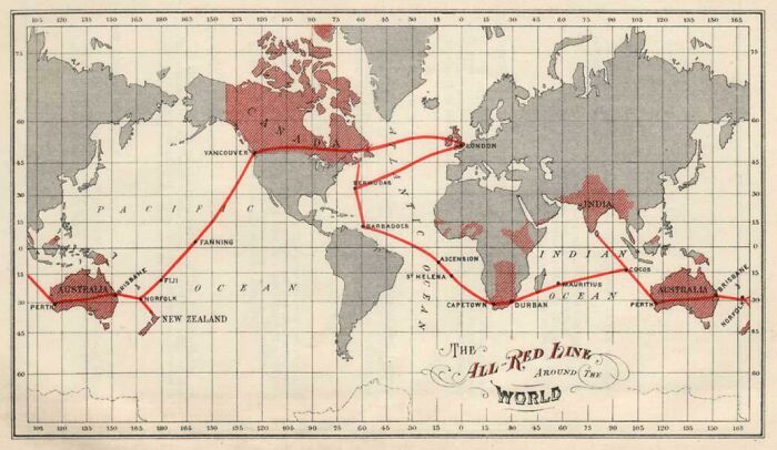
Image credits: Sensei2008
#24 The Largest Towns In 1050 In Europe, North Africa And West Asia (Population Over 40 Thousand)
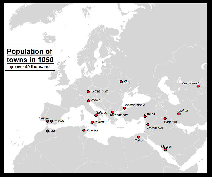
Image credits: Yellowapple1000
#25 Map Showing Flooding Extent In Ukraine Since The Kakhova Dam Breach
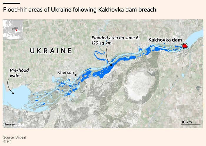
Image credits: sdbernard
#26 Average Number Of Cigarettes Smoked Per Year Per Adult Smoker
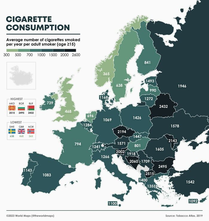
Image credits: theworldmaps
#27 Evidence Of The Storegga Tsunami That Struck The UK And Norway 8000 Years Ago
It is the most dangerous natural disaster in British history and may have ended a quarter of the island’s population
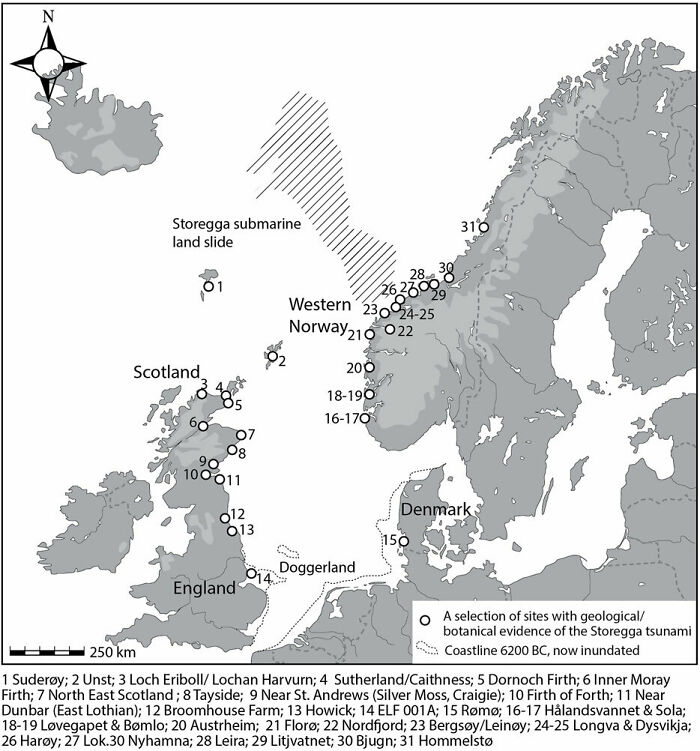
Image credits: reddit.com
#28 Leading Countries For Wine Production In Europe (2021)
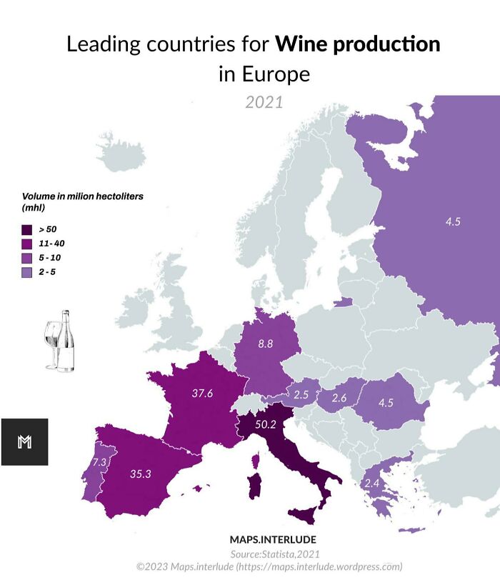
Image credits: quindiassomigli
#29 Public Transport Network Density
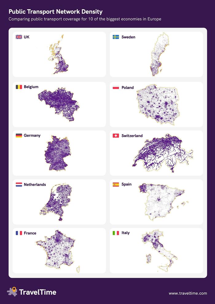
Image credits: YellowOnline
#30 Do You Address Your Own Child As “Mother”?
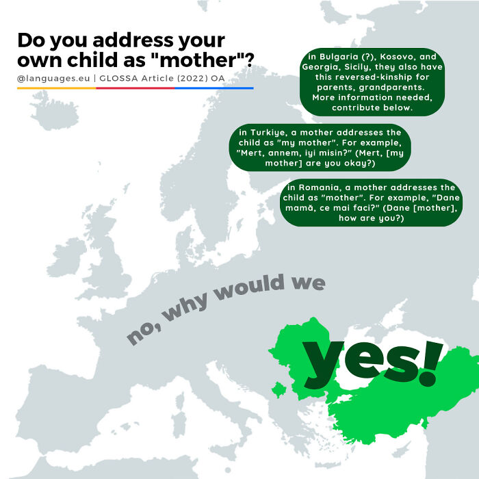
Image credits: languageseu
#31 Robbery Rates In European Countries
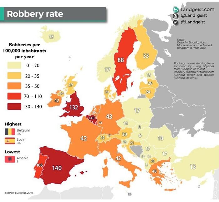
Image credits: Useless_or_inept
#32 In Which Countries Chatgpt Has Been Banned Or Is Unavailable
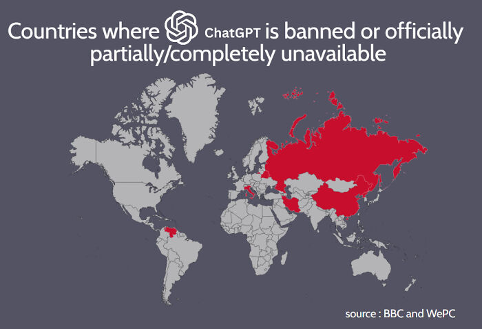
Image credits: Mackelowsky
#33 Relief Map Of San Marino
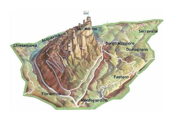
Image credits: Kl——–k
#34 How Many Firearms Per 100 People In Europe
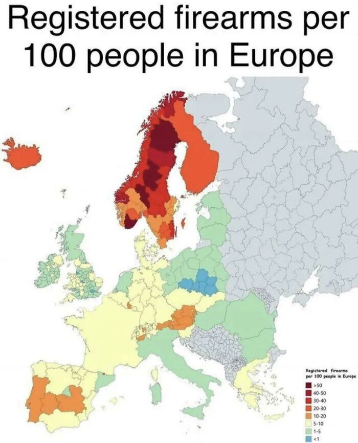
Image credits: Dazed_And_MoreBooze
#35 The Ten Busiest Port In Europe
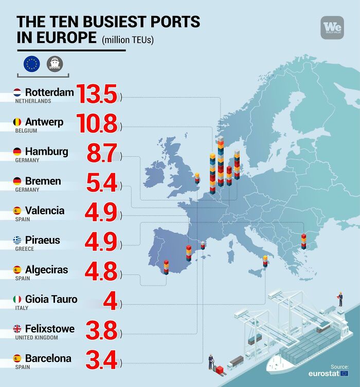
Image credits: Quiet-Luck
#36 Country Names In Finnish🇫🇮
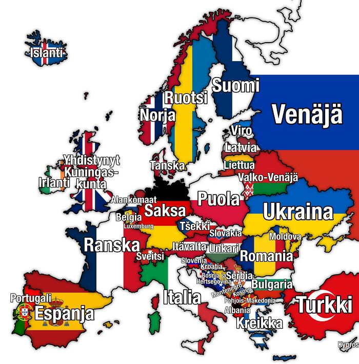
Image credits: Trapziio
#37 Percentage Of The Population With Depression
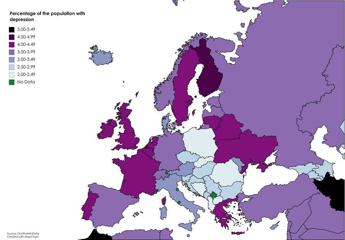
Image credits: viscardvs
#38 Nuclear Power Plants In Europe As Of 21.02.2023
- You Might Also Like: “These 34 Color Photos Show How Beautifully Diverse Our World Was”
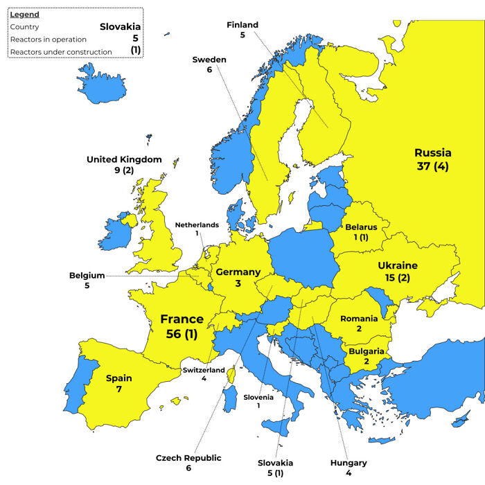
Image credits: takenawaybolt
from Bored Panda https://ift.tt/XgBZuNI
via IFTTT source site : boredpanda