Google Maps’ satellites and cars equipped with cameras have taken more than 220 billion images and covered 10 million miles of roads over the last 20 years. During this time, the devices have captured all sorts of majestic, odd, and funny sights around the world. But only those who took the time to zoom in and get a closer look have been able to reveal them.
In the list below, we gathered some of the most interesting things found while roaming the streets on Google Maps, as shared by the members of the Google Maps Shenanigans subreddit. Scroll down to see them for yourself, and don’t forget to upvote the most unexplainable ones!
#1 Accidental Beatles In DC
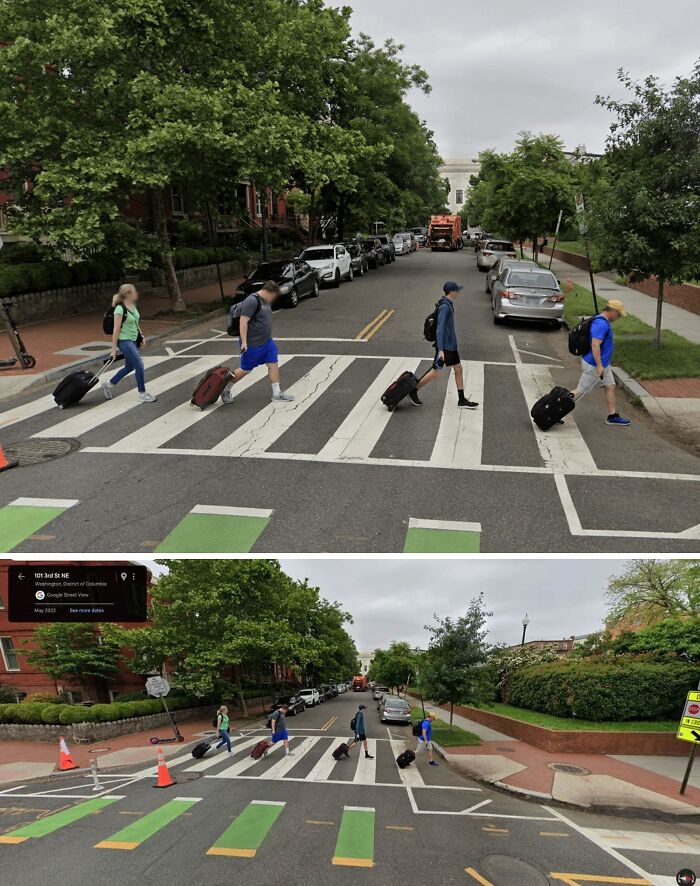
Image credits: Equivalent-Wait9647
#2 Thanks Maps. Really Insightful
Entire-Reference2379:
Must be the scenic route.
Ahaigh9877:
Google Maps likes to offer different routes, which is fine at the beginning of a journey, you can choose one (it could tell you which is more scenic, but I guess that’s a lot to ask from something that’s only been in development for a few thousand years), but that’s okay.
But once I’ve chosen my route, Google Maps you absolute bastard, please do not re-route me on a fucking whim, even if a little “I’m going to re-route you unless you tell me to stop” box appears on the screen for a bit. Don’t f**king do that please Google Maps.
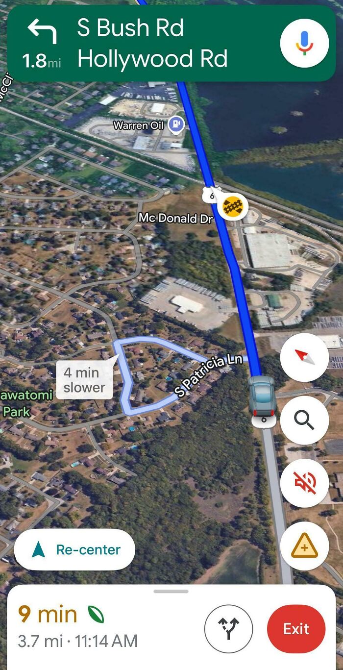
Image credits: Darknesscomesfromyou
#3 4 Months Ago, Google Street View Snapped Me And I Snapped It Back
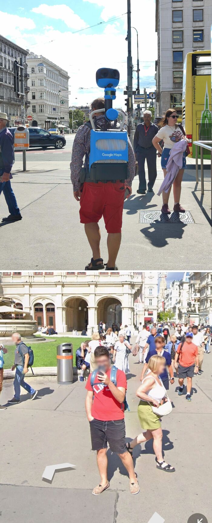
Image credits: NIPLZ
The Google Maps Shenanigans subreddit, at the time of writing, has 159k members, which it garnered during the 8 years of documenting some of the oddest sights found on Google Maps.
In 2019, its creators had a chat with The Next Web and told them a bit about how this community was created.
“I was reading through the comments of a post where people were wishing for a subreddit about funny things found with Google Maps, and the name r/googlemapsshenanigans was thrown out by someone,” the subreddit’s founder, slash23579, told TNW. “I loved the idea so I decided to create the subreddit.”
#4 The Parking Lot Flooded So Long That Gmaps Considers It A National Landmark
canoe_:
That McDonald’s just got torn down.
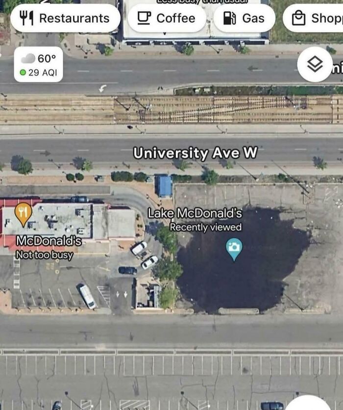
Image credits: The_Chuckness88
#5 So I Guess People Are Renaming Parks Now
Anon:
It’s really not that hard to get additions approved on Google Maps. I’ve added fake businesses to the home addresses of a couple war criminals.
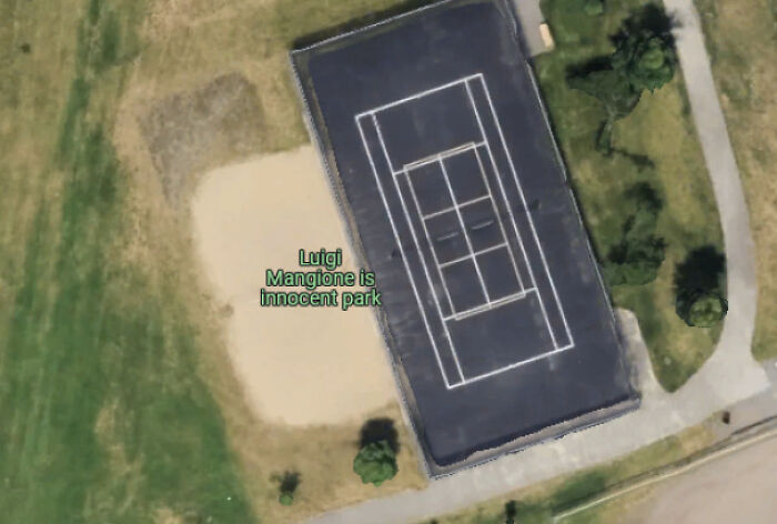
Image credits: Scottp89
#6 Apple Maps Car Overtaking Google Maps Car
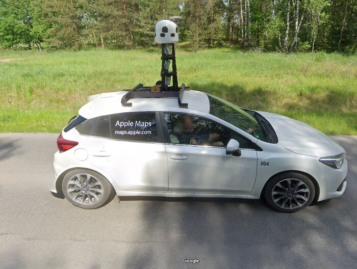
Image credits: Augiiis
Their first post was of two random guys fooling around and posing for the Street View cameras as Google’s car was passing them by.
“It’s not a super complex theme or concept,” Google Maps Shenanigans moderator AeroGlass added. “It’s funny things that people found, […] but sometimes there’s more to it.”
“We often get people that have found oddities on satellite imagery that aren’t simply glitches and are sometimes genuinely interesting or questionable things, and people often speculate about what they could be,” AeroGlass continued. “We haven’t found anything too crazy yet, but it always creates notable discussion.”
#7 My Friend Found This… 💀
Image credits: TheRealChillGuy
#8 University Of Edinburgh
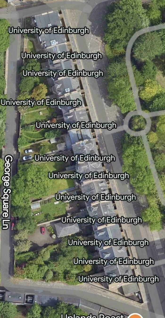
Image credits: frankieepurr
#9 What Is This?
I checked previous dates and it isn’t a statue so I don’t know what it is.
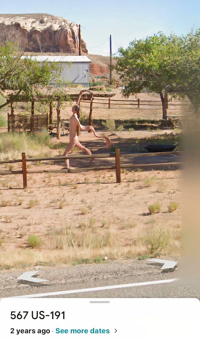
Image credits: Chinesespy423
The founder attributes the popularity of this subreddit to another fellow Reddit community, r/funny, which was kind enough to share one of their posts with their members.
“Since then, though, Google Maps Shenanigans has found itself on Reddit’s trending section on a number of occasions—including with this post showing a man frozen in time as he’s about to fall off some stairs.”
“I feel this post is singlehandedly responsible for putting this subreddit in the public eye,” adds AeroGlass. “That image was submitted and made it near the top of /r/All (the community it was on was /r/funny, I think). This subreddit was linked by someone in that thread, and the next day it was one of Reddit’s featured communities for the day.”
#10 Someone Call The Poliolice
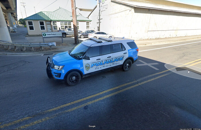
Image credits: Rovvioli
#11 This Is What Happens When You Skip Leg Day And Avoid Walking At All Costs
Image credits: ClassyRedneck
#12 What The Hell Did I Find?
I was exploring the Brooklyn Navy Shipyard and decided to do a little drive around, and all of a sudden this guy shows up. At first I thought Google removed the face but when I zoomed in and tried to figure out what it is, the “person” started jumping around like shown in the pics. Also, when you try to drive past him, maps gives me a “server error” message. Got me spooked ngl.
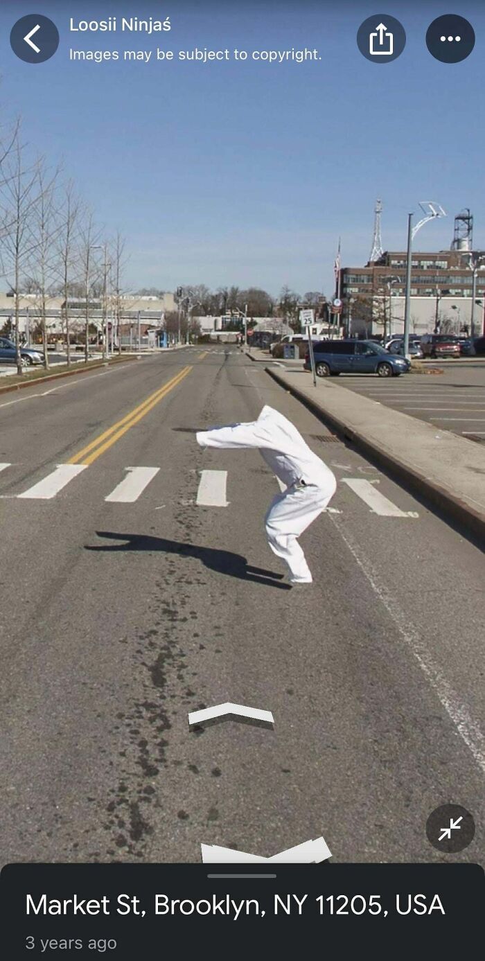
Image credits: Difficult-Fennel1351
Fast forward to now, the subreddit no longer focuses just on Google Maps and has since included posts about anything related to mapping software. “It’s not entirely about Street View anymore, just funny finds from really any sort of mapping software,” the founder explained to TNW.
Along the way, the subreddit’s team has also updated its policies to ensure the quality of the posts.
#13 Skater Falling Mid Air
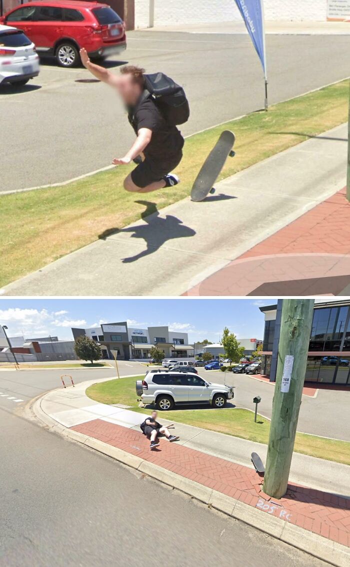
Image credits: reddit.com
#14 A Very Specific Speed Limit
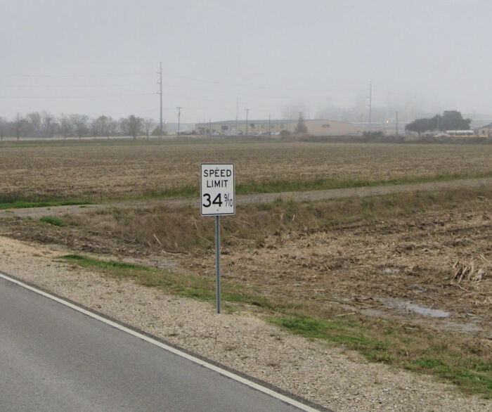
Image credits: Embarrassed-Diet-115
#15 Landslide Caught On Google Maps
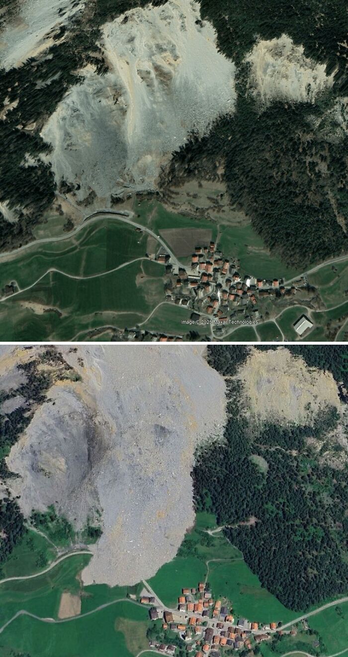
Image credits: _dacops_
“When I first came on, I made significant changes that were designed with popularity in mind, such as making rules consistent and clearly explained, and creating community chat rooms,” AeroGlass said.
“I typically see two to four posts each day, and I’ll generally have to remove a few of those,” the moderator continued. “So, the community ultimately gets one or two quality posts per day. It’s not great, but it’s a far cry from how it was before.”
#16 Coordinates 33.939293, -118.366478 Residential Back Yard Full Of Teslas In Los Angeles
AttackerCat:
My guess is this is someone who (either on their own or as a business) repairs Teslas without an owner needing to go through Tesla themselves. With most car manufacturers it can be incredibly expensive to get a replacement part from them, by design.
This is why right to repair is important.
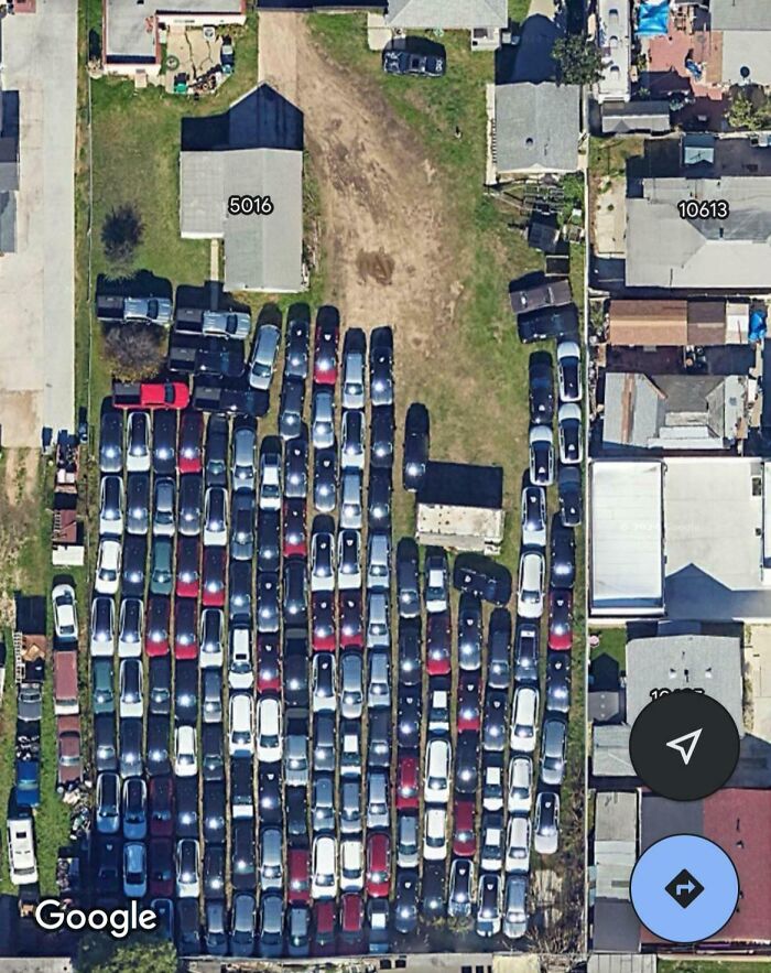
Image credits: sigma_three
#17 Would Anyone Know Why These Palm Trees Are In A Perfect Grid On This Uninhabited Atoll In The Cook Islands? (-16.5642491, -154.6216591)
NotAnotherFNG:
This is Manua’e and is actually located in the Society Islands. It was a coconut plantation in the 1920s. Today it’s a nature preserve.
Coincidentally, there is also a Manuae island in the Cook Islands.
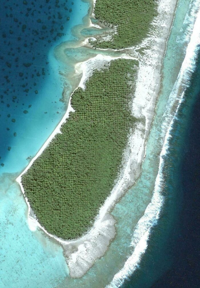
Image credits: Fishywishy_iscool
#18 Google’s AI Mistakes Plant For Face
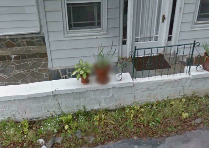
Image credits: TheFrog73259
Lastly, the founder shared their all-time favorite Google Maps Shenanigans entry, which was a Street View GIF of a guy falling off his horse. “I don’t have the link for it but I think it’s one if the top posts still. That cracked me up when I first saw it and it still does.”
#19 My Buddy Who Left Us In November, Is Still On Google Street View
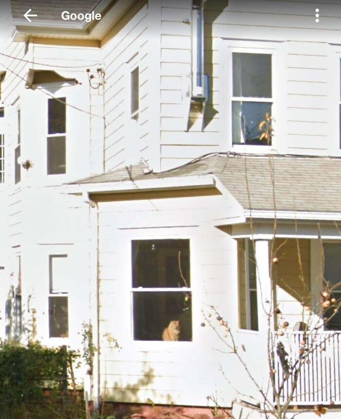
Image credits: rustydittmar
#20 Why?
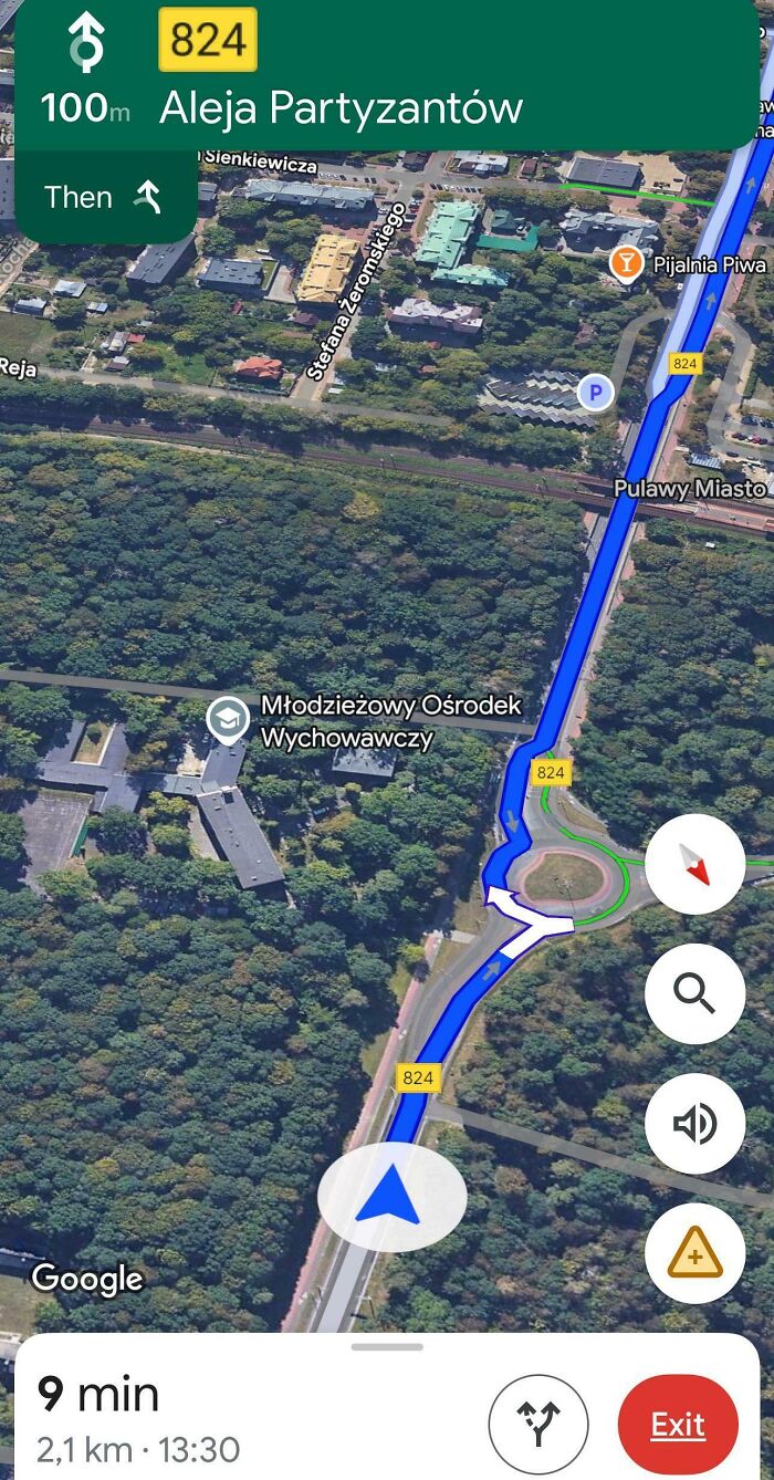
Image credits: PauseNervous5600
#21 Triple Set Of Twins Found On Google Maps
Coordinates of anyone is interested: 14°10’56.6″N 122°39’47.4″E
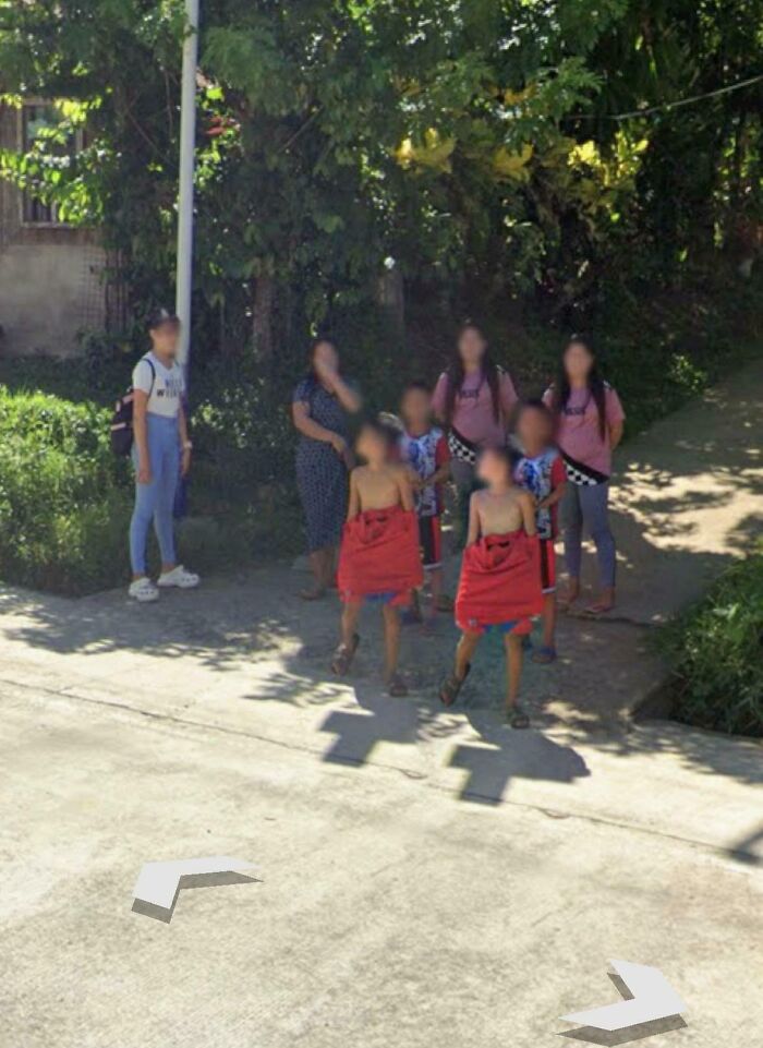
Image credits: OneTemporary998
Neither the subreddit Google Maps Shenanigans nor the photos on their subreddit would exist if Google hadn’t come up with Google Maps and Google Earth in 2005, as well as Google Street View in 2007.
Today, Google mostly uses its camera-equipped Google Maps Street View cars to capture real-life images of various corners of the world to help people navigate more easily. For places these vehicles can’t reach, Google has found other creative ways to get around, including a tricycle, camel, boat, snowmobile, underwater apparatus, and good old feet.
#22 Anyone Know What This Black Square Means?
I was browsing around the midland texas when i found this. Everything got blacked out. I searched for CRMWD and the only thing I found is Colorado River Municipal Water District. Why would a water utility building got censored? Can someone explain.
Abject-Storm4834:
Black balls, don’t put that out of context.
Dwashelle:
Yeah these are those black balls in a water reservoir to stop it from evaporating, there’s a video about it on YouTube that’s pretty interesting.
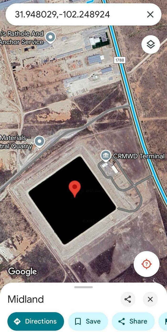
Image credits: SufficientAbility825
#23 WTH Is This
I found a weird thing in northern manitoba and I want to know if anyone know wtf this is 56.4340432, -94.2222389.
traditionaldrummer:
Henday Land Electrode.
cromagnone:
That was a great rabbit hole to fall down. This is basically a place where you can plug a power station into the earth if you need the electricity to go somewhere else for a while.
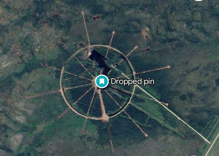
Image credits: cwkaitlyn
#24 Old People Taking A Picture At The Indiana-Michigan Border
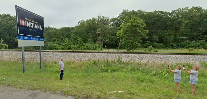
Image credits: grindingonph
In 2023, a Google spokesperson chatted with Reader’s Digest and told them more about how the 360° view of our planet ends up in our tiny smartphones.
“Street View cars have special cameras that take photographs as they drive down public streets,” he explained. “Once the photographs have been taken, they go through computer processing to make them ready for use on Google Maps.”
#25 Creative Naming In Ohio
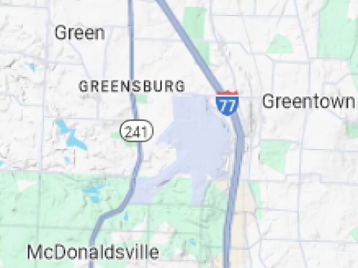
Image credits: Evil_Obama
#26 Is There A Reason Why This Random Part Of Sweden Has Poisoned Gas Instead Of Air?
Antique-Tone-1145:
It’s a reoccurring problem around this time of year and around the end of November, ie the periods where winter tyres, usually studded, start being required but when the roads in town aren’t necessarily covered in ice and snow, meaning the studded tyres tear up the streets and release very harmful particles in the air. It’s a common problem in other Swedish cities, and for example in Stockholm they’ve banned studded tyres from the worst affected roads. That’s not necessarily possible in Östersund though because when it does snow and the roads are icy studded tyres are a necessity for safety reasons.
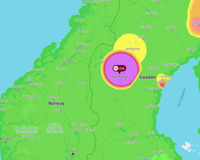
Image credits: kaziniki
#27 TIL In Mongolian Suburbs, Most People Have Yurts In Their Back Yard
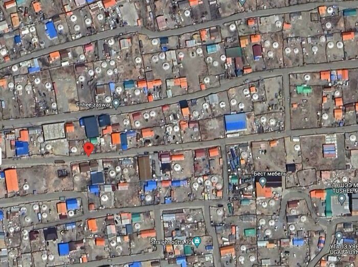
Image credits: loinmaster
During the image-processing stage, the photos are stitched together to create a 360° view of our surroundings that we can access every time we go to Google Street View. For privacy, Google AI technology also blurs any faces or license plates visible in the photos.
And this is how, folks, Google was able to cover nearly 80 countries and upload it online for the whole world to see!
#28 Google Thinks I Am In Ukraine Even Though Im In My Home Country Of Lithuania
madery:
There has been some gps jamming going on lately.
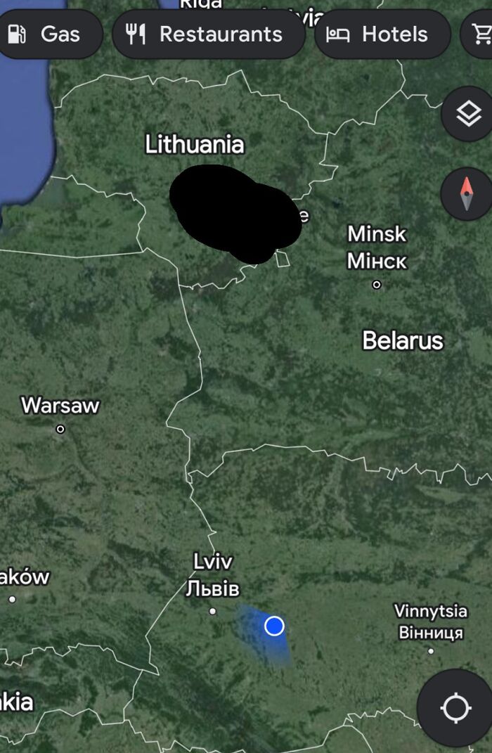
Image credits: NewSouthWalesMan
#29 Swimmining Pool Openining Soon!
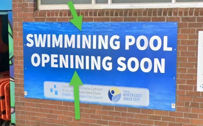
Image credits: geo_gan
#30 Is This A Boat Sinking?
So, I was scanning Lake Washington, right outside Seattle and I came across this. This does look like a large, recreational boat, sinking? I’m not going crazy, nor are my eyes going bad? I did a quick search for news of any boats sinking in that area, but I found nothing. Could this be a shadow effect from the sun? I figured that this would be the best community to post this.
carlitosbahia:
Nah, just google being dumb in images over water.
Example in the same area boats that were there at some other date then google mixed images from more than one date then we see all those “ghost” boats.
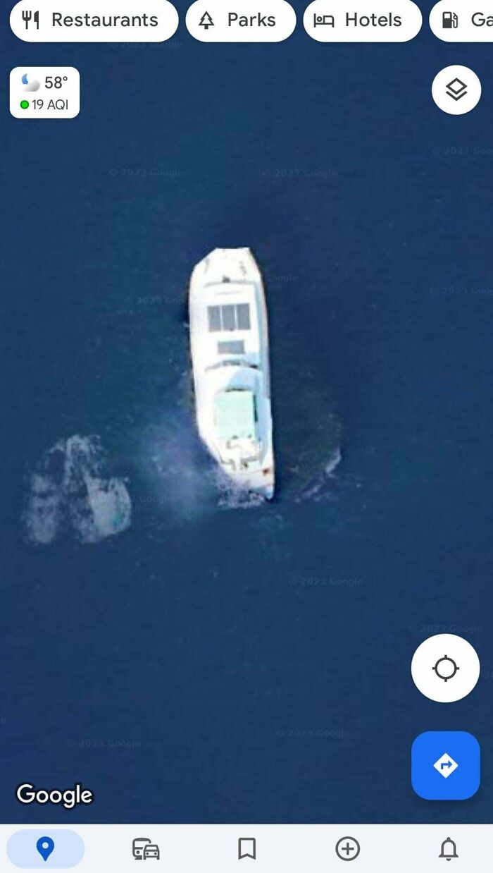
Image credits: WereInbuisness
#31 Google Maps Says You Can Get Through Here. It Was A Really Fun Road That Felt Like An Adventure, So It Was Perfect For Me
Image credits: tomyan112
#32 Oops
Image credits: micdab
#33 Caught Three Guys Breaking Into A Car In Kensington Philadelphia. Improvised Slim Jim On Roof
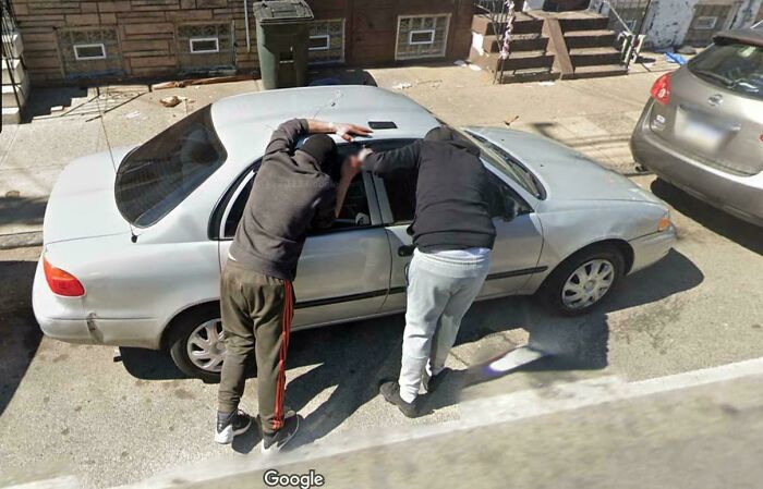
Image credits: wbradford00
#34 Thank You Google For Keeping Superman’s Identity A Secret
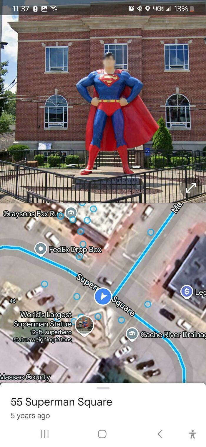
Image credits: AnnieGS
#35 Found The Tiniest Roundabouts In Italy
Coordinates: 40.4007084, 17.6402574

Image credits: IShouldGoToBed2
#36 Why Does Dubai, A Highly Developed City, Not Have 3D Google Earth Imagery?
John_EightThirtyTwo:
I’m always intrigued by the fact that some parts of the world have 3D imagery in Google Maps, and others don’t. In the latter places, you can go into the 3D mode and pan and zoom around, but you’re moving around over features that appear painted onto a flat world.
I know that some of the imagery is from satellites and some from aircraft that fly up and down across a grid over the landscape. I imagine that the 3D feature requires both the latter, more-detailed images and also a bunch of back-end computation at Google. Is that right? Has Google published any info about the process?
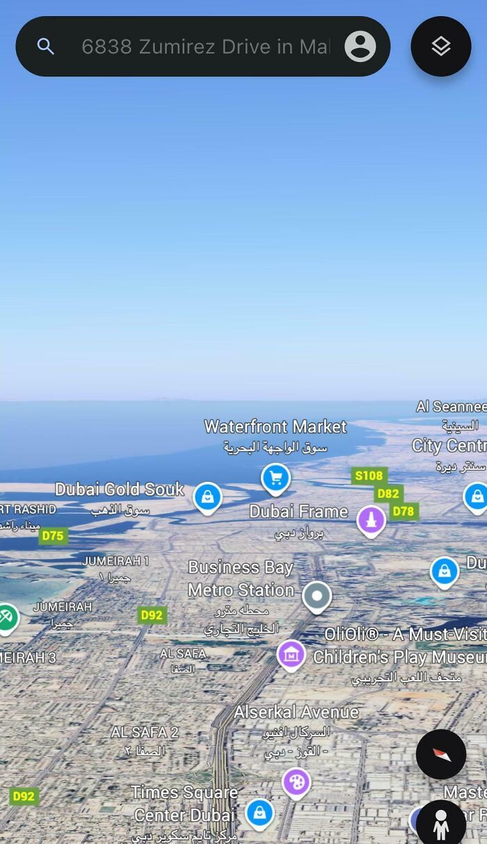
Image credits: TheMasterOfNone_
#37 Shanghai Has 3D Buildings Marked On Google Earth, But They Are Offset Because China
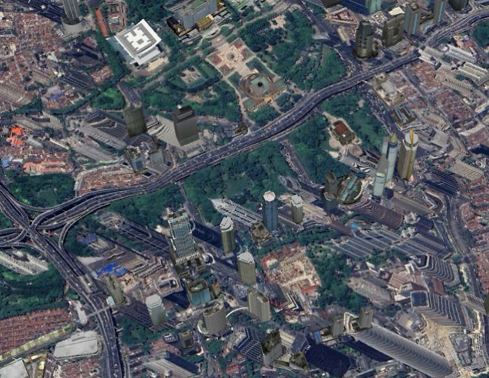
Image credits: PortablePorcelain
#38 These Islands Of The Coast Of Dubai That Are Named Like Countries
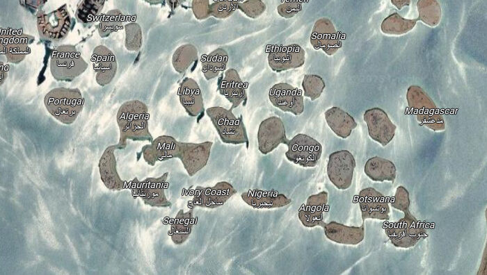
Image credits: Existing_Degree9738
#39 What Are These And How Do I Get Rid Of Them?
No clue what I’ve done here but I can’t get rid of them. Nothing in layers to deselect. Tried uninstalling and reinstalling. Help!
Anon:
Looks like you added a layer with locations of toilets.
Click the “You” tab on the bottom and see if it shows up there under your lists. You may be able to remove it there.
Image credits: Local-Philosopher-14
#40 The Most Stupidest Thing I’ve Ever Seen
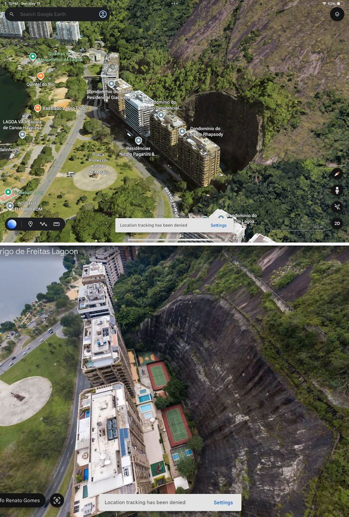
Image credits: FarIntroduction5135
#41 Can Someone Explain What The Heck This Is? I Have No Idea And Never Saw Something Like This Before
Ziginox:
It’s the sun reflecting off of a skylight, greenhouse, or other shiny surface.
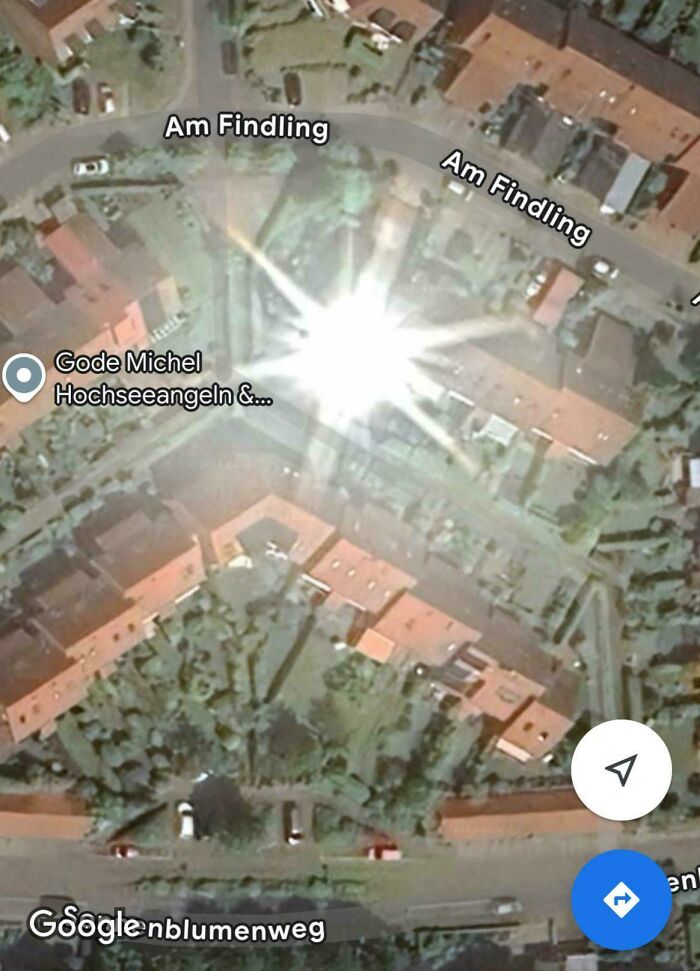
Image credits: Superb_Sir_9026
#42 Found This On Google Earth Its In The Middle Of The Afsluitdijk
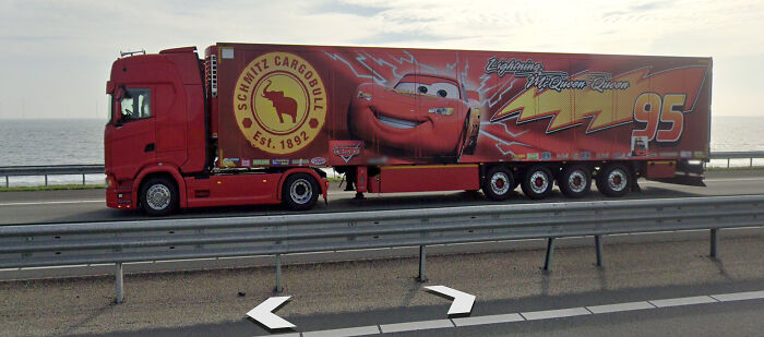
Image credits: Recent-Swordfish9220
#43 For Some Reason This Is In Milwaukee
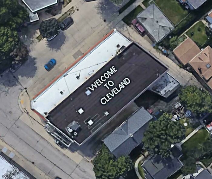
Image credits: LeBatardGoogleMaps
#44 Why Is There A Random Red Square Near Hamburg?
real_hungarian:
I think that’s the Stade red mud reservoir. red mud (bauxite residue) is a byproduct of processing bauxite into aluminium oxide, not a very pleasant chemical.
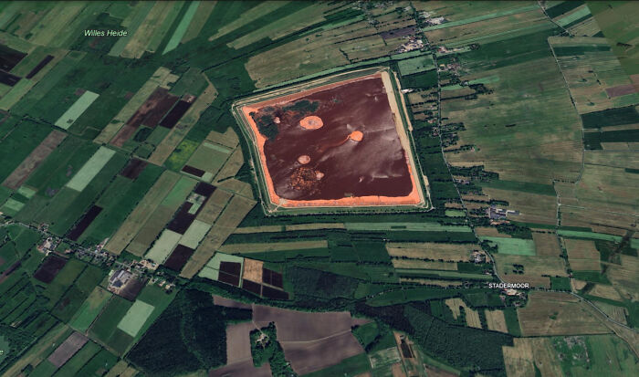
Image credits: l1r2
#45 Randomly Found A Guy Surfing ~50 Miles Off The Coast Of Somalia

Image credits: religion_slayer
#46 Is This A Tribal Area Or Some Random Dude That Likes Peak Isolation In Papua New Guinea
tistisblitskits:
Papua new guinea does have tribal groups, so it might be that.
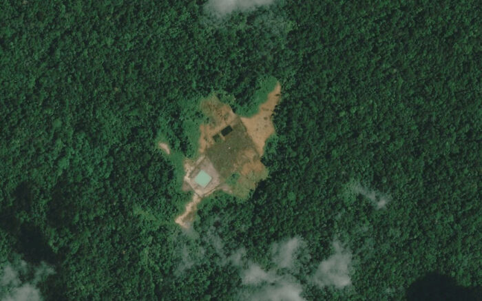
Image credits: Altruistic-Willow265
#47 I Think I Found An Explosive Stockpile From Ww2 In The Middle Of New Guinea
I think it’s Australian grenades, mortars and artillery shells, along with a helmet.
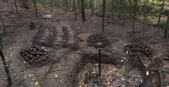
Image credits: TopShelfBrand1134
#48 Wonder What The Door Is For
Image credits: Iki-Balam
#49 We Should Probably Not Rent Box Trucks To People Who Have Never Driven Anything Bigger Than A Corolla
Image credits: VF1379
#50 Plane Caught On Bing’s Bird Eye View
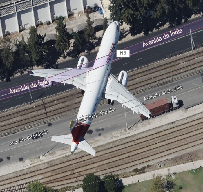
Image credits: _dacops_
#51 Dead End

Image credits: Navstar27
#52 Who The Hell Driving This Unconventional Vehicle
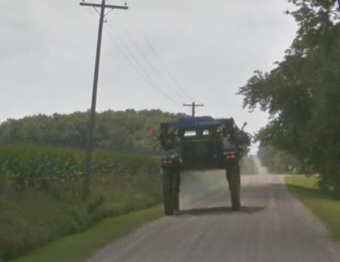
Image credits: GuyWithAHat3
#53 Google Street View Photographer Attacked By The World’s Deadliest Creature!
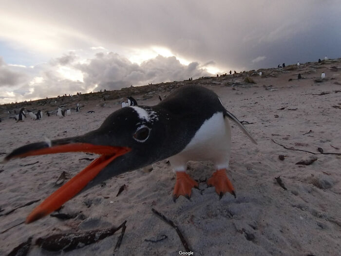
Image credits: MaysunPoss
#54 Does This Count?
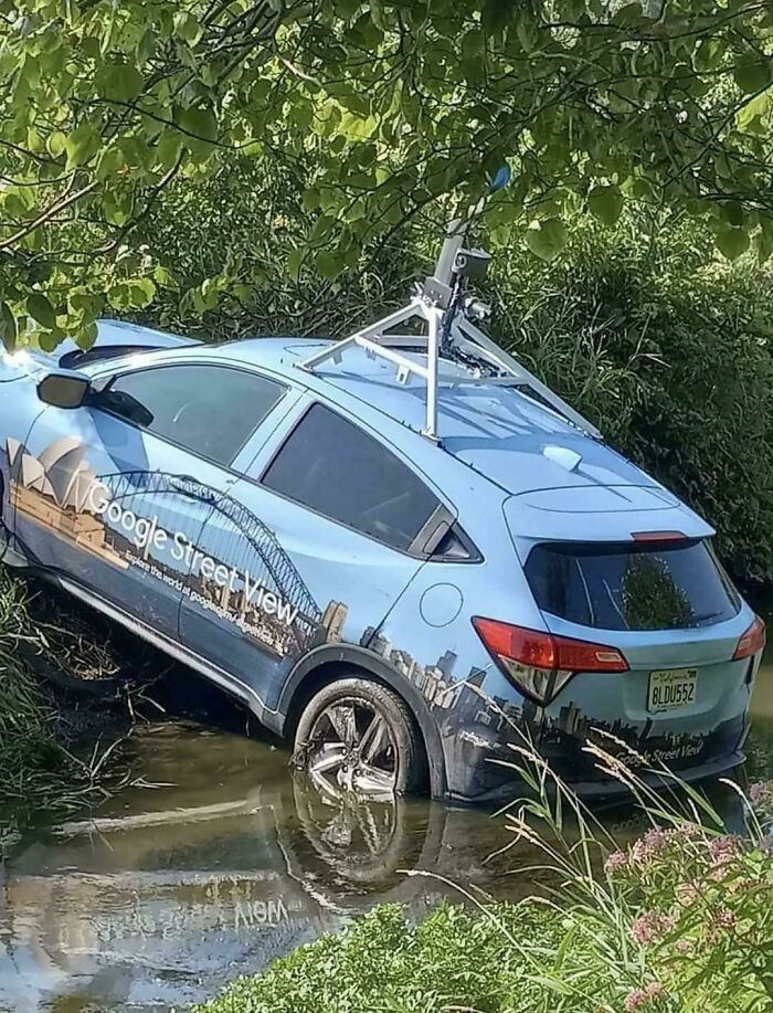
Image credits: Specific_Display_366
#55 What The Hell Happened While I Was Exploring St. Louis?
Heartgirl2020:
That’s what happens to the cameras in a low light environment. They kept rolling a little too close to sunset.
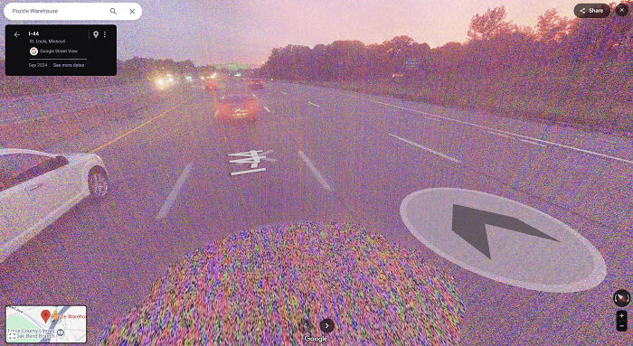
Image credits: Heartgirl2020
#56 Worlds Closest Bookstore

Image credits: Navstar27
#57 How Many Aura Points Do I Gain From Finding This
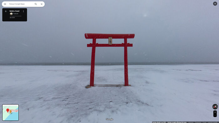
Image credits: Working-Quiet-4474
#58 I Can’t Go To This Island
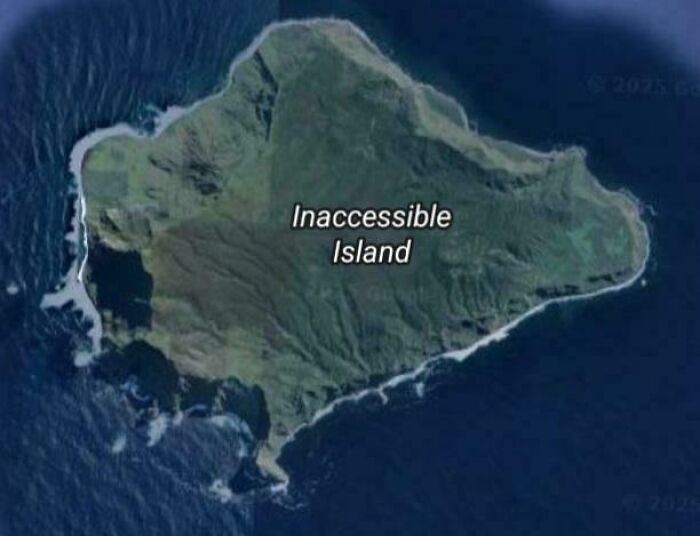
Image credits: Ocopp
#59 Why Does This House Have So Many Bins? Genuine Question
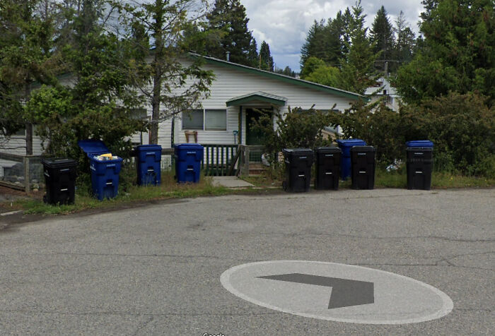
Image credits: Jackack7
#60 Street View Driver Cleaning The Camera

Image credits: champytech_
from Bored Panda https://ift.tt/T79YJNZ
via IFTTT source site : boredpanda