For every Internet commenter who enters online arguments about the USA with facts they got from their butt, there’s a map that presents hard data bare and allows the viewers to make their own interpretations.
From light pollution and tree coverage to out-of-service railways and streets and highways, maps may not immediately look as exciting as a viral cat video — which might explain why we often overlook them when — but that doesn’t mean that are boring. To prove that, we put together a selection of maps that explain the United States better then most textbooks and if broadening your worldview isn’t thrilling, I don’t know what is.
#1 Most Common Surname In The United States By State
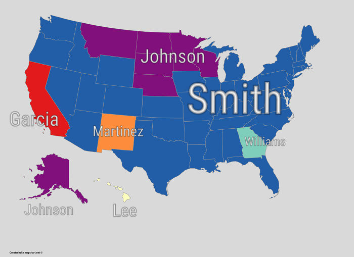
Image credits: reddit.com
#2 Out Of Service Railways
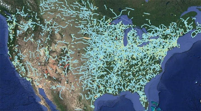
Image credits: Andrew Grigg/
#3 Tree Cover Map Of The US
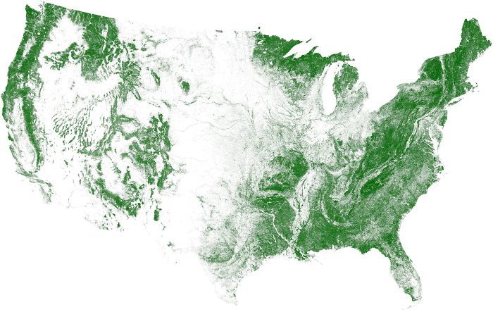
Image credits: reddit.com
#4 Red And Orange Areas Have Equal Populations
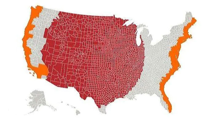
Image credits: Cogo5646
#5 The United States Of America: Alaskan Perspective
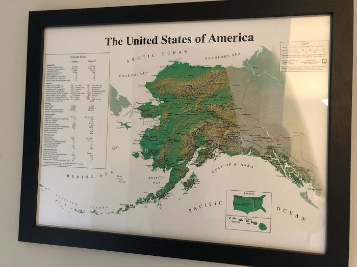
Image credits: reddit.com
#6 States With A Smaller Population Than Los Angeles County
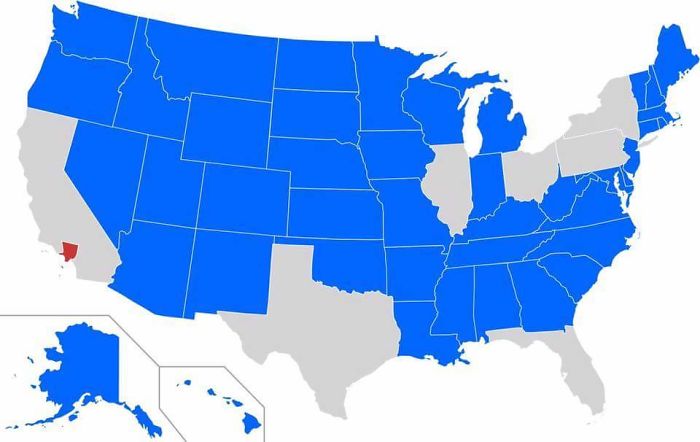
Image credits: reddit.com
#7 More People Live Inside The Red Area Than The Grey Area
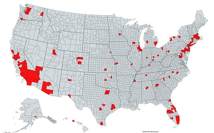
Image credits: reddit.com
#8 The Loudest And Quietest Spots In The Continental US
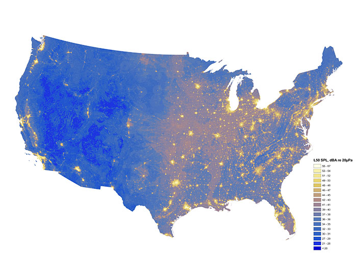
Image credits: ational Park Service 9,9822,736Whoa?
#9 Light Pollution In The United States
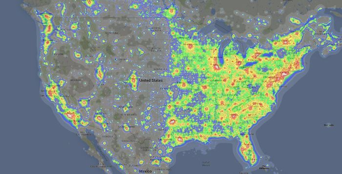
Image credits: reddit.com
#10 US Counties With Gdp Over $100b
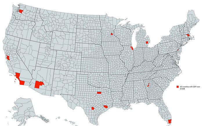
Image credits: reddit.com
#11 United States Population Lines
Image credits: reddit.com
#12 Us States Scaled Proportionally To Population Density
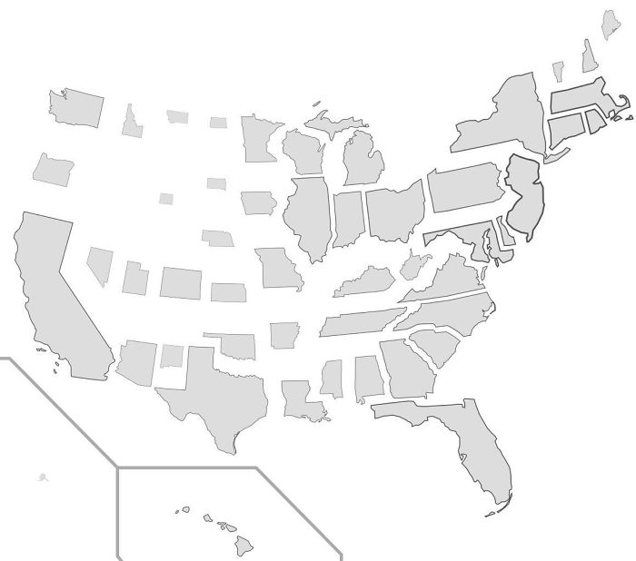
Image credits: reddit.com
#13 How America Utilizes Its Land
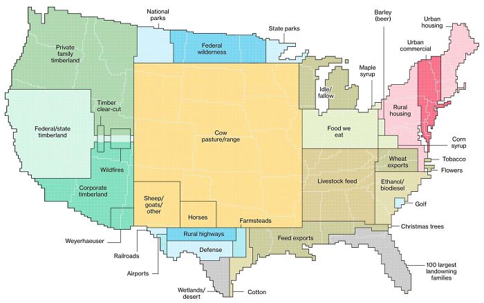
Image credits: reddit.com
#14 Map Of The United States’ 8 Million Miles Of Roads, Streets And Highways
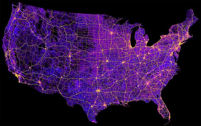
Image credits: reddit.com
#15 The Most Efficient Route Between Every Springfield In The United States
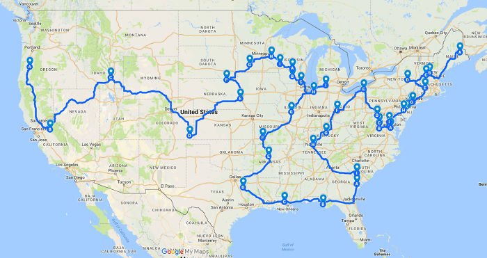
Image credits: reddit.com
#16 Use Of The Word “Dang” Across The Continental US
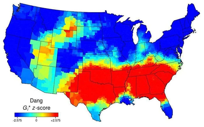
Image credits: AJgloe
#17 Map Of Lowest Recorded Temperature In Each Us State (Fahrenheit)
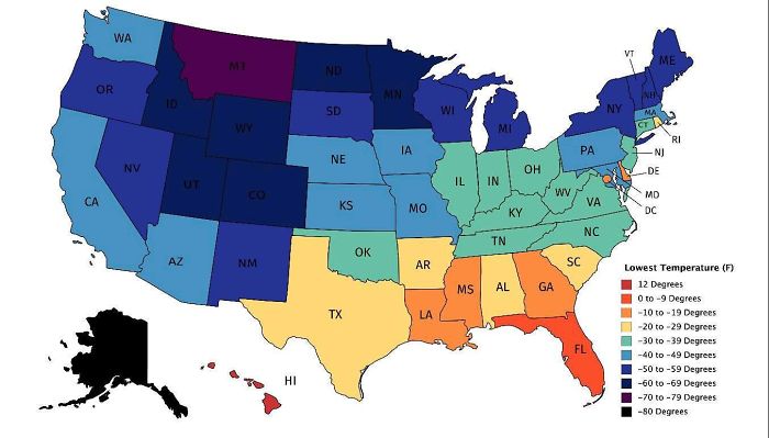
Image credits: reddit.com
#18 Popular Coffee Shop Chains By Number Of Locations
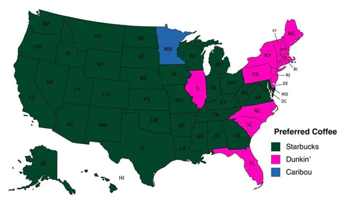
Image credits: dannywat3rm3lon
#19 Regions Of The U.S. That Don’t Officially Celebrate Christopher Columbus Day
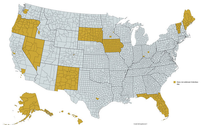
Image credits: reddit.com
#20 USA Tree Diversity
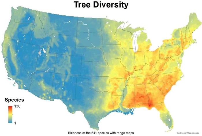
Image credits: reddit.com
#21 Average Size Of US Apartments By Region
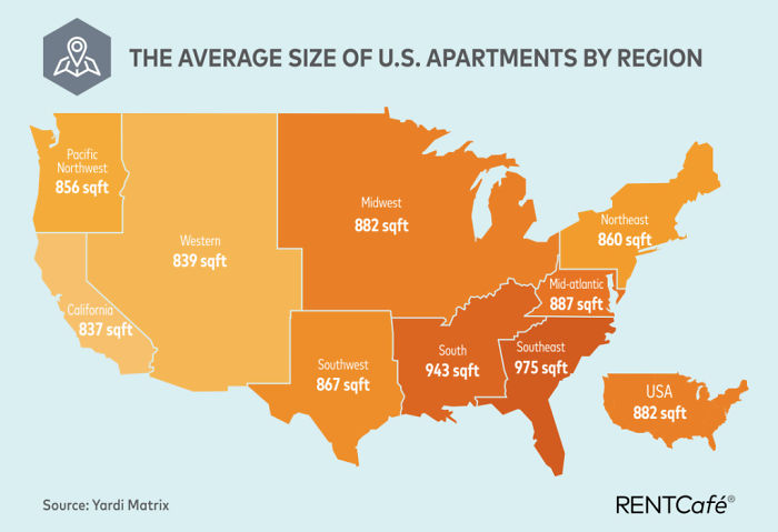
Image credits: reddit.com
#22 All U.S. Counties With In-N-Out Burger As Of May 2020
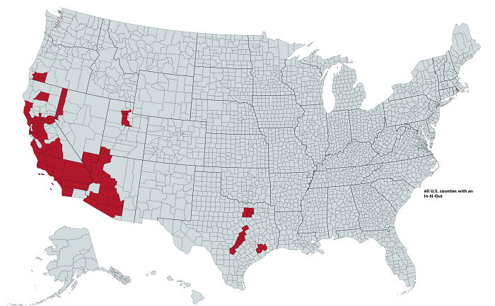
Image credits: reddit.com
#23 The U.S. Mapped By Residents’ Desire To Move To A Different State
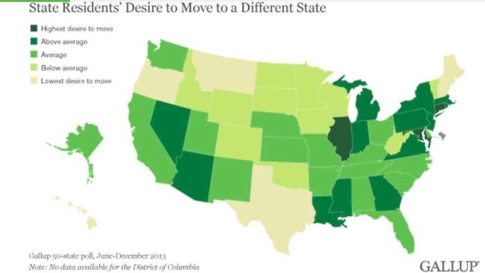
Image credits: reddit.com
#24 Every State’s Least Favorite State
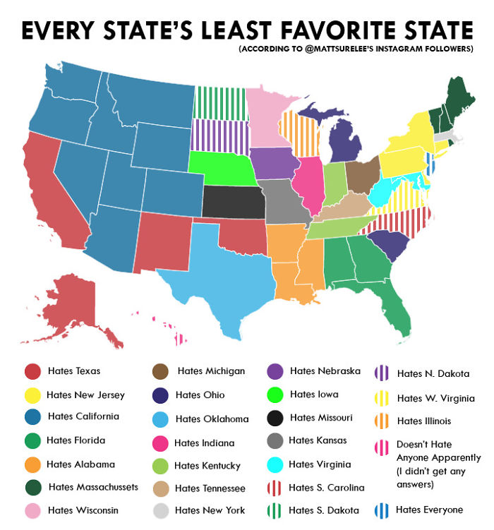
Image credits: reddit.com
#25 How Much Snow Does It Usually Take To Cancel Schools?
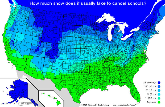
Image credits: reddit.com
#26 US Governors By Eye Color
Image credits: reddit.com
#27 Garbage Can vs. Trash Can In The United States
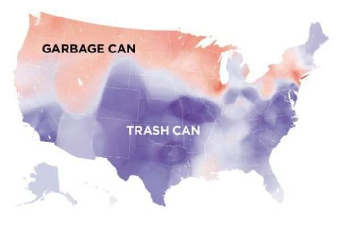
Image credits: reddit.com
#28 Most Commonly Spoken Language In The Us After English And Spanish
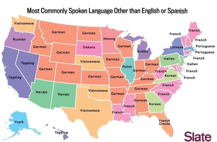
Image credits: reddit.com
#29 Voters Who Didn’t Vote For Hillary Or Trump
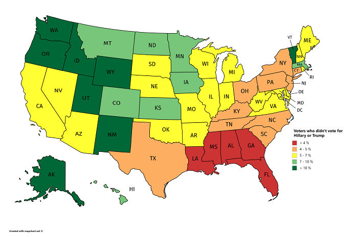
Image credits: reddit.com
#30 Its Very Interesting
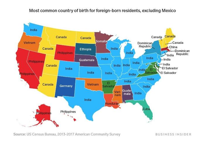
Image credits: reddit.com
#31 Percentage Of People Born Outside The U.S. In Each State
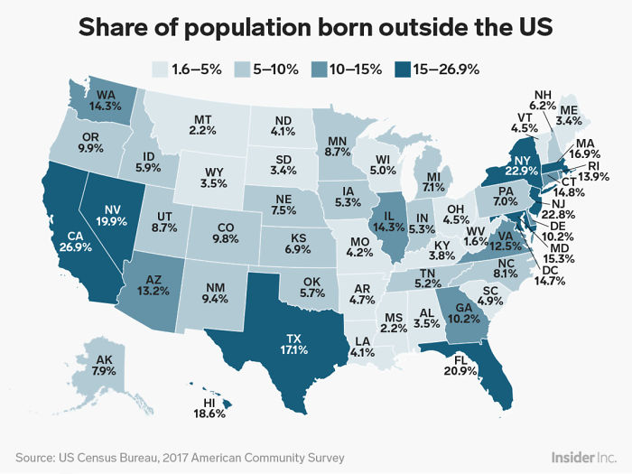
Image credits: reddit.com
#32 A Tastier Map
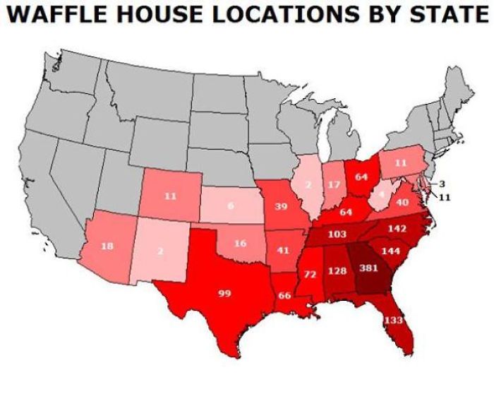
Image credits: reddit.com
#33 US Watersheds
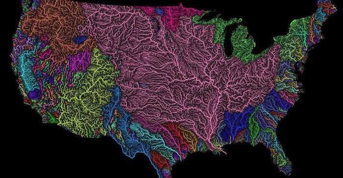
Image credits: reddit.com
#34 U.S. Education Spending Map
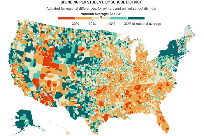
Image credits: reddit.com
#35 Portion Of Each State That Is Federal Land
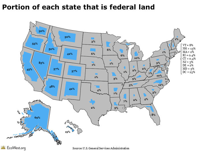
Image credits: reddit.com
#36 Air Traffic Control Zones In The USA
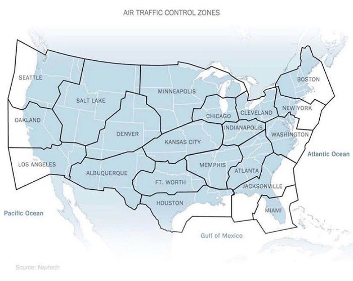
Image credits: reddit.com
#37 USA Country Map Divided By 1/3rds Of Covid Deaths
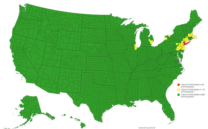
Image credits: reddit.com
#38 Date Of Creation Of All 3,142 U.S. Counties
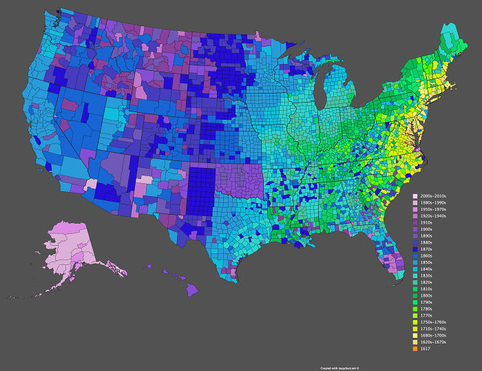
Image credits: reddit.com
#39 How I, A Brit, See The United States (Sorry If It Offends Anyone)
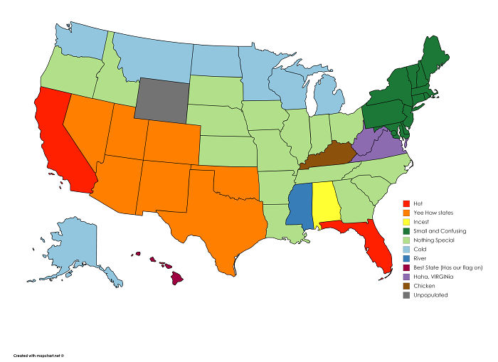
Image credits: reddit.com
#40 Results Of The 1984 United States Presidential Election By County. The Most Lopsided Election In History, The Only State Reagan Failed To Win Was His Opponent’s, Minnesota
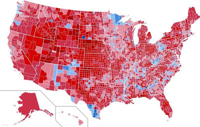
Image credits: reddit.com
#41 Drug Overdose Deaths In The United States Per 100,000 Persons For 1999 And 2014
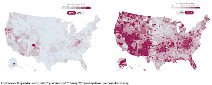
Image credits: reddit.com
from Bored Panda https://ift.tt/2VgnOTM
via IFTTT source site : boredpanda