If you were born in the last 30 years, there’s a good chance you’ve never actually had to rely on a paper map. You might have seen them at amusement parks or folded up in the glove compartment of your dad’s car. But you probably weren’t using them to navigate from the passenger seat while on a road trip with your best friend.
Despite the fact that the majority of the world now uses apps to provide us with directions, there will always be a place for maps. And if you disagree, I hope that the Amazing Maps Instagram page will help change your mind. This account has amassed nearly 75K followers for sharing fascinating maps of the world, along with fun facts and interesting statistics. Below, you’ll find some of their most intriguing posts, so be sure to upvote all of your favorites. And keep reading to find conversations with map experts Ivos Gajdorus from Mapotic and Minas, Creator of MapChart!
#1 Regional Giraffe Patterns
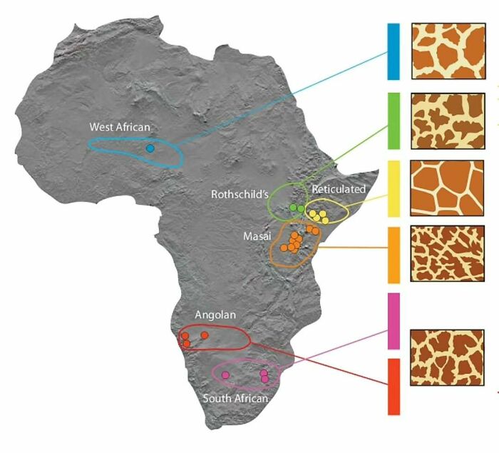
Image credits: amazingmap
#2 Passenger Trains In The United States vs. Europe
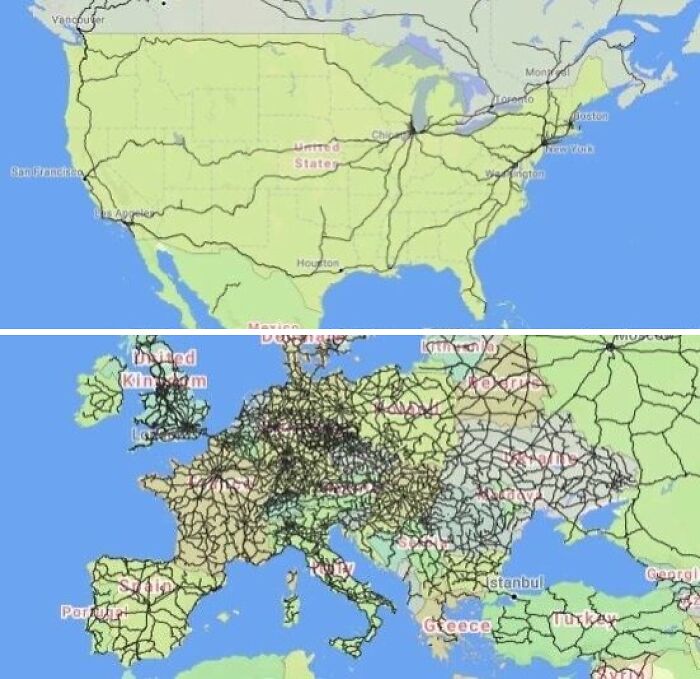
Image credits: amazingmap
#3 How A Coastline 100 Million Years Ago Influences Modern Election Results In Alabama
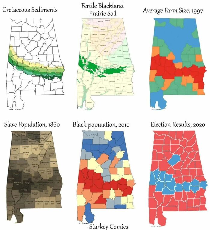
Image credits: amazingmap
#4 In 1992, Around 29,000 Rubber Ducks Fell Off A Cargo Ship In The Pacific Ocean. This Is Where They Made Landfall
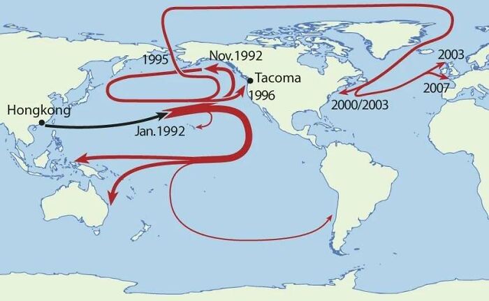
Image credits: amazingmap
#5 Kiribati Is The Only Country In The World That Is In All Four Hemispheres
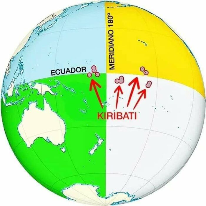
Image credits: amazingmap
#6 Virgin Forest Cover 1620 vs. Today
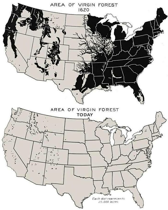
Image credits: amazingmap
#7 Each Section Has 10% Of The World’s Population
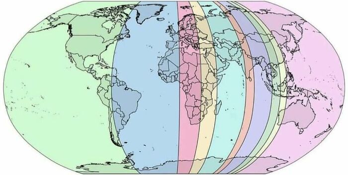
Image credits: amazingmap
#8 The Spilhaus Projection. In 1942, Athelstan Spilhaus Produced A World Map With A Unique Perspective, Presenting The World’s Oceans As One Body Of Water
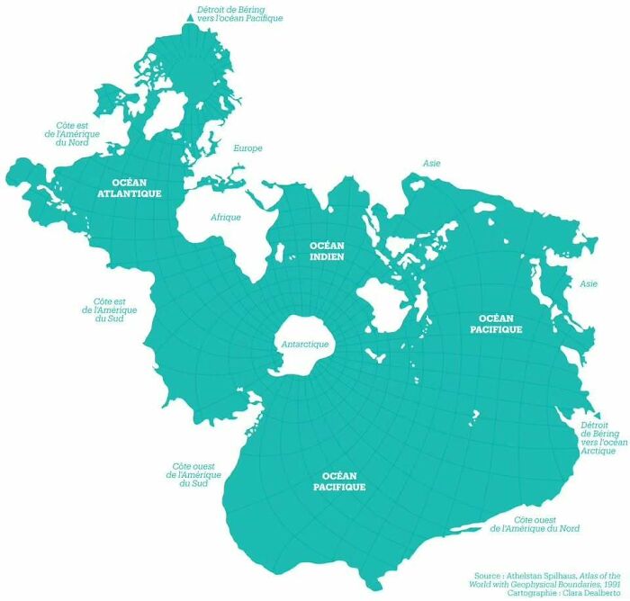
Image credits: amazingmap
#9 Cycle Paths Of Europe
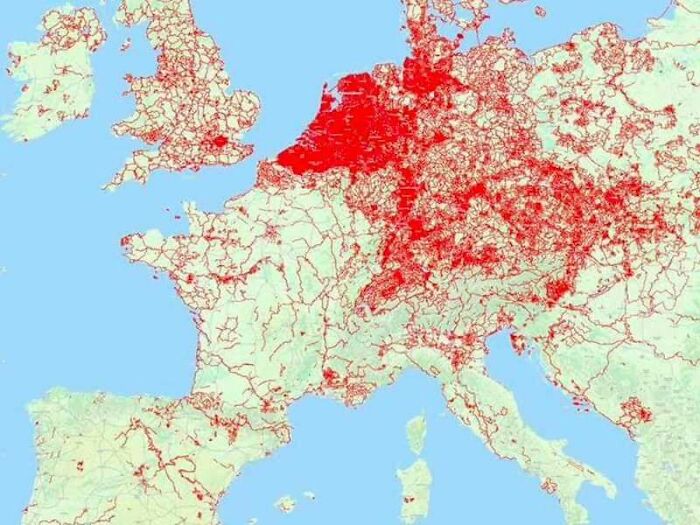
Image credits: amazingmap
#10 A Map Of Geography Terms. Any You Didn’t Know?
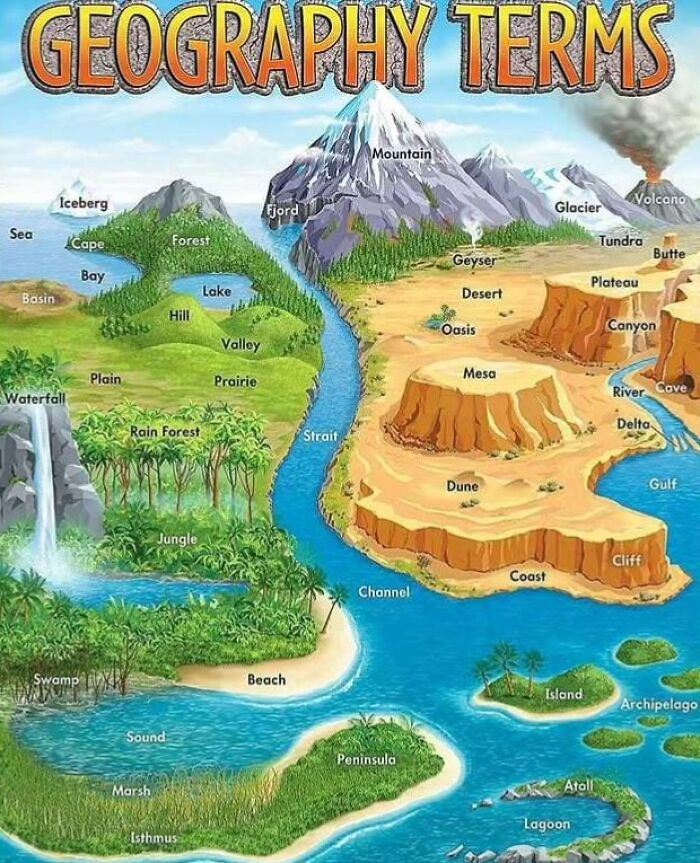
Image credits: amazingmap
#11 Railways In China, 2008 vs. 2020

Image credits: amazingmap
#12 Xinjiang, China. The Farthest Place On Earth From Any Ocean
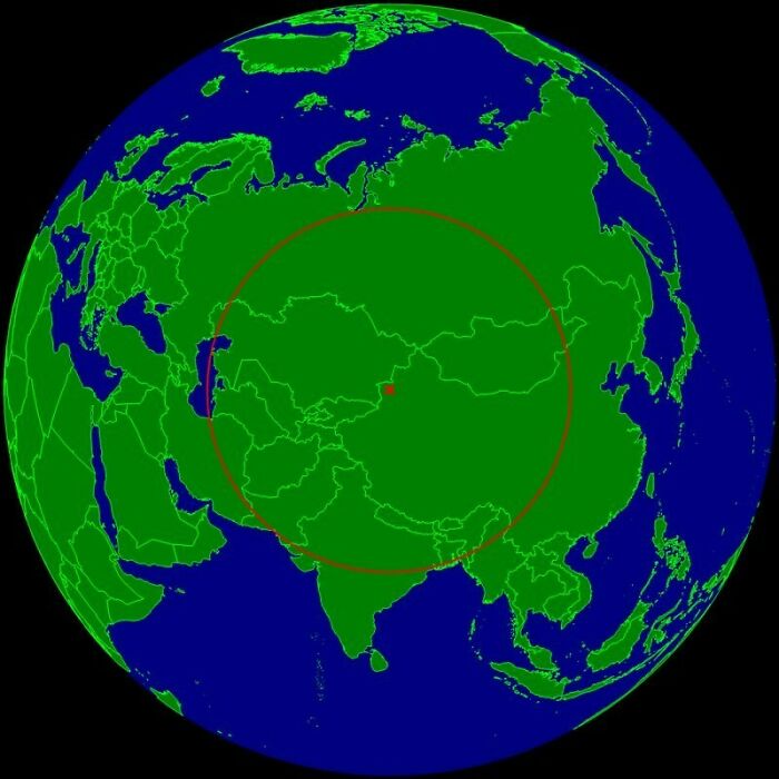
Image credits: amazingmap
#13 A Map Comparing Actual Distances To Their Representation On The Mercator Projection
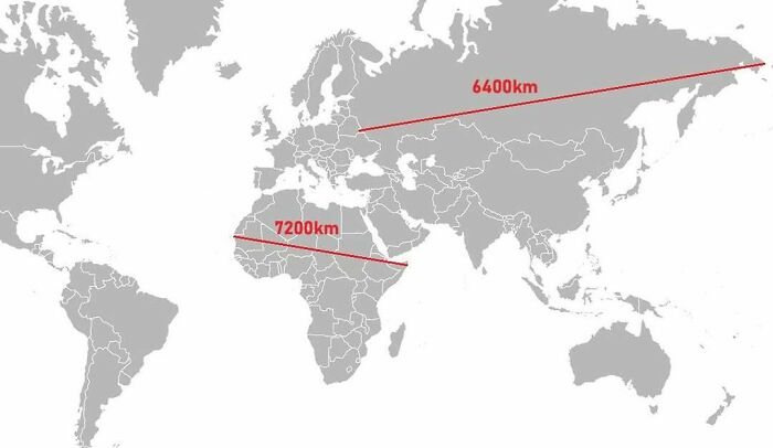
Image credits: amazingmap
#14 Obesity In North America (2021)
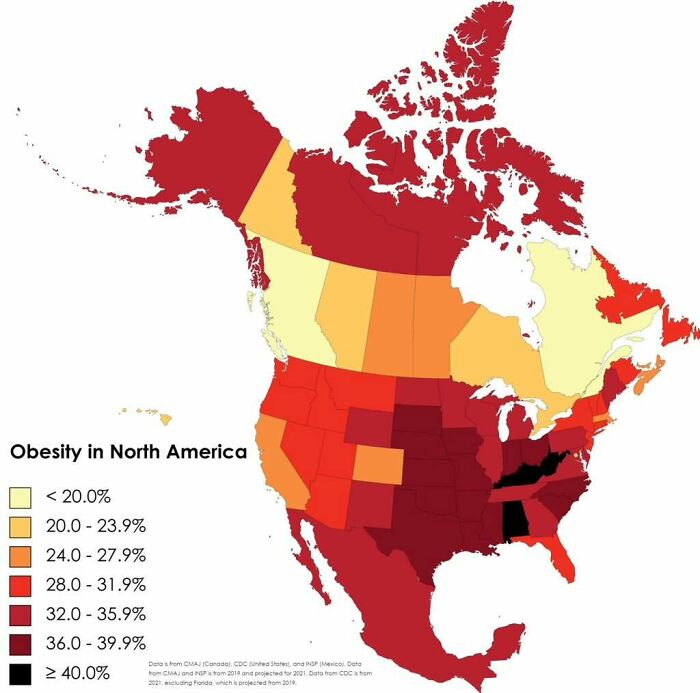
Image credits: amazingmap
#15 Comparing The Urban Areas Of European Capitals
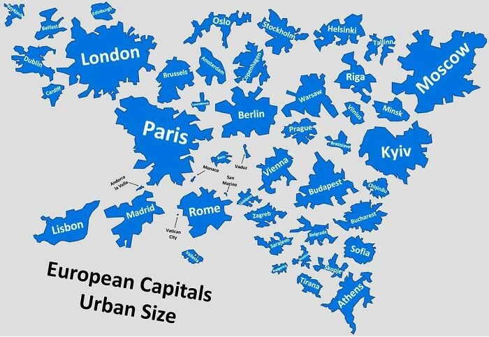
Image credits: amazingmap
#16 Historical And Current Grizzly Bear Range In North America
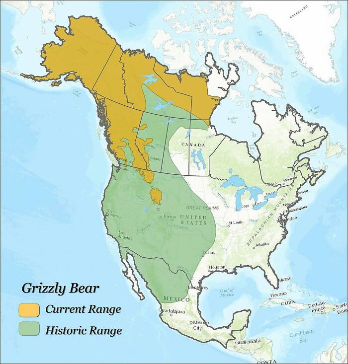
Image credits: amazingmap
#17 Countries Where Cheek Kissing Is A Common Greeting
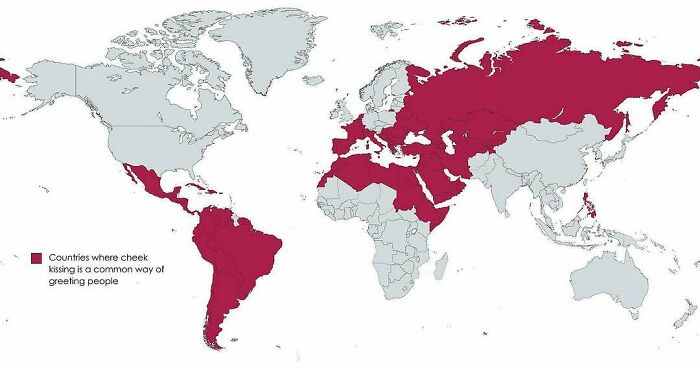
Image credits: amazingmap
#18 Homicide Rates In Different Regions Of The World
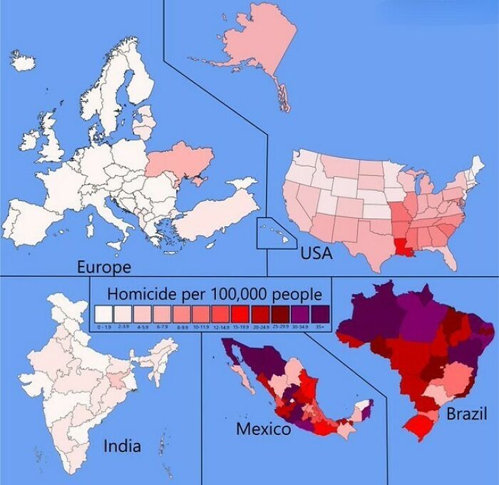
Image credits: amazingmap
#19 Map Of The 1910 Tour De France Route
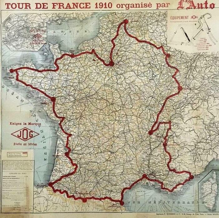
Image credits: amazingmap
#20 The Red And Orange Areas Have Equal Population
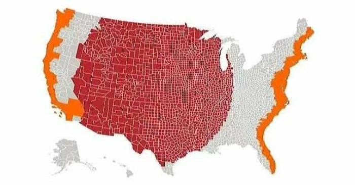
Image credits: amazingmap
#21 A Map Of Europe’s Most Common Surnames
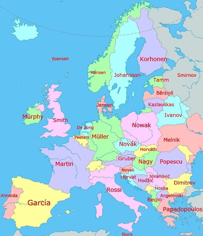
Image credits: amazingmap
#22 The First World Map By Anaximander Of Miletus (610bc-546bc), Greek Philosopher
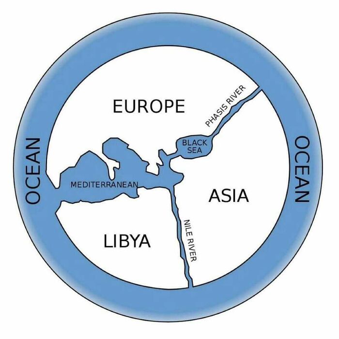
Image credits: amazingmap
#23 Map Of Languages Spoken In China
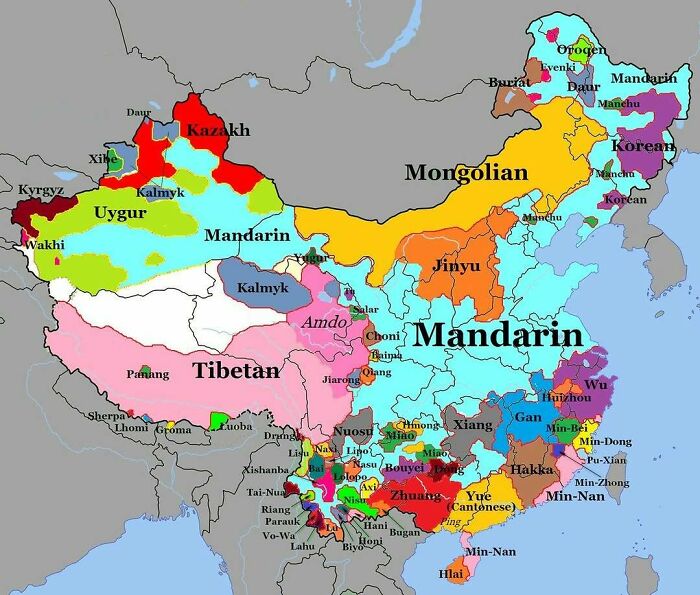
Image credits: amazingmap
#24 Highway 1 In Australia. The Longest National Highway In The World At Around 14,500km
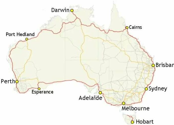
Image credits: amazingmap
#25 Dividing British Columbia Into Three Regions With Equal Population
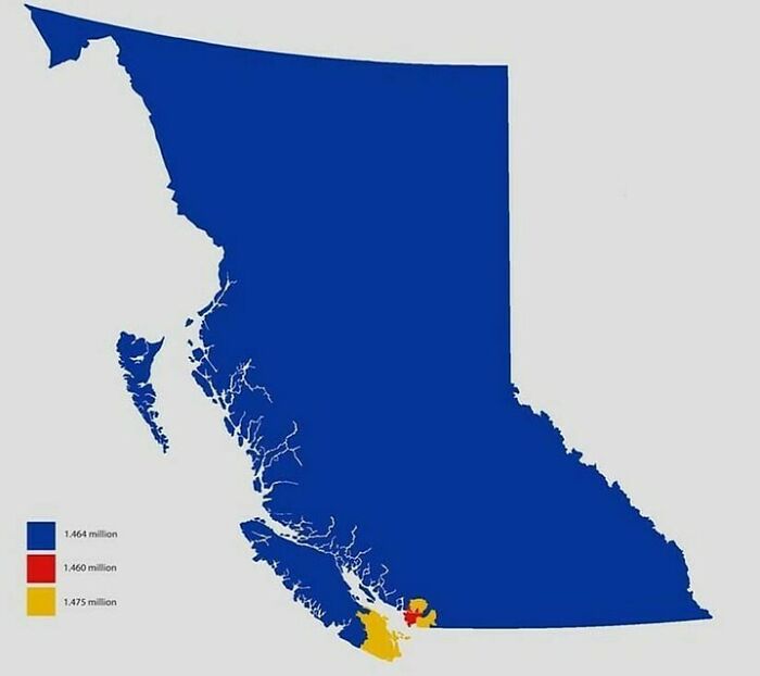
Image credits: amazingmap
#26 Location Of Every City Founded By The Roman Empire, Outside Of Italy
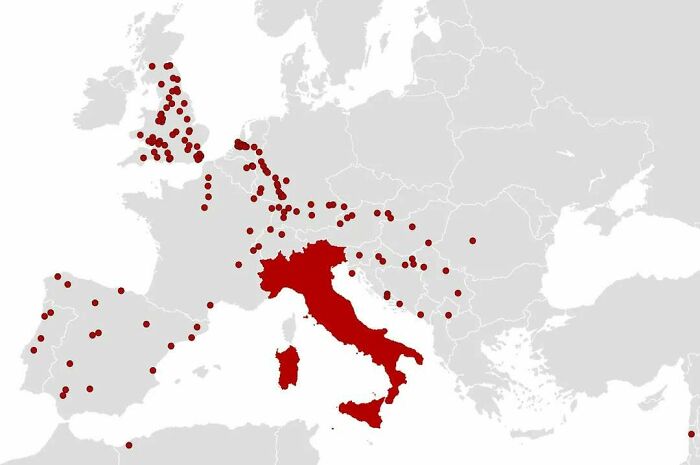
Image credits: amazingmap
#27 North America 92 Million Years Ago
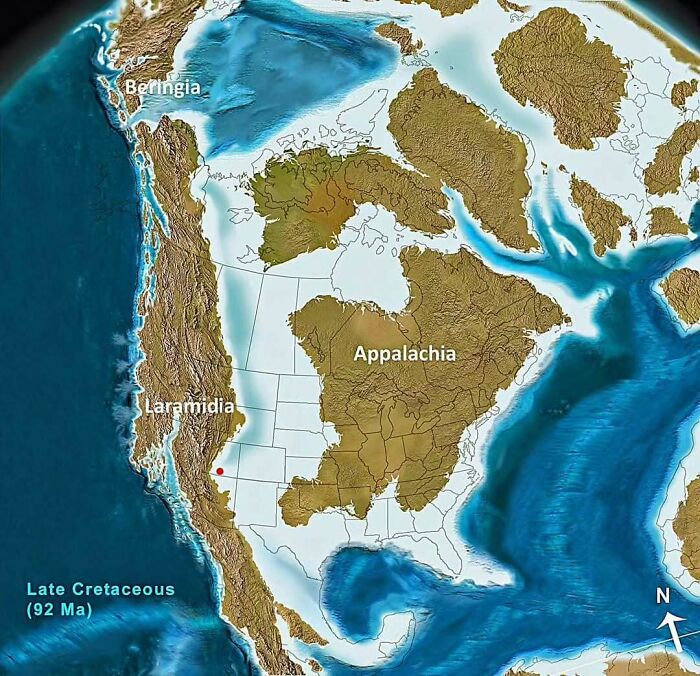
Image credits: amazingmap
#28 A Portuguese Propaganda Poster Showing The Size Of Portuguese Colonial Possessions Compared To Europe

Image credits: amazingmap
#29 Melbourne Is Closer To Antarctica Than It Is To Darwin

Image credits: amazingmap
#30 The Roundest Countries
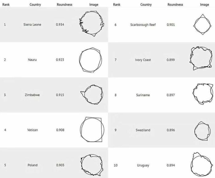
Image credits: amazingmap
#31 The 25 Largest Lakes In The World, Side By Side
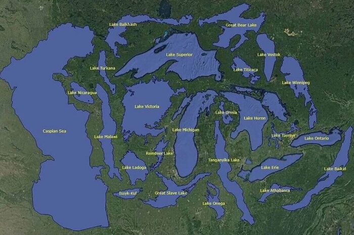
Image credits: amazingmap
#32 United States Gdp, Split In Half
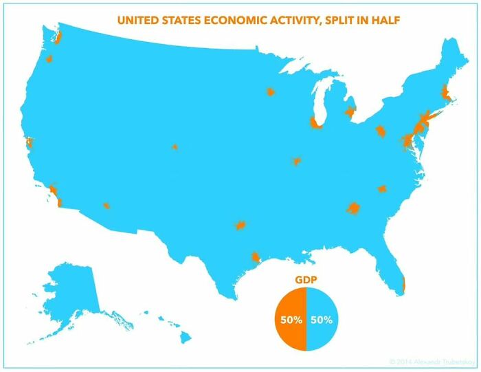
Image credits: amazingmap
#33 The Distance From Perth To Sydney Is Greater Than The Distance From Paris To Moscow
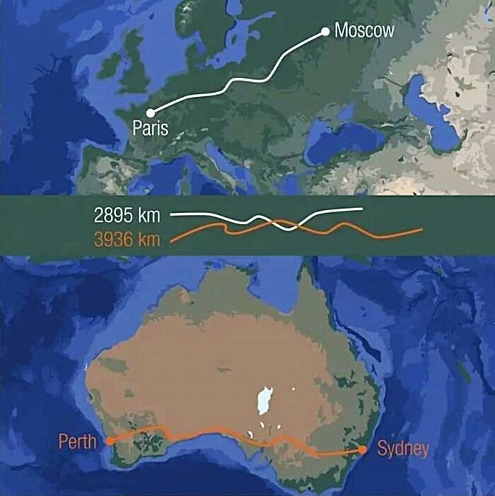
Image credits: amazingmap
#34 A Euler Diagram-Map Of The British Isles
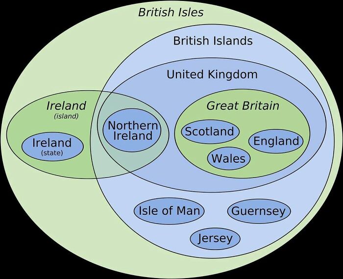
Image credits: amazingmap
#35 A Map Of The World Constructed From Time Zones
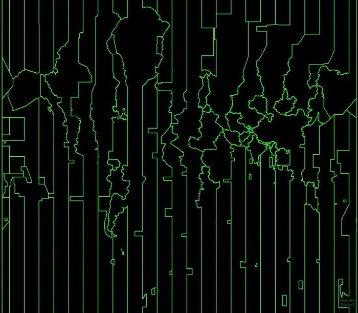
Image credits: amazingmap
#36 There’s More Water In Loch Ness Than In All Of England And Wales’ Lakes, Rivers, And Reservoirs Combined
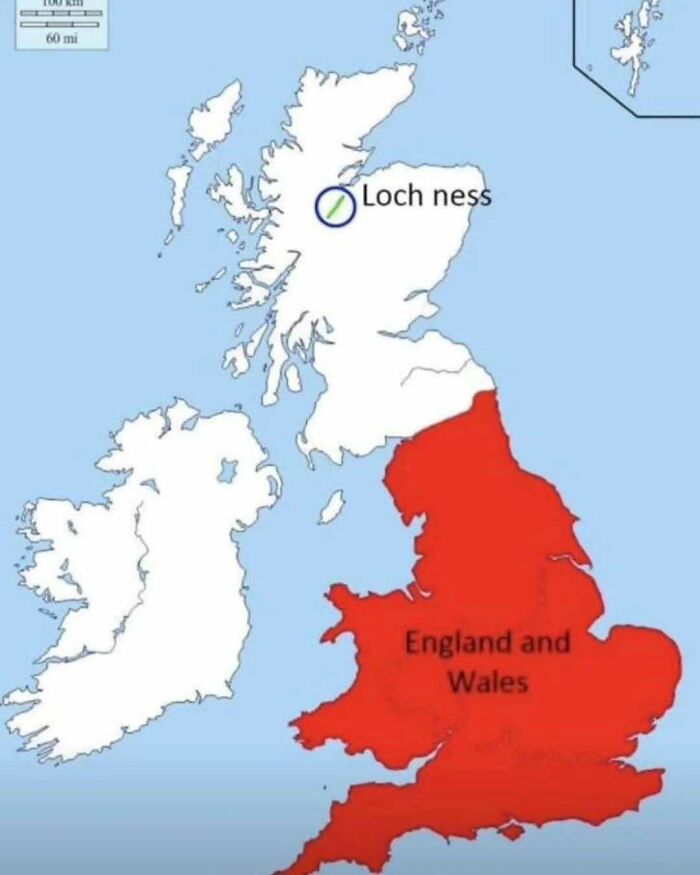
Image credits: amazingmap
#37 Greater Tokyo vs. Greater London
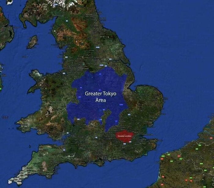
Image credits: amazingmap
#38 Los Angeles County Has A Greater Population Than 42 U.S. States And Territories
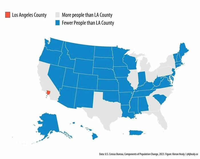
Image credits: amazingmap
#39 What The Great Pacific Garbage Patch Looks Like Layered Over The USA
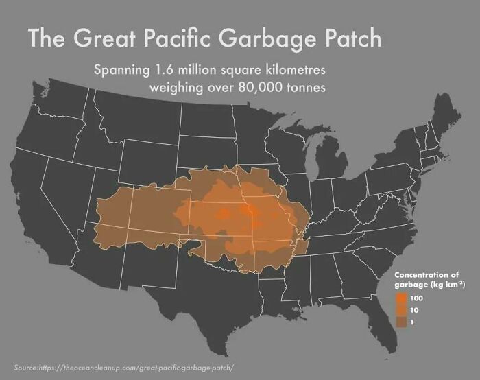
Image credits: amazingmap
#40 Route E45. The Longest North–south European Route At 5,190km
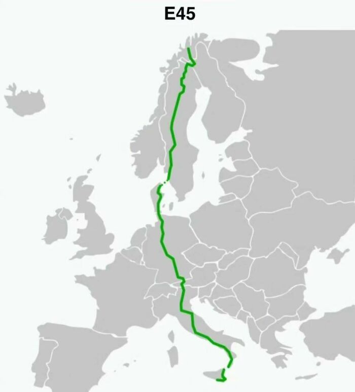
Image credits: amazingmap
from Bored Panda https://ift.tt/GRs6y2Q
via IFTTT source site : boredpanda