Article created by: Gabija Palšytė
While most of us use Google Maps and GPS on a daily basis, it’s pretty rare to find real fans of cartography, the study and practice of making and using maps. If you were ever into geography or history as a kid, the chances are you’re not much of a map person.
But today, we’re going to turn this around. Combining science, aesthetics and technique, cartography builds on the premise that reality can be modeled in ways that communicate spatial information effectively. And below we collected some of the most unusual, intriguing and informative examples of maps that will put our reality in a whole new realm.
Thanks to this awesome corner of Reddit (whose name we cannot mention thanks to the notorious internet police), there’s a LOT to uncover! Get ready to boost that inner adventurer of yours since we’re about to go places you’ve never even known existed. Psst! More awesome maps can be found in our previous posts here, here and here.
- Read More: 25 Unique And Informative Maps Shared On This Group That Might Change Your Perspective On Things
#1 A Map Centered On Antarctica
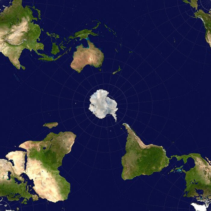
Image credits: TeroLife
#2 Made An Ink Map Of The Grand Canyon!
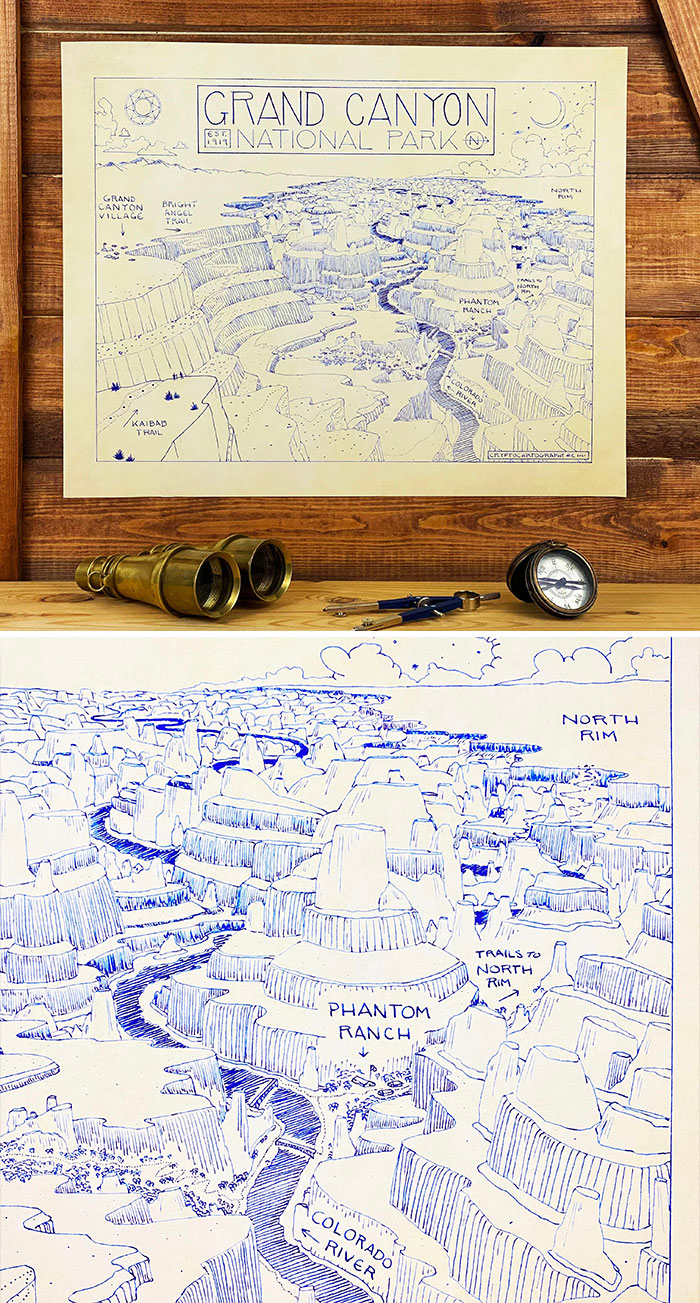
Image credits: _Triangulum
#3 Countries That Have Had Female Heads Of State Or Government In The Last Century
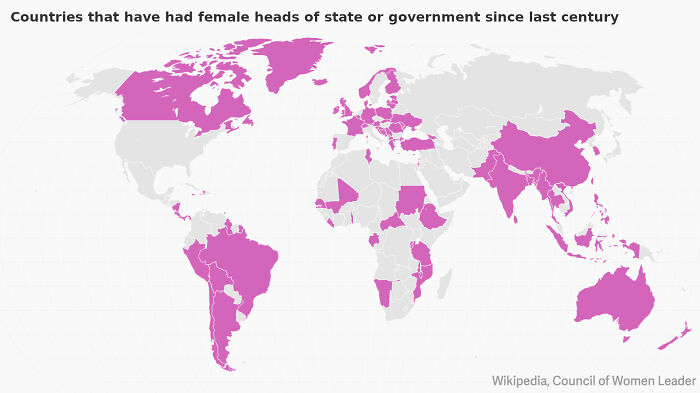
Image credits: marrow_monkey
#4 15th October 2019 – 1st November 2021: Indian Households With A Tap Water Connection (Data: Jal Jeevan Mission)
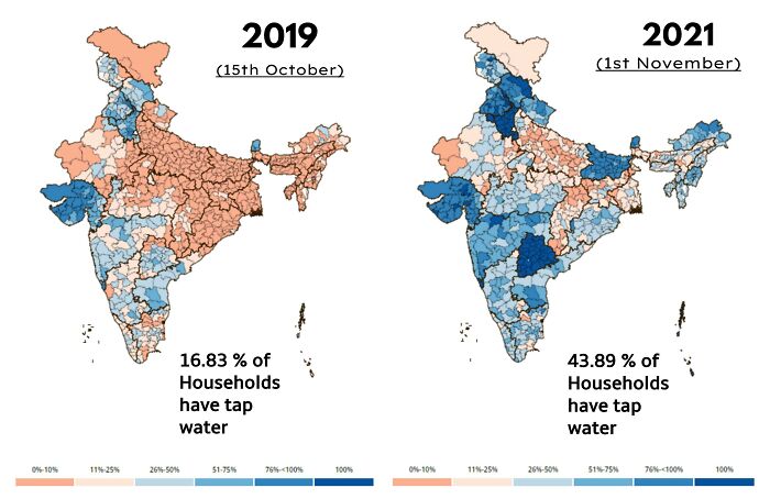
Image credits: FrozenJalapeno
#5 This Map Of All Of The Sunken Japanese Ships Of Wwii Is Mind Blowing!
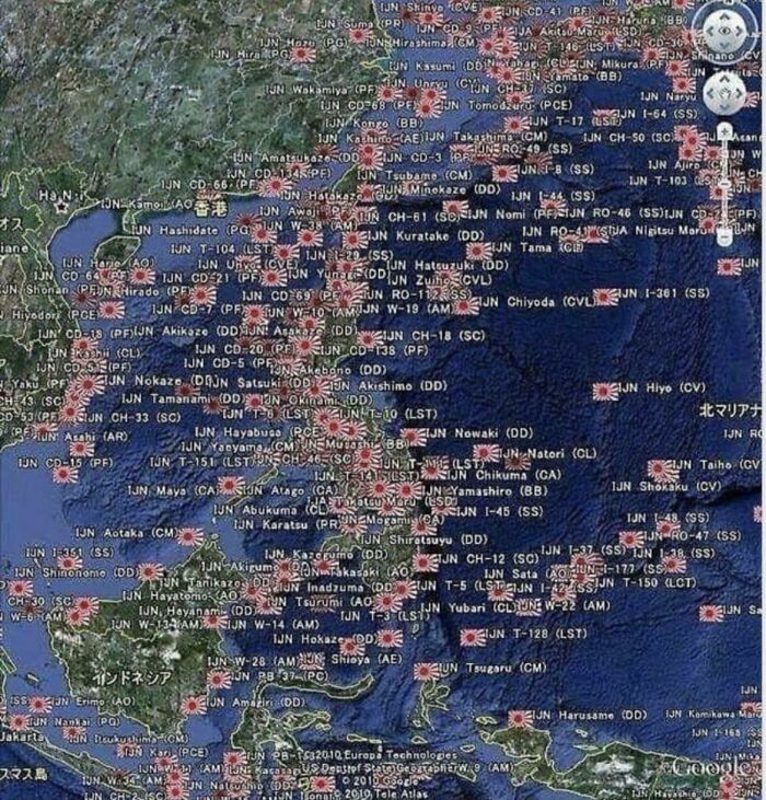
Image credits: Disastrous_Ratio7510
#6 The Topography Of Russia
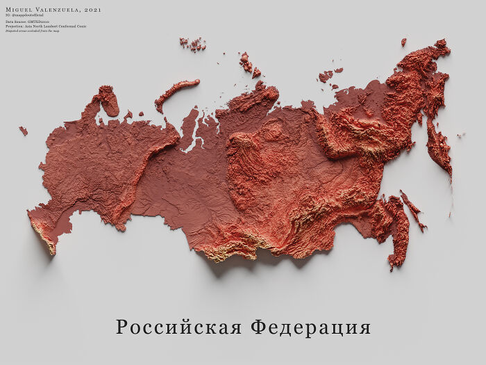
Image credits: boytutoy
#7 The New Longest Possible Train Journey In The World
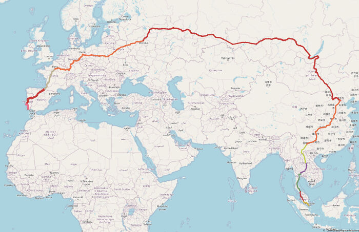
Image credits: htGoSEVe
#8 Comparative Size Of Australia And The Mediterranean
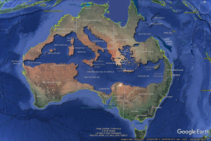
Image credits: totally-suspicious
#9 Canada, But Its Just Roads
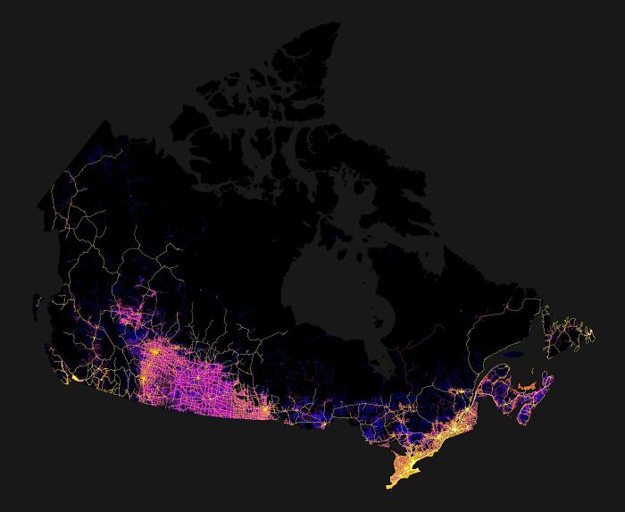
Image credits: burgerking_foot
#10 A Map Visualizing The Armenian Genocide – Started 106 Years Ago
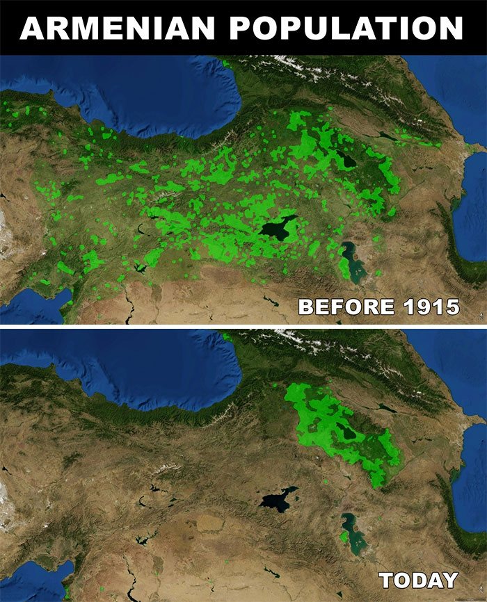
Image credits: roiaumedejherusalem
#11 Countries With The Most Islands
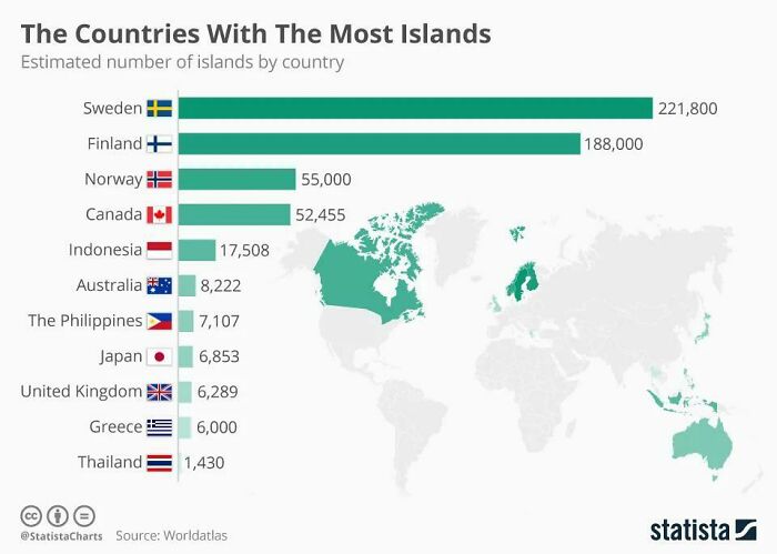
Image credits: magontklas
#12 20 Years Of Deforestation In The Amazon
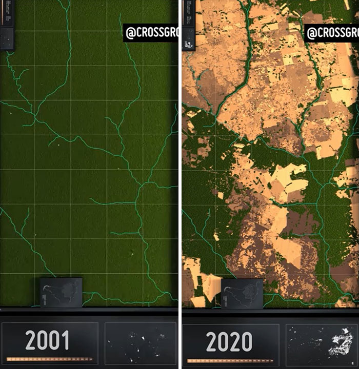
Image credits: crossground
#13 Canada, But Its Just Trees
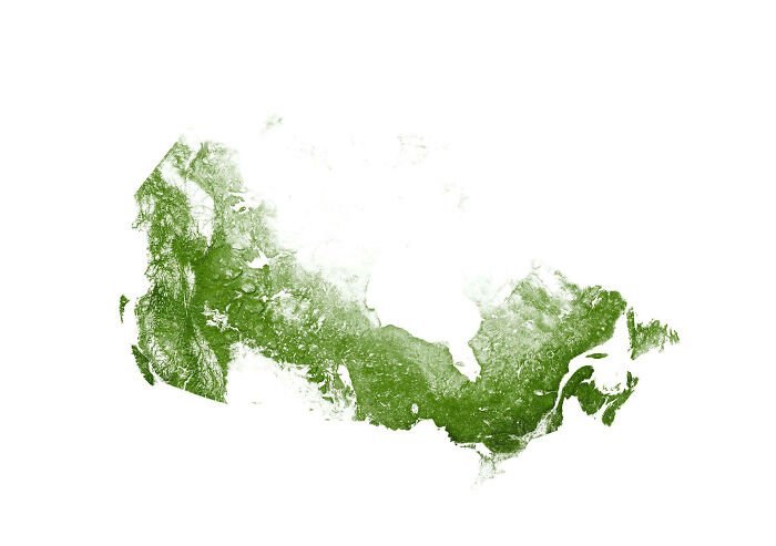
Image credits: burgerking_foot
#14 The World If The Sea Level Decreased By 1000 Meters
Image credits: burgerking_foot
#15 A Phone-Map Of Ireland

Image credits: GriffinFTW
#16 This Road Trip Will Be The Same Temperature Year-Round
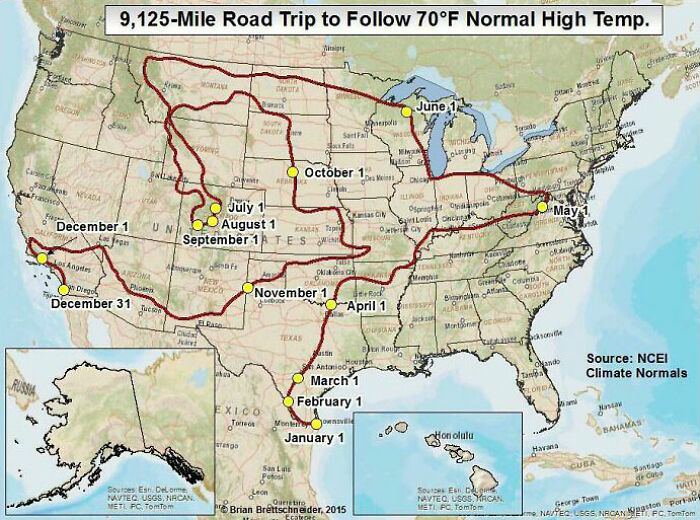
Image credits: burgerking_foot
#17 Innocent Opinions That Divide Nations
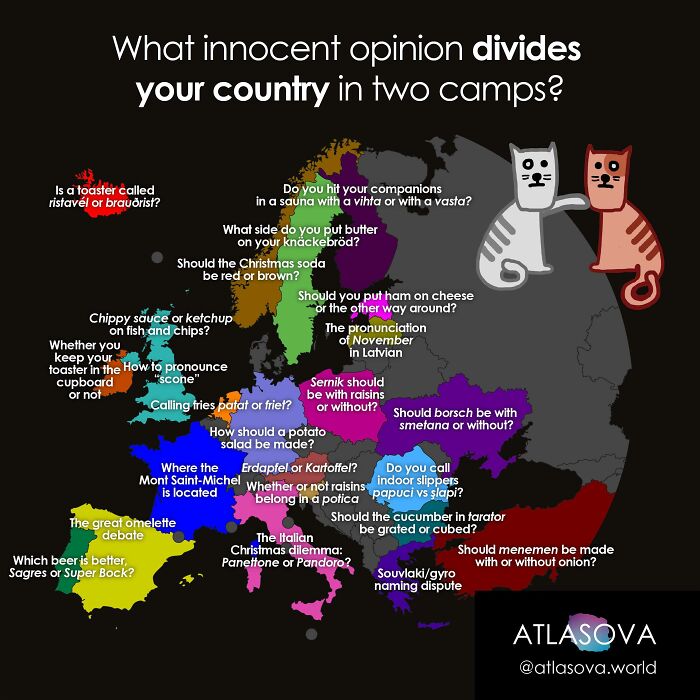
Image credits: atlasova
#18 The World’s Longest Non-Stop Flights
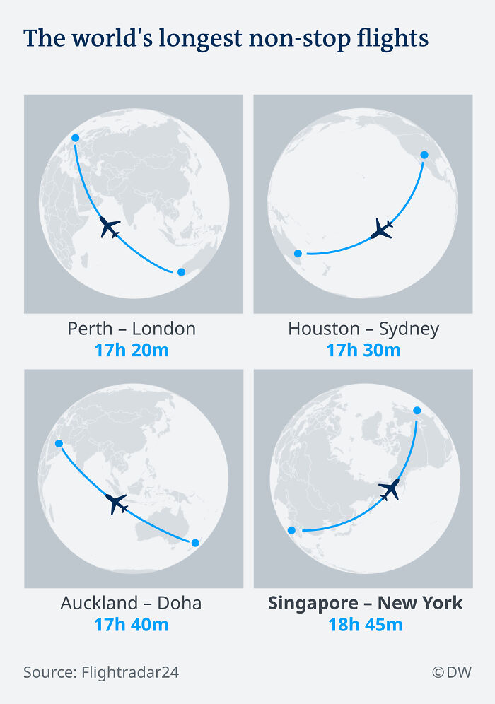
Image credits: behrkon
#19 Most Common Means Of Transportation To Work By County. [usa] Acs Survey
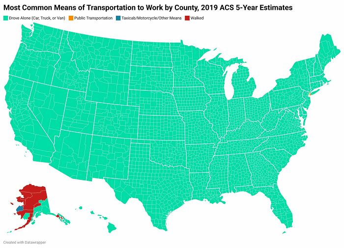
Image credits: railrod7
#20 Europe: Protests: 2020-2021
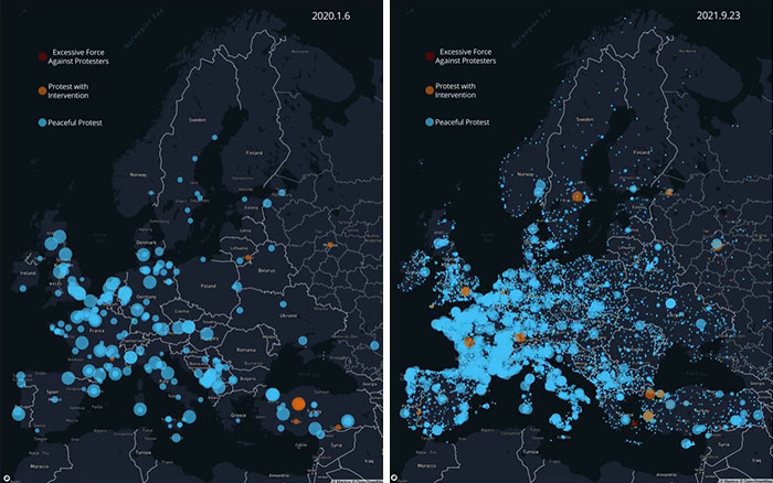
Image credits: i_make_maps_0
#21 Each Star Represents A Capital City Of A Country
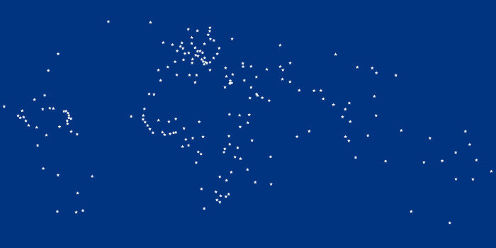
Image credits: XtremeBurrito
#22 European Cultural Superiority
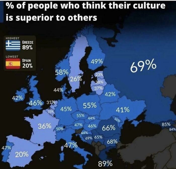
Image credits: SpartanKing76
#23 Government Request To Remove Content (Google) Since 2011
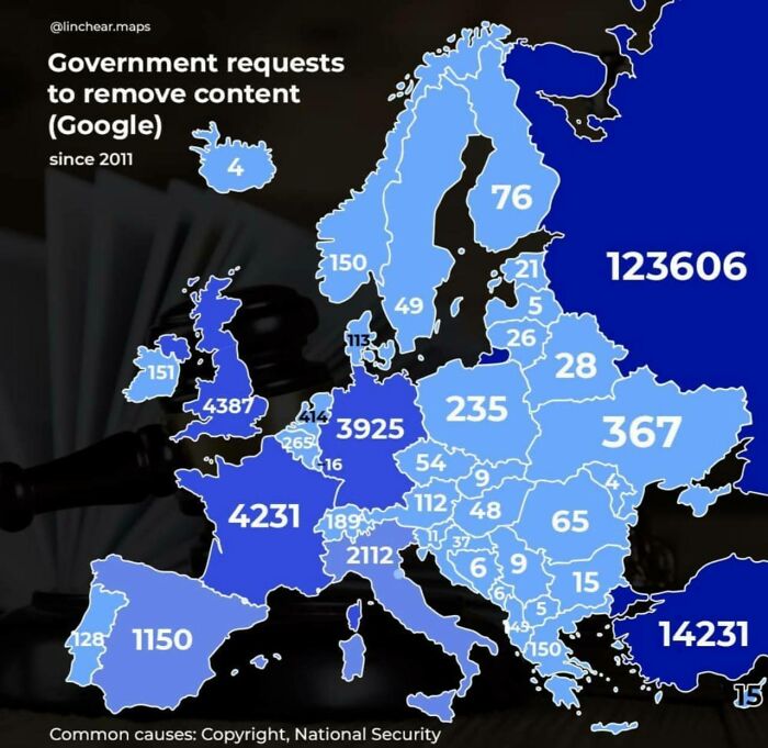
Image credits: latecomer11
#24 Olympus Mons Compared To France
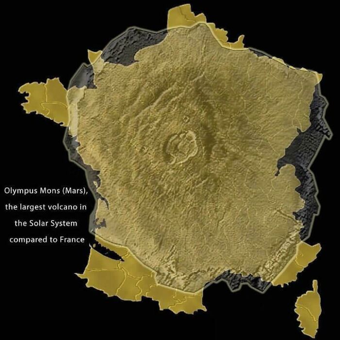
Image credits: burgerking_foot
#25 Europe And North America At The Same Latitude
- You Might Also Like: “These 34 Color Photos Show How Beautifully Diverse Our World Was”
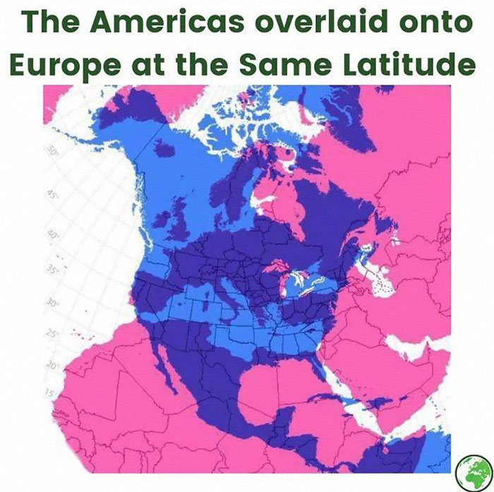
Image credits: burgerking_foot
from Bored Panda https://ift.tt/T4ZzolN
via IFTTT source site : boredpanda